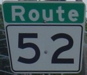
Metro Route 52
 |
|
Pictures are arranged from north to south. Click here to show the route.
;)
| Route 52 ends at PTH 101 and continues north as PTH 9. Click here for PTH 101 images and here for PTH 9 images. | ||||
| Location | Description | Photo
| ||
| RM of West St. Paul |
Northbound view on Main Street at the junction of PTH 101/PTH 9.  Photograph taken in June 2009. |
;) |
||
| RM of West St. Paul |
Northbound view on Main Street at the junction of PTH 101/PTH 9 showing a closeup of the overhead signage. Photograph taken in June 2009. |
;) |
||
| City of Winnipeg |
Northbound view on Main Street approaching the junction of PTH 101. Photograph taken in May 2010. |
;) |
||
| City of Winnipeg |
Northbound view on Main Street showing the new sign indicating entry into the RM of West St. Paul. Photograph taken in May 2014. |
;) |
||
| City of Winnipeg |
Northbound view on Main Street showing the 1 km advance signage for the junction of PTH 101. Photograph taken in June 2009. |
;) |
||
| City of Winnipeg |
Southbound view on Main Street showing the first southbound marker. Photograph taken in May 2014. |
;) |
||
| City of Winnipeg |
Southbound view on Main Street showing a closeup of the first southbound marker. Photograph taken in May 2014. |
;) |
||
| City of Winnipeg |
Northbound view on Main Street north of Chief Peguis Trail. Photograph taken in July 2010. |
;) |
||
| City of Winnipeg |
Southbound view on Main Street approaching Chief Peguis Trail. Photograph taken in July 2010. |
;) |
||
| Route 52 meets Route 17 at Chief Peguis Trail. Click here for Route 17 images. | ||||
| City of Winnipeg |
Northbound view on Main Street approaching Chief Peguis Trail. Photograph taken in October 2009. |
;) |
||
| City of Winnipeg |
Northbound view on Main Street at Seaforth Avenue. Photograph taken in October 2009. |
;) |
||
| City of Winnipeg |
Northbound view on Main Street showing the advance signage for the junction of Route 17. Photograph taken in October 2009. |
;) |
||
| City of Winnipeg |
Southbound view on Main Street at Newton Avenue. Photograph taken in June 2009. |
;) |
||
| City of Winnipeg |
Northbound view on Main Street approaching Newton Avenue. The marker for PTH 9 is erroneously included along with the marker for Route 52. The presence of the PTH 9 marker is particularly surprising, since provincial highway signs within the Perimeter Highway are severely frowned upon even when their presence is warranted. Photograph taken in October 2009. |
;) |
||
| Route 52 meets Route 23 at Leila and Partridge Avenues. Click here for Route 23 images. | ||||
| City of Winnipeg |
Northbound view on Main Street at Royal Avenue. Photograph taken in May 2010. |
;) |
||
| Route 52 meets Route 37 at Redwood Avenue. Click here for Route 37 images. | ||||
| City of Winnipeg |
Northbound view on Main Street at Higgins Avenue. Ahead is the underpass under the CP rail lines. This is one of the most seediest areas of Winnipeg and the park at right is noted as a virtual hotel for drunken bums. Photograph taken in March 2012. |
;) |
||
| Route 52 meets Route 47 at Logan Avenue. Click here for Route 47 images. | ||||
| Route 52 meets Route 42 at Disraeli Freeway. Click here for Route 42 images. | ||||
| City of Winnipeg |
Northbound view on Main Street at Rupert Avenue. Photograph taken in June 2010. |
;) |
||
| City of Winnipeg |
Northbound view on Main Street at James Avenue. Photograph taken in June 2010. |
;) |
||
| City of Winnipeg |
Northbound view on Main Street at McDermot Avenue. Photograph taken in June 2010. |
;) |
||
| City of Winnipeg |
Northbound view on Main Street approaching Lombard Avenue. Photograph taken in June 2010. |
;) |
||
| Route 52 meets Route 57 and Route 85 at Portage Avenue. Click here for Route 57 images and here for Route 85 images. | ||||
| City of Winnipeg |
Northbound view on Main Street approaching Portage Avenue. Photograph taken in June 2010. |
;) |
||
| City of Winnipeg |
Northbound view on Main Street at Pioneer Avenue. Photograph taken in June 2010. |
;) |
||
| City of Winnipeg |
Northbound view on Main Street at Graham Avenue. Photograph taken in June 2010. |
;) |
||
| City of Winnipeg |
Northbound view on Main Street approaching St. Mary Avenue. Photograph taken in June 2010. |
;) |
||
| PTH 1 follows Route 52 between Broadway and St. Anne's Road. Click here for PTH 1 images. | ||||
| City of Winnipeg |
Overhead signage for Route 52 on Stradbrook Avenue. Photograph taken in December 2009. |
;) |
||
| Route 52 meets Route 115 at Marion Street. Click here for Route 115 images. | ||||
| Route 52 meets Route 150 at St. Anne's Road. Click here for Route 150 images. | ||||
| City of Winnipeg |
Northbound view on St. Mary's Road near St. Anne's Road. Photograph taken in February 2014. |
;) |
||
| City of Winnipeg |
Northbound view on St. Mary's Road approaching Inman Avenue showing the first marker past Fermor Avenue. Photograph taken in February 2014. |
;) |
||
| Route 52 meets Route 135 at Fermor Avenue. Click here for Route 135 images. | ||||
| City of Winnipeg |
Northbound view on St. Mary's Road near Fermor Avenue. Photograph taken in February 2014. |
;) |
||
| City of Winnipeg |
Southbound view on St. Mary's Road at Glen Avenue. Photograph taken in May 2010. |
;) |
||
| City of Winnipeg |
Northbound view on St. Mary's Road showing the advance signage for the junction of Route 135. Photograph taken in February 2014. |
;) |
||
| City of Winnipeg |
Northbound view on St. Mary's Road approaching Fermor Avenue. Photograph taken in February 2014. |
;) |
||
| City of Winnipeg |
Northbound view on St. Mary's Road at St. Vital Road. Photograph taken in February 2014. |
;) |
||
| City of Winnipeg |
Northbound view on St. Mary's Road approaching Sadler Avenue. Photograph taken in February 2014. |
;) |
||
| City of Winnipeg |
Southbound view on St. Mary's Road at Parkville Drive. Photograph taken in May 2010. |
;) |
||
| City of Winnipeg |
Northbound view on St. Mary's Road showing the first marker past Dakota Street/Dunkirk Drive. Photograph taken in February 2014. |
;) |
||
| Route 52 meets Route 62 at Dunkirk Drive and Dakota Street. Click here for Route 62 images. | ||||
| City of Winnipeg |
Northbound view on St. Mary's Road at Beliveau Road. Photograph taken in April 2010. |
;) |
||
| City of Winnipeg |
Northbound view on St. Mary's Road past Bishop Grandin Boulevard. Photograph taken in April 2010. |
;) |
||
| Route 52 meets Route 165 at Bishop Grandin Boulevard. Click here for Route 165 images. | ||||
| City of Winnipeg |
Northbound view on St. Mary's Road at Avalon Road. Photograph taken in January 2010. |
;) |
||
| City of Winnipeg |
Southbound view on St. Mary's Road at Henteleff Park. Photograph taken in July 2009. |
;) |
||
| City of Winnipeg |
Southbound view on St. Mary's Road at Warde Avenue. Photograph taken in July 2009. |
;) |
||
| City of Winnipeg |
Southbound view on St. Mary's Road at the end of the divided highway. Photograph taken in July 2009. |
;) |
||
| City of Winnipeg |
Southbound view on St. Mary's Road north of the junction of PTH 100. Photograph taken in September 2004. |
;) |
||
| City of Winnipeg |
Southbound view on St. Mary's Road approaching the junction of PTH 100. Photograph taken in August 2008. |
;) |
||
| City of Winnipeg |
Northbound view on St. Mary's Road showing the first northbound reassurance marker and some constructive civil disobedience. Photograph taken in August 2007. |
;) |
||
| City of Winnipeg |
Southbound view on St. Mary's Road at the junction of PTH 100. Photograph taken in September 2004. |
;) |
||
| Route 52 ends at PTH 100 and continues south as PR 200. Click here for PTH 100 images and here for PR 200 images. | ||||
© Curtis Walker. All rights reserved. All pictures used on this site are the property of the respective photographers and are used by permission. No picture may be used without the consent of the respective photographer.
All pictures taken by Curtis Walker unless otherwise noted.