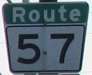
Metro Route 57
 |
|
Pictures are arranged from east to west. Click here to show the eastbound route and here to show the westbound route.
;)
;)
| Route 57 ends at Route 30 (Archibald Street). Click here for Route 30 images. | ||||
| Location | Description | Photo
| ||
| City of Winnipeg |
Westbound view on Provencher Boulevard showing the newly installed marker featuring Clearview numbering.  Photograph taken in May 2012. |
|||
| City of Winnipeg |
Eastbound view on Provencher Boulevard approaching Archibald Street. Photograph taken in February 2009. |
;) |
||
| City of Winnipeg |
Westbound view on Provencher Boulevard past Des Meurons Street. Photograph taken in February 2010. |
;) |
||
| City of Winnipeg |
Westbound view on Provencher Boulevard at Langevin Street. Photograph taken in February 2009. |
;) |
||
| City of Winnipeg |
Eastbound view on Provencher Boulevard at Langevin Street. Photograph taken in February 2009. |
;) |
||
| City of Winnipeg |
A look at the new Provencher Bridge that crosses the Red River. The restaurant on the bridge houses a toilet that cost $1 million to install. As a result, the bridge is sometimes derisively referred to as the Glen Murray Toilet Bridge, in honor of the former Winnipeg mayor who was responsible for this frivolous waste of the taxpayers' money. Photograph taken in June 2005. |
;) |
||
| City of Winnipeg |
Westbound view from the new Provencher Bridge. Photograph taken in June 2004. |
;) |
||
| City of Winnipeg |
Westbound view from the new Provencher Bridge. Photograph taken in June 2004. |
;) |
||
| City of Winnipeg |
Eastbound view of the new Provencher Bridge. Photograph taken in June 2004. |
;) |
||
| City of Winnipeg |
Westbound view on Westbrook Street approaching Portage Avenue East. Photograph taken in February 2010. |
;) |
||
| City of Winnipeg |
Westbound view on Portage Avenue East approaching Main Street. Photograph taken in February 2010. |
;) |
||
| Route 57 meets Route 52 and Route 85 at Main Street. Click here for Route 52 images and here for Route 85 images. | ||||
| City of Winnipeg |
Eastbound view on Portage Avenue at Fort Street and Notre Dame Avenue. Photographer: Carli Ward. Taken May 2006. |
;) |
||
| Route 57 meets Route 42 at Princess and King Streets. Click here for Route 42 images. | ||||
| City of Winnipeg |
Westbound view on Notre Dame Avenue past Princess Street. Photograph taken in February 2010. |
;) |
||
| City of Winnipeg |
Westbound view on Notre Dame Avenue at Young Street. Photograph taken in September 2009. |
;) |
||
| Route 57 meets Route 62 at Isabel and Balmoral Streets. Click here for Route 62 images. | ||||
| Route 57 meets Route 70 at Sherbrook and Maryland Streets. Click here for Route 70 images. | ||||
| City of Winnipeg |
Westbound view on Notre Dame Avenue at Maryland Street. Photograph taken in June 2014. |
;) |
||
| City of Winnipeg |
Westbound view on Notre Dame Avenue at Burnell Street. Photograph taken in September 2009. |
;) |
||
| Route 57 meets Route 180 at McPhillips Street. Click here for Route 180 images. | ||||
| City of Winnipeg |
Westbound view on Notre Dame Avenue at Lipton Street. Photograph taken in May 2010. |
;) |
||
| City of Winnipeg |
Westbound view on Notre Dame Avenue near Wall Street. Photograph taken in July 2009. |
;) |
||
| City of Winnipeg |
Westbound view on Notre Dame Avenue at Flint Street. Photograph taken in July 2009. |
;) |
||
| City of Winnipeg |
Westbound view on Dublin Avenue showing the advance signage for the junction of Route 90. Photograph taken in July 2009. |
;) |
||
| Route 57 ends at Route 90 (King Edward Street). Click here for Route 90 images. | ||||
© Curtis Walker. All rights reserved. All pictures used on this site are the property of the respective photographers and are used by permission. No picture may be used without the consent of the respective photographer.
All pictures taken by Curtis Walker unless otherwise noted.