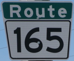
Metro Route 165
 |
|
Pictures are arranged from east to west. Click here to show the route.
;)
| Route 165 ends at PTH 59 (Lagimodière Boulevard). Click here for PTH 59 images. | ||||
| Location | Description | Photo
| ||
| Route 165 meets Route 150 at St. Anne's Road. Click here for Route 150 images. | ||||
| Route 165 meets Route 62 at Dakota Street. Click here for Route 62 images. | ||||
| City of Winnipeg |
Eastbound view past St. Mary's Road.  Photograph taken in January 2010. |
;) |
||
| Route 165 meets Route 52 at St. Mary's Road. Click here for Route 52 images. | ||||
| City of Winnipeg |
Eastbound view at River Road. Photograph taken in March 2013. |
;) |
||
| City of Winnipeg |
Eastbound view at River Road showing a closeup of the newly installed marker featuring Clearview numbering. Photograph taken in March 2013. |
;) |
||
| City of Winnipeg |
Westbound view west of River Road. Photograph taken in March 2009. |
;) |
||
| City of Winnipeg |
Northbound view on River Road at Avalon Road showing the advance signage for Route 165. Photograph taken in April 2010. |
;) |
||
| City of Winnipeg |
Westbound view at the Pembina Highway exit. When Bishop Grandin Boulevard was first constructed, it ended at Pembina Highway and all traffic was routed along this exit to a traffic light. This intersection became a major bottleneck and traffic was often backed up well east of the bridge during rush hour. Photograph taken in March 2009. |
;) |
||
| City of Winnipeg |
Westbound view at the Pembina Highway exit showing a closeup of the overhead signage. Photograph taken in March 2009. |
;) |
||
| City of Winnipeg |
Eastbound view looking at the Fort Garry Bridge. Photograph taken in July 2005. |
;) |
||
| City of Winnipeg |
Westbound view near the underpass at Pembina Highway. Photograph taken in April 2010. |
;) |
||
| City of Winnipeg |
Westbound view near the underpass at Pembina Highway. Photograph taken in October 2009. |
;) |
||
| Route 165 meets PTH 75/Route 42 at Pembina Highway. Click here for PTH 75 images and here for Route 42 images. | ||||
| City of Winnipeg |
A look at the stone display and plaque commemorating Bishop Grandin Boulevard and Bishop Vital Grandin. Photograph taken in May 2014. |
;) |
||
| City of Winnipeg |
A closeup of the plaque commemorating Bishop Grandin Boulevard and Bishop Vital Grandin. Photograph taken in May 2014. |
;) |
||
| City of Winnipeg |
Eastbound view approaching Pembina Highway. Photograph taken in March 2009. |
;) |
||
| City of Winnipeg |
Westbound view west of Pembina Highway. Photograph taken in March 2009. |
;) |
||
| City of Winnipeg |
Westbound view approaching Route 80 (Waverley Street). Photograph taken in March 2009. |
');) |
||
| City of Winnipeg |
Eastbound view past Waverley Street. Photograph taken in October 2009. |
;) |
||
| Route 165 meets Route 80 at Waverley Street. Click here for Route 80 images. | ||||
| City of Winnipeg |
Westbound view west of Route 80 (Waverley Street). Photograph taken in March 2009. |
');) |
||
| City of Winnipeg |
Eastbound view showing the advance signage for the junction of Route 80/Waverley Street. Photograph taken in November 2009. |
;) |
||
| City of Winnipeg |
Westbound view approaching the junction of Route 90/Kenaston Boulevard. Photograph taken in November 2012. |
;) |
||
| City of Winnipeg |
Westbound view showing a closeup of the overhead signage approaching the junction of Route 90/Kenaston Boulevard. Photograph taken in November 2012. |
;) |
||
| City of Winnipeg |
Westbound view as Bishop Grandin Boulevard turns north and becomes Kenaston Boulevard. Photograph taken in March 2009. |
;) |
||
| City of Winnipeg |
Westbound view approaching the junction of Route 90/Kenaston Boulevard. Southbound traffic on Kenaston Boulevard must use one of the two lanes in the expanded median to turn left, while northbound traffic continues ahead. This interchange was recently completed to handle the extension of Kenaston Boulevard that will not only serve the new Waverley West subdivision, but eventually reach the Perimeter Highway. Photograph taken in November 2012. |
;) |
||
| City of Winnipeg |
Eastbound view showing the first eastbound marker following the turn from Kenaston Boulevard. Photograph taken in November 2009. |
;) |
||
| Route 165 ends at Route90/Kenaston Boulevard. Click here for Route 90 images. | ||||
© Curtis Walker. All rights reserved. All pictures used on this site are the property of the respective photographers and are used by permission. No picture may be used without the consent of the respective photographer.
All pictures taken by Curtis Walker unless otherwise noted.