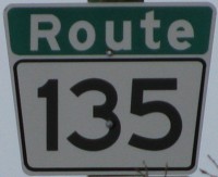
Metro Route 135
 |
|
Pictures are arranged from east to west. Click here to show the route.
;)
| Route 135 begins at Plessis Road and joins with PTH 1. Click here for PTH 1 images. | ||||
| Location | Description | Photo
| ||
| Route 135 meets Route 30 at Archibald Street. Click here for Route 30 images. | ||||
| Route 135 meets Route 150 at St. Anne's Road. Click here for Route 150 images. | ||||
| City of Winnipeg |
Westbound view west of St. Anne's Road.  Photograph taken in April 2009. |
;) |
||
| City of Winnipeg |
Westbound view at St. Mary's Road. Photograph taken in October 2009. |
;) |
||
| City of Winnipeg |
Eastbound view at St. David Road showing the newly-installed marker featuring Clearview numbering. Photograph taken in August 2012. |
;) |
||
| City of Winnipeg |
Westbound view at St. Mary's Road. Photograph taken in April 2009. |
;) |
||
| Route 135 meets Route 52 at St. Mary's Road. Click here for Route 52 images. | ||||
| City of Winnipeg |
Westbound view west of St. Mary's Road. Photograph taken in August 2009. |
;) |
||
| City of Winnipeg |
Westbound view near Dunkirk Drive showing the last Route 135 marker. There is no southbound access to Dunkirk Drive at this intersection. Photograph taken in April 2009. |
;) |
||
| City of Winnipeg |
Westbound view near Dunkirk Drive showing a closeup of the last Route 135 marker. Photograph taken in April 2009. |
;) |
||
| City of Winnipeg |
Westbound view showing the newly installed marker featuring Clearview numbering indicating the end of Route 135. Photograph taken in November 2012. |
;) |
||
| City of Winnipeg |
Westbound view showing a closeup of the newly installed marker featuring Clearview numbering indicating the end of Route 135. Photograph taken in November 2012. |
;) |
||
| City of Winnipeg |
Westbound view showing the newly installed marker featuring Clearview numbering indicating that Route 62 north proceeds to the right. Photograph taken in November 2012. |
;) |
||
| City of Winnipeg |
Westbound view showing a closeup of the newly installed marker featuring Clearview numbering indicating that Route 62 north proceeds to the right. Photograph taken in November 2012. |
;) |
||
| Route 135 ends at Route 62 (Dunkirk Drive). Click here for Route 62 images. | ||||
© Curtis Walker. All rights reserved. All pictures used on this site are the property of the respective photographers and are used by permission. No picture may be used without the consent of the respective photographer.
All pictures taken by Curtis Walker unless otherwise noted.