 |
|
;)
;)
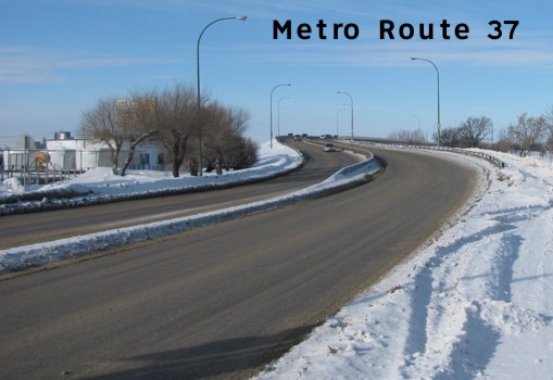
Pictures are arranged from east to west.
| Route 37 ends at Route 115 (Dugald Road). Click here for Route 115 images. | ||||
| Location | Description | Photo
| ||
| City of Winnipeg |
Southbound view on Ravenhurst Street approaching Dugald Road. The traffic light ahead had recently become operational at the time this photograph was taken.  Photograph taken in February 2010. |
;) |
||
| City of Winnipeg |
Southbound view on Ravenhurst Street approaching Dugald Road. This photograph was taken prior to the installation of the traffic light shown in the previous photograph. Photograph taken in March 2009. |
;) |
||
| City of Winnipeg |
Southbound view on Ravenhurst Street showing the new marker indicating the upcoming end of Route 37. Photograph taken in May 2014. |
;) |
||
| City of Winnipeg |
Northbound view on Ravenhurst Street approaching Pandora Avenue East. Route 37 follows Pandora Avenue East ahead, yet there is no sign to indicate this little detail. Photograph taken in May 2010. |
;) |
||
| City of Winnipeg |
Southbound view on Ravenhurst Street south of Pandora Avenue East. Photograph taken in March 2009. |
;) |
||
| City of Winnipeg |
Southbound view on Ravenhurst Street showing the last eastbound marker and the newly installed directional sign underneath. Photograph taken in June 2012. |
;) |
||
| City of Winnipeg |
Northbound view on Ravenhurst Street at Pandora Avenue East showing the marker directing Route 37 traffic east on Pandora Avenue. There had previously been no indication that Route 37 followed Pandora Avenue and there is still no advance signage alerting motorists to turn left to follow Route 37. Photograph taken in June 2012. |
;) |
||
| City of Winnipeg |
Eastbound view on Pandora Avenue East showing the new marker indicating that Route 37 follows Ravenhurst Street to the right. Photograph taken in May 2014. |
;) |
||
| City of Winnipeg |
Westbound view on Pandora Avenue East past Ravenhurst Street showing the first westbound marker. Photograph taken in May 2010. |
;) |
||
| City of Winnipeg |
Westbound view on Pandora Avenue East showing the newly installed marker featuring Clearview numbering. Photograph taken in June 2012. |
;) |
||
| City of Winnipeg |
Westbound view on Pandora Avenue East past Ravenhurst Street. Photograph taken in May 2010. |
;) |
||
| City of Winnipeg |
Eastbound view on Pandora Avenue East past Redonda Street. Photograph taken in June 2009. |
;) |
||
| City of Winnipeg |
Eastbound view on Pandora Avenue West past Madeline Street. Photograph taken in June 2009. |
;) |
||
| City of Winnipeg |
Westbound view on Pandora Avenue West at Plessis Road. Farther south, Plessis Road (Road 19E) serves as the boundary between the City of Winnipeg and the RM of Springfield. Photograph taken in May 2011. |
;) |
||
| City of Winnipeg |
Westbound view on Regent Avenue West past Owen Street. Photograph taken in December 2009. |
;) |
||
| City of Winnipeg |
Westbound view on Regent Avenue West past Rougeau Avenue. Photograph taken in May 2010. |
;) |
||
| Route 37 meets PTH 59 at Lagimodière Boulevard. Click here for PTH 59 images. | ||||
| City of Winnipeg |
Westbound view on Nairn Avenue at the foot of the Nairn Overpass. Photograph taken in February 2010. |
;) |
||
| City of Winnipeg |
Westbound view on Nairn Avenue atop the Nairn Overpass. Photograph taken in February 2010. |
;) |
||
| Route 37 meets Route 30 at Watt Street. Click here for Route 30 images. | ||||
| City of Winnipeg |
Southbound view on Levis Street facing the sign for eastbound Route 37. Ahead is the Louise Bridge that crosses the Red River. Photograph taken in March 2010. |
;) |
||
| City of Winnipeg |
Southbound view on Levis Street showing the new guide sign for Route 37 east. Photograph taken in May 2014. |
;) |
||
| City of Winnipeg |
Westbound view on Midwinter Avenue at Levis Street showing a new marker for Route 37 featuring Clearview numbering. Photograph taken in July 2011. |
;) |
||
| City of Winnipeg |
Eastbound view on Midwinter Avenue near Levis Street. Photograph taken in November 2010. |
;) |
||
| City of Winnipeg |
Eastbound view on Midwinter Avenue passing under the Disraeli Overpass. Photograph taken in November 2010. |
;) |
||
| City of Winnipeg |
Northbound view on Watt Street approaching the intersection of Levis Street and Chalmers Avenue. Photograph taken in September 2009. |
;) |
||
| City of Winnipeg |
Northbound view on Watt Street at the intersection of Levis Street and Chalmers Avenue. Photograph taken in May 2010. |
;) |
||
| City of Winnipeg |
Westbound view on Chalmers Avenue at Watt and Levis Streets. Photograph taken in September 2009. |
;) |
||
| City of Winnipeg |
Westbound view on Levis Street at Johnson Avenue West. Photograph taken in July 2010. |
;) |
||
| City of Winnipeg |
Westbound view on Johnson Avenue at Roch Street. Photograph taken in April 2011. |
;) |
||
| City of Winnipeg |
Westbound view on Johnson Avenue showing the advance signage for the junction of Route 42. Photograph taken in April 2011. |
;) |
||
| City of Winnipeg |
Westbound view on Johnson Avenue at Henderson Highway. Photograph taken in April 2011. |
;) |
||
| Route 37 meets Route 42 at Henderson Highway. Click here for Route 42 images. | ||||
| City of Winnipeg |
Eastbound view showing the newly refurbished Redwood Bridge that crosses the Red River. Photograph taken in March 2010. |
;) |
||
| City of Winnipeg |
Eastbound view on Redwood Avenue past Main Street. Photograph taken in June 2009. |
;) |
||
| Route 37 meets Route 52 at Main Street. Click here for Route 52 images. | ||||
| City of Winnipeg |
Westbound view on Redwood Avenue at Salter Street. Both Route 37 and Route 62 dead-end at this intersection. Photograph taken in June 2013. |
;) |
||
| Route 37 ends at Route 62 (Salter Street). Click here for Route 62 images. | ||||
© Curtis Walker. All rights reserved. All pictures used on this site are the property of the respective photographers and are used by permission. No picture may be used without the consent of the respective photographer.
All pictures taken by Curtis Walker unless otherwise noted.