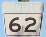
Metro Route 62
 |
|
Pictures are arranged from north to south. Click here to show the route.
;)
| Route 62 ends at Route 37 (Redwood Avenue). Click here for Route 37 images. | ||||
| Location | Description | Photo
| ||
| City of Winnipeg |
Northbound view on Salter Street near Aberdeen Avenue showing the sign for the end of Route 62.  Photograph taken in March 2010. |
;) |
||
| City of Winnipeg |
Northbound view on Salter Street atop the Slaw Rebchuk Bridge that crosses the CP rail yards. Photograph taken in March 2010. |
;) |
||
| City of Winnipeg |
Northbound view on Salter Street at the foot of the Slaw Rebchuk Bridge. Photograph taken in March 2010. |
;) |
||
| Route 62 meets Route 47 at Logan Avenue. Click here for Route 47 images. | ||||
| Route 62 meets Route 57 at Notre Dame and Cumberland Avenues. Click here for Route 57 images. | ||||
| City of Winnipeg |
Southbound view on Colony Street at Portage Avenue. Photograph taken in June 2010. |
;) |
||
| Route 62 meets Route 85 at Portage Avenue. Click here for Route 85 images. | ||||
| City of Winnipeg |
A look at the stone engraving facing Route 62 showing the meaning of the naming of Memorial Boulevard. Photograph taken in June 2011. |
;) |
||
| City of Winnipeg |
Northbound view on Memorial Boulevard approaching Portage Avenue/Route 85. Photograph taken in June 2011. |
;) |
||
| City of Winnipeg |
Northbound view on Memorial Boulevard approaching Portage Avenue/Route 85. Photograph taken in June 2011. |
;) |
||
| City of Winnipeg |
Southbound view on Osborne Street North at Cooper Avenue. Photograph taken in June 2009. |
;) |
||
| City of Winnipeg |
Northbound view on Osborne Street North approaching St. Mary Avenue. Photograph taken in June 2011. |
;) |
||
| City of Winnipeg |
Northbound view on Osborne Street North at York Avenue. Photograph taken in June 2009. |
;) |
||
| Route 62 meets PTH 1 at Broadway. Click here for PTH 1 images. | ||||
| City of Winnipeg |
Northbound view on Osborne Street North showing the advange signage for the junction of PTH 1. Photograph taken in December 2010. |
;) |
||
| Route 62 meets Route 42/PTH 75 at Pembina Highway and Donald Street. Click here for Route 42 images and here for PTH 75 images. | ||||
| City of Winnipeg |
Northbound view on Osborne Street at Mulvey Avenue. Atop the railway underpass is the Osborne terminal for Winnipeg's so-called “Rapid Transit,” a multi-million dollar boondoggle that has done virtually nothing to improve the transit system. Photograph taken in March 2013. |
;) |
||
| City of Winnipeg |
Northbound view on Osborne Street showing the sign for the multi-street intersection known as Confusion Corner. Photograph taken in April 2009. |
;) |
||
| City of Winnipeg |
Southbound view on Osborne Street at Brandon Avenue. Photograph taken in April 2010. |
;) |
||
| City of Winnipeg |
Northbound view on Osborne Street near Morley Avenue. Photograph taken in April 2010. |
;) |
||
| City of Winnipeg |
Southbound view on Osborne Street approaching Rosedale Avenue showing the advance signage for the junction of Route 125. Photograph taken in June 2011. |
;) |
||
| City of Winnipeg |
Northbound view on Osborne Street north of Jubilee Avenue. Photograph taken in September 2009. |
;) |
||
| Route 62 meets Route 125 at Jubilee Avenue. Click here for Route 125 images. | ||||
| City of Winnipeg |
Southbound view on Osborne Street showing the newly installed marker past Jubilee Avenue. Photograph taken in May 2013. |
;) |
||
| City of Winnipeg |
Northbound view on Osborne Street at Jubilee Avenue. Photograph taken in April 2009. |
;) |
||
| City of Winnipeg |
Southbound view at the northern abutment of the St. Vital Bridge showing the newly installed advance signage for Kingston Row. Photograph taken in May 2013. |
;) |
||
| City of Winnipeg |
Southbound view on the St. Vital Bridge that crosses the Red River. Photograph taken in April 2009. |
;) |
||
| City of Winnipeg |
A look at the defaced plaque on the St. Vital Bridge that crosses the Red River. Photograph taken in April 2010. |
;) |
||
| City of Winnipeg |
Northbound view on the St. Vital Bridge that crosses the Red River. Photograph taken in April 2009. |
;) |
||
| City of Winnipeg |
Looking north at the St. Vital Bridge that crosses the Red River. Photograph taken in April 2010. |
;) |
||
| City of Winnipeg |
Northbound view on Dunkirk Drive at Kingston Row. Photograph taken in April 2009. |
;) |
||
| City of Winnipeg |
Northbound view on Dunkirk Drive showing the new Clearview overhead signage at Kingston Row. Despite the elaborate interchange, Kingston Row is a lightly travelled street and is best known as a layover stop for Winnipeg Transit drivers. Photograph taken in August 2011. |
|||
| City of Winnipeg |
Southbound view on Dunkirk Drive at Kingston Row. Photograph taken in April 2009. |
;) |
||
| City of Winnipeg |
Northbound view on Dunkirk Drive north of Fermor Avenue. Photograph taken in September 2009. |
;) |
||
| City of Winnipeg |
Northbound view on Dunkirk Drive north of Fermor Avenue showing the newly-installed marker featuring Clearview numbering. Photograph taken in March 2012. |
|||
| City of Winnipeg |
Northbound view on Dunkirk Drive at Fermor Avenue. Photograph taken in September 2009. |
;) |
||
| Route 62 meets Route 135 at Fermor Avenue. Click here for Route 135 images. | ||||
| City of Winnipeg |
Northbound view on Dunkirk Drive at Fermor Avenue. Photograph taken in September 2009. |
;) |
||
| City of Winnipeg |
Northbound view on Dunkirk Drive near Fermor Avenue. Photograph taken in April 2009. |
;) |
||
| City of Winnipeg |
Northbound view on Dunkirk Drive at West Fernwood Avenue. Photograph taken in September 2009. |
;) |
||
| City of Winnipeg |
Southbound view on Dunkirk Drive at Kenwood Place. Photograph taken in September 2009. |
;) |
||
| City of Winnipeg |
Northbound view on Dunkirk Drive at St. Vital Road. Photograph taken in September 2009. |
;) |
||
| City of Winnipeg |
Northbound view on Dunkirk Drive at Parkville Drive. Photograph taken in September 2009. |
;) |
||
| Route 62 meets Route 52 at St. Mary's Road. Click here for Route 52 images. | ||||
| City of Winnipeg |
Northbound view on Dakota Street showing the sign indicating the turnoff for Route 52 north. In a revulsive deference to Canada's occupying power, the Quebec-language wording is listed first. Photograph taken in February 2014. |
;) |
||
| City of Winnipeg |
Northbound view on Dakota Street near St. Mary's Road. Photograph taken in November 2009. |
;) |
||
| City of Winnipeg |
Northbound view on Dakota Street showing the new advance signage for the junction of Route 52. Photograph taken in February 2014. |
;) |
||
| City of Winnipeg |
Southbound view on Dakota Street near Bishop Grandin Boulevard showing the sign for the end of Route 62. Photograph taken in May 2010. |
;) |
||
| City of Winnipeg |
Northbound view on Dakota Street showing the first northbound marker. Photograph taken in February 2014. |
;) |
||
| Route 62 ends at Route 165 (Bishop Grandin Boulevard). Click here for Route 165 images. | ||||
© Curtis Walker. All rights reserved. All pictures used on this site are the property of the respective photographers and are used by permission. No picture may be used without the consent of the respective photographer.
All pictures taken by Curtis Walker unless otherwise noted.