Metro Route 17
 |
|
Pictures are arranged from east to west. Click here to show the route.
;)
| Route 17 ends at PTH 59. Click here for PTH 59 images. | ||||
| Location | Description | Photo
| ||
| City of Winnipeg |
Westbound view past Lagimodière Boulevard.  Photograph taken in December 2011. |
;) |
||
| City of Winnipeg |
Westbound view past Lagimodière Boulevard. Photograph taken in December 2011. |
;) |
||
| City of Winnipeg |
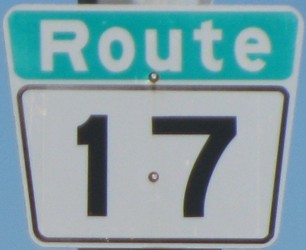
Westbound view past Lagimodière Boulevard showing a closeup of the first westbound marker. Photograph taken in June 2012. |
;) |
||
| City of Winnipeg |
Eastbound view showing the overhead signage at Lagimodière Boulevard. Photograph taken in December 2011. |
;) |
||
| City of Winnipeg |
Eastbound view showing a closeup of the overhead signage at Lagimodière Boulevard. Once again, in typical Winnipeg fashion, the signage for PTH 59 is omitted. In addition, the accents on Lagimodière are missing. Photograph taken in December 2011. |
;) |
||
| City of Winnipeg |
Westbound view from the median past Lagimodière Boulevard. Photograph taken in June 2012. |
;) |
||
| City of Winnipeg |
Westbound view approaching Gateway Road. Photograph taken in June 2012. |
;) |
||
| City of Winnipeg |
Eastbound view past Gateway Road. Photograph taken in December 2011. |
;) |
||
| City of Winnipeg |
A construction shot looking west from Raleigh Street. Photograph taken in April 2011. |
;) |
||
| City of Winnipeg |
Westbound view approaching Gateway Road. Photograph taken in December 2011. |
;) |
||
| City of Winnipeg |
Westbound view from atop the foot bridge at Raleigh Street. Photograph taken in March 2012. |
;) |
||
| City of Winnipeg |
Eastbound view from atop the foot bridge at Raleigh Street. Photograph taken in March 2012. |
;) |
||
| City of Winnipeg |
Eastbound view at the underpass at Raleigh Street. Photograph taken in December 2011. |
;) |
||
| City of Winnipeg |
Eastbound view approaching Gateway Road. Photograph taken in December 2011. |
;) |
||
| City of Winnipeg |
Westbound view at the underpass at Rothesay Street. Photograph taken in December 2011. |
;) |
||
| City of Winnipeg |
Westbound view from Rothesay Street. Photograph taken in March 2012. |
;) |
||
| City of Winnipeg |
A construction shot near Rothesay Street. Photograph taken in September 2011. |
;) |
||
| City of Winnipeg |
Eastbound view approaching the underpass at Rothesay Street. Photograph taken in December 2011. |
;) |
||
| City of Winnipeg |
Eastbound view approaching the underpass at Rothesay Street. Photograph taken in December 2011. |
;) |
||
| City of Winnipeg |
Eastbound view showing the reassurance marker past Henderson Highway. Photograph taken in December 2011. |
;) |
||
| City of Winnipeg |
Eastbound view showing a closeup of the reassurance marker past Henderson Highway. Photograph taken in December 2011. |
;) |
||
| City of Winnipeg |
A construction shot at Henderson Highway. Photograph taken in July 2011. |
;) |
||
| City of Winnipeg |
A construction shot at Henderson Highway. Photograph taken in April 2011. |
;) |
||
| City of Winnipeg |
Westbound view showing the overhead signage at Henderson Highway. Photograph taken in December 2011. |
;) |
||
| City of Winnipeg |
A look at the collection of wolves at the corner of Chief Peguis Trail and Henderson Highway. Photograph taken in June 2014. |
;) |
||
| Route 17 meets Route 42 at Henderson Highway. Click here for Route 42 images. | ||||
| City of Winnipeg |
Westbound view from Henderson Highway. Photograph taken in December 2008. |
;) |
||
| City of Winnipeg |
Westbound view showing the marker past Henderson Highway. Photograph taken in June 2009. |
;) |
||
| City of Winnipeg |
Westbound view showing a closeup of the marker past Henderson Highway. Photograph taken in June 2009. |
;) |
||
| City of Winnipeg |
Eastbound view showing the overhead signage at Henderson Highway. Photograph taken in October 2009. |
;) |
||
| City of Winnipeg |
Eastbound view showing the newly installed overhead signage at Henderson Highway. Photograph taken in June 2012. |
;) |
||
| City of Winnipeg |
Westbound view showing the advance signage for Route 52/Main Street. Photograph taken in June 2009. |
;) |
||
| City of Winnipeg |
Westbound view approaching the Kildonan Settlers Bridge. Photograph taken in June 2009. |
;) |
||
| City of Winnipeg |
Eastbound view showing the advance signage for Route 42/Henderson Highway. Photograph taken in October 2009. |
;) |
||
| City of Winnipeg |
Westbound view at Main Street. Photograph taken in June 2009. |
;) |
||
| City of Winnipeg |
Eastbound view showing the first eastbound marker. Photograph taken in October 2009. |
;) |
||
| Route 17 ends at Route 52. Click here for Route 52 images. | ||||
© Curtis Walker. All rights reserved. All pictures used on this site are the property of the respective photographers and are used by permission. No picture may be used without the consent of the respective photographer.
All pictures taken by Curtis Walker unless otherwise noted.