Provincial Trunk Highway 75
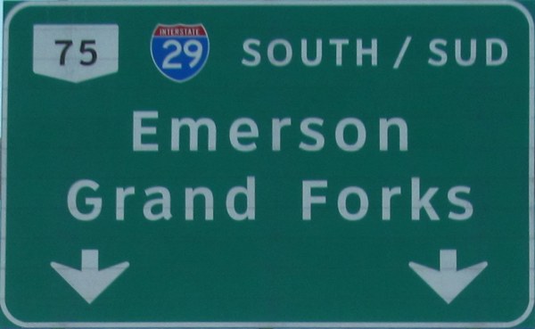 |
| PTH 75 serves as the northern part of the primary ground transportation link between Winnipeg and the U.S.A. and is used heavily by truckers and weekend shoppers travelling from Winnipeg to Grand Forks and/or Fargo. It is divided and twinned for most of its length and, outside of Winnipeg, the only low-speed zones are in the towns of Morris and Emerson. Click here to show the route. |
| When the trunk highway system was being developed in January 1924, this route was numbered as PTH 14, but was renumbered to PTH 75 between 1940 and 1955 to match US 75 in Minnesota. Ironically, since the closing of the Canadian border crossing at the eastern end of Emerson and the US border crossing near Noyes, MN, the two highways no longer intersect. |
| In 2012, the routing of PTH 75 was changed to follow the former PTH 29 directly to the US border. The former routing turned east just north of the US border and crossed the Red River into Emerson. That portion of the route is now part of PR 200. |
| Northern Terminus: Junction of Route 62 (Osborne Street) in Winnipeg. |
| Southern Terminus: US border at Emerson. |
;)
|
Images of PTH 75: |
Time lapse video driving southbound on PTH 75 between Winnipeg and St. Jean Baptiste:
Detailed Route Guide
| Municipality | Distance (km) | |
| City of Winnipeg | 0.0 | Junction of Route 62/Osborne Street. |
| City of Winnipeg | 0.1 | Junction of Route 95/Corydon Avenue. |
| City of Winnipeg | 1.2 | Junction of Route 105/Grant Avenue. |
| City of Winnipeg | 2.2 | Junction of Route 70/Stafford Street. |
| City of Winnipeg | 2.7 | Junction of Route 125/Jubilee Avenue. |
| City of Winnipeg | 3.9 | Junction of PTH 3/Route 155/McGillivray Boulevard. |
| City of Winnipeg | 6.4 | Junction of Route 165/Bishop Grandin Boulevard. |
| City of Winnipeg | 11.2 | Junction of PTH 100. |
| City of Winnipeg | 13.9 | Intersection of Turnbull Drive. At this corner is the St. Norbert Provincial Heritage Park and Turnbull Drive leads to Courchaine Road and the gates for the Red River Floodway. |
| RM of Ritchot | 17.9 | Junction of PR 247. |
| RM of Ritchot | 25.1 | Junction of PR 210 near St. Adolphe. |
| RM of Ritchot | 35.9 | Junction of PR 305 near Ste. Agathe. |
| RM of Morris | 50.2 | Junction of PR 205. |
| RM of Morris | 60.0 | Junction of PR 330. |
| Town of Morris | 63.4 | Junction of PTH 23/Boyne Avenue. |
| Town of Morris | 63.9 | Junction of PTH 23/Montreal Avenue. |
| Town of Morris | 65.1 | Railway crossing. |
| RM of Montcalm | 72.2 | Junction of PR 246 near St. Jean Baptiste. |
| RM of Montcalm | 82.1 | Junction of PTH 14. |
| RM of Montcalm | 89.0 | Junction of PR 201 near Letellier. |
| RM of Montcalm | 96.1 | Junction of PR 421. |
| Town of Emerson | 102.9 | Junction of PR 243. |
| Town of Emerson | 104.3 | Junction of PR 200. |
| Town of Emerson | 104.8 | Canada/US border. |
© Curtis Walker. All rights reserved. All pictures used on this site are the property of the respective photographers and are used by permission. No picture may be used without the consent of the respective photographer.
All pictures taken by Curtis Walker unless otherwise noted.