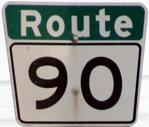
Metro Route 90
 |
|
Pictures are arranged from north to south. Click here to show the route.
;)
| Route 90 ends at |
||||
| Location | Description | Photo
| ||
| RM of Rosser |
Northbound view showing the overhead signage at the junction of PTH 101.  Photograph taken in May 2011. |
;) |
||
| RM of Rosser |
Northbound view showing the newly installed Clearview overhead signage at the junction of PTH 101. Photograph taken in June 2013. |
;) |
||
| RM of Rosser |
Northbound view showing a closeup of the newly installed Clearview overhead signage at the junction of PTH 101. Photograph taken in June 2013. |
;) |
||
| RM of Rosser |
Southbound view just south of the junction of PTH 101. Photograph taken in January 2009. |
;) |
||
| RM of Rosser |
Southbound view showing the advance signage for Mollard Road. Photograph taken in June 2013. |
;) |
||
| RM of Rosser |
Northbound view showing the last Route 90 marker. Photograph taken in January 2009. |
;) |
||
| City of Winnipeg |
Northbound view at Mollard Road. Photograph taken in May 2011. |
;) |
||
| City of Winnipeg |
Northbound view showing the advance signage for Mollard Road. Photograph taken in May 2011. |
;) |
||
| City of Winnipeg |
Northbound view on Brookside Boulevard 2 km from the junction of PTH 101. Photograph taken in May 2009. |
;) |
||
| City of Winnipeg |
Southbound view showing the “Welcome to Winnipeg” sign. Photograph taken in January 2009. |
;) |
||
| City of Winnipeg |
Northbound view at Jefferson Avenue (Road 65N). Photograph taken in May 2011. |
');) |
||
| City of Winnipeg |
Southbound view showing the first southbound reassurance marker. Photograph taken in January 2009. |
;) |
||
| City of Winnipeg |
Southbound view at the intersection of PR 221/Route 25 (Inkster Boulevard). At this intersection, there is no southbound signage for PR 221 west. Photograph taken in January 2009. |
;) |
||
| Route 90 meets PTH 190/Route 25 at Inkster Boulevard. Click here for PTH 190 images and here for Route 25 images. | ||||
| City of Winnipeg |
Northbound view on Brookside Boulevard near Inkster Boulevard. Straight ahead is the only signage for PR 221, a dirty first-generation sign that couldn't possibly be more obscurely placed. Photograph taken in May 2009. |
;) |
||
| City of Winnipeg |
Northbound view on Brookside Boulevard near Inkster Boulevard. Photograph taken in May 2009. |
;) |
||
| City of Winnipeg |
Northbound view at the northern intersection of Egesz Street. Photograph taken in May 2011. |
;) |
||
| City of Winnipeg |
Northbound view approaching Eagle Drive. Photograph taken in May 2011. |
;) |
||
| Route 90 meets Route 47 at Logan Avenue. Click here for Route 47 images. | ||||
| City of Winnipeg |
Northbound view past Dublin Avenue. Photograph taken in May 2011. |
;) |
||
| Route 90 meets Route 57 at Dublin Avenue. Click here for Route 57 images. | ||||
| City of Winnipeg |
Northbound view as traffic from Century Street merges into King Edward Street. Photograph taken in October 2010. |
;) |
||
| City of Winnipeg |
Northbound view on Century Street past the turnoff for Border Street. Photograph taken in October 2010. |
;) |
||
| City of Winnipeg |
Northbound view on Century Street near the turnoff for Border Street. Photograph taken in January 2010. |
;) |
||
| City of Winnipeg |
Northbound view on Century Street past Wellington Avenue. Photograph taken in October 2010. |
;) |
||
| City of Winnipeg |
Westbound view on Wellington Avenue approaching King Edward Street. Photograph taken in October 2010. |
;) |
||
| City of Winnipeg |
Northbound view on Century Street showing the advance signage for Wellington Avenue. Photograph taken in October 2010. |
;) |
||
| City of Winnipeg |
Northbound view on Century Street showing a closeup of the reassurance marker past Ellice Avenue. Photograph taken in May 2013. |
;) |
||
| City of Winnipeg |
Northbound view on Century Street at Ellice Avenue. Photograph taken in May 2013. |
;) |
||
| City of Winnipeg |
Southbound view on King Edward Street south of Ellice Avenue. Photograph taken in March 2009. |
;) |
||
| City of Winnipeg |
Northbound view on Century Street as Route 90 splits across Century and King Edward Streets. Photograph taken in February 2014. |
;) |
||
| City of Winnipeg |
Southbound view on Century Street as Route 90 resumes a common course. Photograph taken in February 2014. |
;) |
||
| City of Winnipeg |
Northbound view on Century Street at Silver Avenue showing the sign for Route 90 Sales. This auto dealer formerly used the authentic Route 90 symbol in the signage, but later changed to a poor knock-off. In all probabilty, the business owner had tried to trademark the authentic symbol, which would have been impossible. Photograph taken in May 2013. |
;) |
||
| City of Winnipeg |
Northbound view on Century Street past Ness Avenue. Photograph taken in February 2013. |
;) |
||
| City of Winnipeg |
Southbound view on Century Street past Ness Avenue. Photograph taken in February 2013. |
;) |
||
| Route 90 meets |
||||
| City of Winnipeg |
Northbound view from the overpass at Portage Avenue. Photograph taken in January 2009. |
;) |
||
| City of Winnipeg |
Southbound view from the overpass at Portage Avenue. Photograph taken in October 2012. |
;) |
||
| City of Winnipeg |
Northbound view from the overpass at Portage Avenue showing a closeup of the overhead signage approaching Ness Avenue. Photograph taken in January 2009. |
;) |
||
| City of Winnipeg |
Southbound view on the St. James Bridge showing the overhead signage for the Academy Road east turnoff. Photograph taken in November 2009. |
;) |
||
| City of Winnipeg |
Northbound view on the St. James Bridge approaching the turnoff for PTH 1/Route 85 east. Photograph taken in November 2009. |
;) |
||
| City of Winnipeg |
Northbound view on the St. James Bridge showing the advance signage for PTH 1/Route 85 east. Photograph taken in November 2009. |
;) |
||
| City of Winnipeg |
Southbound view on Kenaston Boulevard at Academy Road. Photograph taken in November 2009. |
;) |
||
| City of Winnipeg |
Approaching Route 90 from Academy Road. Photograph taken in November 2009. |
;) |
||
| City of Winnipeg |
Southbound view on Kenaston Boulevard at Carpathia Road. Photograph taken in January 2013. |
;) |
||
| City of Winnipeg |
Southbound view on Kenaston Boulevard showing the reassurance marker past Tuxedo Avenue. Photograph taken in January 2013. |
;) |
||
| City of Winnipeg |
Southbound view on Kenaston Boulevard at Lockston Avenue. Photograph taken in January 2013. |
;) |
||
| City of Winnipeg |
Northbound view on Kenaston Boulevard past Corydon Avenue. Photograph taken in March 2013. |
;) |
||
| City of Winnipeg |
Southbound view on Kenaston Boulevard approaching Route 95/Corydon Avenue. Curiously, there is no advance signage for Route 95. Photograph taken in January 2013. |
;) |
||
| Route 90 meets Route 95 at Corydon Avenue. Click here for Route 95 images. | ||||
| City of Winnipeg |
Southbound view on Kenaston Boulevard approaching Route 105/Grant Avenue showing the advance signage for Route 105. Photograph taken in January 2013. |
;) |
||
| Route 90 meets Route 105 at Grant Avenue. Click here for Route 105 images. | ||||
| City of Winnipeg |
Northbound view on Kenaston Boulevard approaching the turnoff to Route 105 east. Photograph taken in March 2013. |
;) |
||
| City of Winnipeg |
Northbound view on Kenaston Boulevard showing the advance signage for Route 105. Photograph taken in March 2013. |
;) |
||
| City of Winnipeg |
Northbound view on Kenaston Boulevard showing the reassurance marker past Taylor Avenue. Photograph taken in March 2013. |
;) |
||
| City of Winnipeg |
A look at the sign on Kenaston Boulevard at Taylor Avenue designating this stretch of Route 90 as Reg Alcock Way. Alcock served as the MP for the area between 1993 and 2006. Photograph taken in May 2014. |
;) |
||
| City of Winnipeg |
Southbound view on Kenaston Boulevard showing the marker past Taylor Avenue. Photograph taken in May 2014. |
;) |
||
| City of Winnipeg |
Northbound view on Kenaston Boulevard approaching a railway underpass. Photograph taken in January 2010. |
;) |
||
| City of Winnipeg |
Southbound view on Kenaston Boulevard showing the overhead signage approaching Sterling Lyon Parkway. Photograph taken in May 2014. |
;) |
||
| City of Winnipeg |
Southbound view on Kenaston Boulevard showing a closeup of the overhead signage approaching Sterling Lyon Parkway. Photograph taken in May 2014. |
;) |
||
| City of Winnipeg |
Northbound view on Kenaston Boulevard north of Route 145/Sterling Lyon Parkway. Photograph taken in October 2009. |
;) |
||
| Route 90 meets Route 145 at Sterling Lyon Parkway. Click here for Route 145 images. | ||||
| City of Winnipeg |
A look at the sign on Kenaston Boulevard at Sterling Lyon Parkway designating this stretch of Route 90 as Reg Alcock Way. Photograph taken in May 2014. |
;) |
||
| City of Winnipeg |
Northbound view on Kenaston Boulevard showing the overhead signage approaching Route 145/Sterling Lyon Parkway. At left is the sign for Winnipeg's IKEA store. Photograph taken in November 2012. |
;) |
||
| City of Winnipeg |
Northbound view on Kenaston Boulevard showing a closeup of the overhead signage approaching Route 145/Sterling Lyon Parkway. Photograph taken in November 2012. |
;) |
||
| City of Winnipeg |
Northbound view on Kenaston Boulevard north of Rothwell Road. Photograph taken in November 2009. |
;) |
||
| City of Winnipeg |
Southbound view on Kenaston Boulevard south of Rothwell Road. Photograph taken in November 2009. |
;) |
||
| City of Winnipeg |
Southbound view on Kenaston Boulevard at the junction of PTH 3/McGillivray Boulevard. Photograph taken in November 2009. |
;) |
||
| Route 90 meets PTH 3/Route 155 at McGillivray Boulevard. Click here for PTH 3 images. | ||||
| City of Winnipeg |
Northbound view on Kenaston Boulevard approaching the junction of PTH 3/McGillivray Boulevard. Photograph taken in August 2009. |
;) |
||
| City of Winnipeg |
Southbound view on Kenaston Boulevard at Scurfield Boulevard. Photograph taken in November 2009. |
;) |
||
| City of Winnipeg |
Southbound view on Kenaston Boulevard showing the temporary advance signage for the turnoff for Route 90 south. Photograph taken in November 2012. |
;) |
||
| City of Winnipeg |
Southbound view on Kenaston Boulevard south of Scurfield Boulevard. This is the last southbound marker for Route 90. Photograph taken in November 2009. |
;) |
||
| City of Winnipeg |
Northbound view on Kenaston Boulevard showing the first northbound marker. Photograph taken in March 2009. |
;) |
||
| City of Winnipeg |
Northbound view on Kenaston Boulevard approaching the merge of traffic coming from south of Bishop Grandin Boulevard. Photograph taken in November 2012. |
;) |
||
| City of Winnipeg |
Southbound view showing the last Route 90 marker as Kenaston Boulevard turns east and becomes Route 165/Bishop Grandin Boulevard. Photograph taken in November 2009. |
;) |
||
| City of Winnipeg |
Northbound view on Kenaston Boulevard showing the newly installed marker featuring Clearview numbering. Photograph taken in November 2012. |
;) |
||
| City of Winnipeg |
Southbound view on Kenaston Boulevard approaching the turnoff for Route 90 south. Through traffic continues ahead as Bishop Grandin Boulevard/Route 165. Photograph taken in November 2012. |
;) |
||
| City of Winnipeg |
Northbound view showing the two lanes in the median coming from south of Bishop Grandin Boulevard. These two lanes will narrow to one, then merge into northbound traffic coming from Bishop Grandin Boulevard. This is perhaps Winnipeg's most convoluted interchange. Photograph taken in November 2012. |
;) |
||
| City of Winnipeg |
Views of the construction taking place at the intersection of Kenaston and Bishop Grandin Boulevards. Photographs taken in May 2014. |
;) ;) ;) ;) ;) ;) |
||
| Route 90 meets Route 165 at Bishop Grandin Boulevard. Click here for Route 165 images. | ||||
| City of Winnipeg |
Southbound view on Kenaston Boulevard past Route 165. Though the route is open, it is not yet signed with Route 90 markers. Future development will take this route as far south as the Perimeter Highway (PTH 100). Photograph taken in November 2012. |
;) |
||
| City of Winnipeg |
Northbound view on Kenaston Boulevard approaching Route 165/Bishop Grandin Boulevard. Photograph taken in November 2012. |
;) |
||
| City of Winnipeg |
Northbound view on Kenaston Boulevard showing the temporary advance signage for Kenaston and Bishop Grandin Boulevards. Route 90 follows Kenaston Boulevard to the left, while Route 165/Bishop Grandin Boulevard begins to the right. Photograph taken in November 2012. |
;) |
||
| City of Winnipeg |
Northbound view on Kenaston Boulevard showing a closeup of the temporary advance signage for Kenaston and Bishop Grandin Boulevards. Photograph taken in November 2012. |
;) |
||
| Route 90 meets Route 80 at Waverley Street. Click here for Route 80 images. | ||||
| Route 90 ends at |
||||
© Curtis Walker. All rights reserved. All pictures used on this site are the property of the respective photographers and are used by permission. No picture may be used without the consent of the respective photographer.
All pictures taken by Curtis Walker unless otherwise noted.