Metro Route 180
 |
|
Pictures are arranged from south to north. Click here to show the route.
;)
| Route 180 ends at Route 57 (Notre Dame Avenue). Click here for Route 57 images. | ||||
| Location | Description | Photo
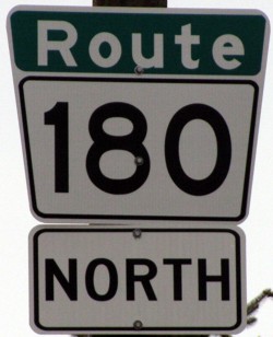
| ||
| City of Winnipeg |
Northbound view showing the first northbound reassurance marker.  Photograph taken in April 2014. |
;) |
||
| City of Winnipeg |
Southhbound view near Notre Dame Avenue showing the sign indicating the end of Route 180. Photograph taken in July 2009. |
;) |
||
| Route 180 meets Route 47 at Logan Avenue. Click here for Route 47 images. | ||||
| City of Winnipeg |
Southbound view approaching Henry Avenue showing the advance signage for the junction of Route 47. Photograph taken in January 2013. |
;) |
||
| City of Winnipeg |
Northbound view approaching a railway underpass. In the distance off to the left is McPhillips Street Casino, a major money maker for the government. Photograph taken in March 2010. |
;) |
||
| City of Winnipeg |
Northbound view approaching Jarvis Avenue. Photograph taken in June 2014. |
;) |
||
| City of Winnipeg |
Northbound view approaching Selkirk Avenue. Photograph taken in June 2014. |
;) |
||
| City of Winnipeg |
Northbound view at Burrows Avenue. Photograph taken in June 2014. |
;) |
||
| Route 180 meets Route 25 at Inkster Boulevard. Click here for Route 25 images. | ||||
| City of Winnipeg |
Northbound view approaching Jefferson Avenue. Photograph taken in June 2014. |
;) |
||
| City of Winnipeg |
Northbound view at Canna Boulevard. Photograph taken in March 2013. |
;) |
||
| City of Winnipeg |
Northbound view showing the sign for Route 23 east. Photograph taken in March 2013. |
;) |
||
| Route 180 meets Route 23 at Leila Avenue. Click here for Route 23 images. | ||||
| City of Winnipeg |
Northbound view past Leila Avenue. Photograph taken in January 2013. |
;) |
||
| City of Winnipeg |
Northbound view at Swailes Avenue. Photograph taken in March 2009. |
;) |
||
| City of Winnipeg |
Southbound view south of Murray Avenue. Photograph taken in October 2009. |
;) |
||
| City of Winnipeg |
Northbound view showing the 2 km advance signage for the junction of PTH 101. Photograph taken in March 2009. |
;) |
||
| City of Winnipeg |
Northbound view showing the last northbound marker. Photograph taken in March 2009. |
;) |
||
| Route 180 ends at PTH 101 and continues north as PTH 8. Click here for PTH 101 images and here for PTH 8 images. | ||||
© Curtis Walker. All rights reserved. All pictures used on this site are the property of the respective photographers and are used by permission. No picture may be used without the consent of the respective photographer.
All pictures taken by Curtis Walker unless otherwise noted.