Metro Route 30
 |
|
Pictures are arranged from north to south. Click here to show the route.
;)
| Route 30 ends at Route 37 (Nairn Avenue). Click here for Route 37 images. | ||||
| Location | Description | Photo
| ||
| City of Winnipeg |
Southbound view on Watt Street south of Nairn Avenue showing the first southbound marker.  Photograph taken in February 2010. |
;) |
||
| City of Winnipeg |
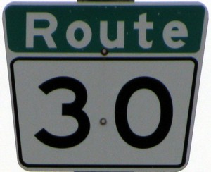
Southbound view on Watt Street showing the newly installed marker featuring Clearview numbering. Photograph taken in May 2012. |
;) |
||
| City of Winnipeg |
Northbound view on Watt Street at Nairn Avenue. This is the northern terminus of Route 30. Photograph taken in May 2009. |
;) |
||
| City of Winnipeg |
Northbound view on Archibald Street at a railway underpass. Photograph taken in May 2009. |
;) |
||
| City of Winnipeg |
Northbound view on Archibald Street approaching Mission Street. Photograph taken in April 2011. |
;) |
||
| Route 30 meets Route 57 at Provencher Boulevard. Click here for Route 57 images. | ||||
| City of Winnipeg |
Northbound view on Archibald Street at Marion Street showing the new marker featuring Clearview numbering. Photograph taken in February 2012. |
|||
| City of Winnipeg |
Northbound view on Archibald Street at Marion Street showing a closeup of the new marker featuring Clearview numbering. Photograph taken in February 2012. |
|||
| Route 30 meets Route 115 at Marion Street. Click here for Route 115 images. | ||||
| City of Winnipeg |
Northbound view on Archibald Street near Prosper Street. Ahead is another instance of the Great Canadian Traffic Jam - the rush in and out of a Tim Hortons location. Photograph taken in September 2009. |
;) |
||
| City of Winnipeg |
Northbound view on Archibald Street north of Elizabeth Road. Photograph taken in September 2009. |
;) |
||
| City of Winnipeg |
Southbound view on Archibald Street approaching Fermor Avenue. Photograph taken in November 2009. |
;) |
||
| City of Winnipeg |
Northbound view on Archibald Street showing the first northbound marker. Photograph taken in April 2009. |
;) |
||
| Route 30 ends at PTH 1/Route 135 (Fermor Avenue). Click here for PTH 1 images and here for Route 135 images. | ||||
© Curtis Walker. All rights reserved. All pictures used on this site are the property of the respective photographers and are used by permission. No picture may be used without the consent of the respective photographer.
All pictures taken by Curtis Walker unless otherwise noted.