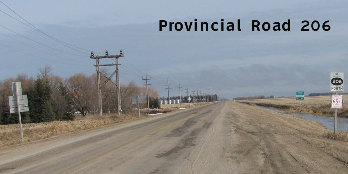
PR 206 runs north-south from the junction of PTH 44 east of Lockport along the eastern boundary of Birds Hill Provincial Park through Oakbank and Dugald to the junction of PTH 1. The route continues south through Landmark, ending at the junction of PTH 52 near Randolph.
The portion of the route south of Landmark is known locally as “Pig Sh*t Alley” on account of all the hog farms in the area. Credit for this factoid goes to the late Lloyd Klassen, a former colleague of your photographer.
Northern Terminus: Junction of PTH 44 east of Lockport.
Southern Terminus: Junction of PTH 52 near Randolph.
Multiplexes: PR 206 follows PTH 1 for 3 km in the RM of Taché and PR 210 follows PR 206 for 2 km in the RM of Taché.
Pictures are arranged from north to south. Click here to show the route.
;)
| PR 206 ends at PTH 44 between Lockport and Garson. Click here for PTH 44 images. | ||||
| Location | Description | Photo
| ||
| RM of St. Clements |
Southbound view at the junction of PTH 44.  Photograph taken in September 2012. |
;) |
||
| RM of St. Clements |
Northbound view at the junction of PTH 44. Photograph taken in May 2009. |
;) |
||
| RM of St. Clements |
Southbound view showing the first southbound marker. Photograph taken in May 2009. |
;) |
||
| RM of St. Clements |
Southbound view showing a closeup of the first southbound marker. Photograph taken in May 2009. |
;) |
||
| RM of Springfield |
Southbound view at Melrose Road. Photograph taken in May 2009. |
;) |
||
| RM of Springfield |
Southbound view near the northern boundary of Birds Hill Provincial Park. Photograph taken in May 2009. |
;) |
||
| RM of Springfield |
Southbound view at the east gate of Birds Hill Provincial Park. Photograph taken in May 2009. |
;) |
||
| Birds Hill Provincial Park |
View from North Drive showing the sign for PR 206 and the East Gate. Photograph taken in April 2010. |
;) |
||
| RM of Springfield |
The east gate of Birds Hill Provincial Park. Photograph taken in May 2009. |
;) |
||
| RM of Springfield |
The sign for Birds Hill Provincial Park. Photograph taken in May 2009. |
;) |
||
| RM of Springfield |
Signs for PR 206 leaving Birds Hill Provincial Park. Photograph taken in May 2009. |
;) |
||
| PR 206 meets PR 213 north of Oakbank. Click here for PR 213 images. | ||||
| RM of Springfield |
Northbound view showing the first marker past the junction of PTH 15. Photograph taken in May 2014. |
;) |
||
| RM of Springfield |
Northbound view showing a closeup of the first marker past the junction of PTH 15. Photograph taken in May 2014. |
;) |
||
| RM of Springfield |
A look at the sign for the Springfield Public Library and Memorial Park. Photograph taken in May 2014. |
;) |
||
| RM of Springfield |
A look at an old army vehicle in Memorial Park. Photograph taken in May 2014. |
;) |
||
| RM of Springfield |
A look at the cenotaph in Memorial Park. Photograph taken in May 2014. |
;) |
||
| RM of Springfield |
A look at the Springfield Public Library. Photograph taken in May 2014. |
;) |
||
| RM of Springfield |
Southbound view showing the trailblazer sign in advance of the junction of PTH 15. Photograph taken in May 2014. |
;) |
||
| RM of Springfield |
Southbound view approaching the junction of PTH 15. The traffic lights ahead at the junction of PTH 15 were installed in 2013. Photograph taken in May 2014. |
;) |
||
| RM of Springfield |
Southbound view approaching the junction of PTH 15 showing a closeup of the signs. Photograph taken in May 2014. |
;) |
||
| PR 206 meets PTH 15 in Dugald. Click here for PTH 15 images. | ||||
| RM of Springfield |
Southbound view south of the junction of PTH 15. Photograph taken in April 2009. |
;) |
||
| RM of Springfield |
Southbound view south of the junction of PTH 15 showing a closeup of the markers. Photograph taken in April 2009. |
;) |
||
| RM of Springfield |
Southbound view showing the new Clearview marker past the junction of PTH 15 featuring the “warthog”-style buffalo. Curiously, the sign giving the distance to PTH 1 has been removed. Photograph taken in May 2014. |
;) |
||
| RM of Springfield |
Southbound view showing a closeup of the new Clearview marker past the junction of PTH 15 featuring the “warthog”-style buffalo. Photograph taken in May 2014. |
;) |
||
| RM of Springfield |
Northbound view approaching the junction of PTH 15. Photograph taken in May 2014. |
;) |
||
| RM of Springfield |
Northbound view approaching the junction of PTH 15 showing a closeup of the signs. Photograph taken in May 2014. |
;) |
||
| RM of Springfield |
Northbound view approaching the junction of PTH 15. Photograph taken in April 2009. |
;) |
||
| RM of Springfield |
Northbound view showing the new trailblazer sign in advance of the junction of PTH 15. Photograph taken in May 2014. |
;) |
||
| RM of Springfield |
Northbound view showing a closeup of the new trailblazer sign in advance of the junction of PTH 15. Photograph taken in May 2014. |
;) |
||
| RM of Taché |
Southbound view at the junction of PTH 1. Photograph taken in March 2010. |
;) |
||
| RM of Taché |
Northbound view north of the junction of PTH 1. Photograph taken in March 2010. |
;) |
||
| RM of Taché |
Northbound view north of the junction of PTH 1 showing a closeup of the marker. Photograph taken in March 2010. |
;) |
||
| PR 206 meets |
||||
| RM of Taché |
Northbound view at the junction of PTH 1. Photograph taken in March 2010. |
;) |
||
| RM of Taché |
Northbound view at the junction of PTH 1 showing a closeup of the markers. Below is a sign giving the direction and distance to Deacon's Corner and Ste. Anne as part of an organized snowmobile trail system in the area. Photograph taken in March 2010. |
;) |
||
| RM of Taché |
Southbound view south of the junction of PTH 1. Photograph taken in March 2010. |
;) |
||
| RM of Taché |
Southbound view south of the junction of PTH 1 showing a closeup of the marker. Photograph taken in March 2010. |
;) |
||
| PR 206 meets PR 207 between Lorette and Dufresne. Click here for PR 207 images. | ||||
| PR 206 meets PR 405 between Lorette and Dufresne. Click here for PR 405 images. | ||||
| PR 206 meets PR 210 in Landmark. Click here for PR 210 images. | ||||
© Curtis Walker. All rights reserved. All pictures used on this site are the property of the respective photographers and are used by permission. No picture may be used without the consent of the respective photographer.
All pictures taken by Curtis Walker unless otherwise noted.