 |
|
Pictures are arranged from west to east. Click here to show the route.
;)
| PTH 15 ends at PTH 101 and continues west as Route 115. Click here for PTH 101 images and here for Route 115 images. | ||||
| Location | Description | Photo
| ||
| City of Winnipeg |
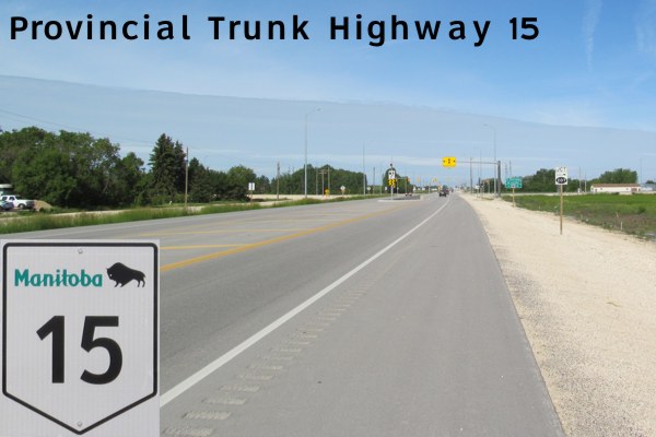
Eastbound view of the first eastbound marker.  Photograph taken in April 2009. |
;) |
||
| RM of Springfield |
Eastbound view showing the newly installed marker featuring the new “warthog”-style buffalo. Photograph taken in November 2010. |
;) |
||
| RM of Springfield |
Westbound view approaching the junction of PTH 101. Photograph taken in June 2012. |
;) |
||
| RM of Springfield |
Westbound view looking at the new bridge over the Red River Floodway. Photograph taken in November 2010. |
;) |
||
| RM of Springfield |
Westbound view approaching the junction of PTH 101. Photograph taken in April 2009. |
;) |
||
| RM of Springfield |
Westbound view showing the 1 km advance signage for the junction of PTH 101. Photograph taken in June 2012. |
;) |
||
| RM of Springfield |
Eastbound view showing the sign indicating the entry into the RM of Springfield. Photograph taken in April 2009. |
;) |
||
| RM of Springfield |
Westbound view showing the sign welcoming visitors to Winnipeg. Ironically, this sign is not located within the City of Winnipeg. Photograph taken in June 2012. |
;) |
||
| RM of Springfield |
Eastbound view showing the advance signage for the junction of PR 207. Photograph taken in April 2009. |
;) |
||
| RM of Springfield |
Eastbound view showing the advance signage for the junction of PR 207 featuring the “warthog”-style buffalo. Ahead is the newly installed traffic light at this intersection. Photograph taken in June 2012. |
;) |
||
| RM of Springfield |
Eastbound view approaching the junction of PR 207. Photograph taken in June 2012. |
;) |
||
| RM of Springfield |
Eastbound view approaching the junction of PR 207. Photograph taken in June 2012. |
;) |
||
| RM of Springfield |
Westbound view past the junction of PR 207 showing the last marker for PTH 15. This marker has since been removed. Photograph taken in April 2009. |
;) |
||
| PTH 15 meets PR 207 east of Winnipeg. Click here for PR 207 images. | ||||
| RM of Springfield |
Westbound view approaching the junction of PR 207. Photograph taken in October 2005. |
;) |
||
| RM of Springfield |
Eastbound view showing the reassurance marker past the junction of PR 207. Photograph taken in April 2009. |
;) |
||
| RM of Springfield |
Eastbound view showing the reassurance marker past the junction of PR 207. Photograph taken in June 2012. |
;) |
||
| RM of Springfield |
Westbound view approaching the junction of PR 207. Photograph taken in June 2012. |
;) |
||
| RM of Springfield |
Westbound view approaching the junction of PR 207. Photograph taken in June 2012. |
;) |
||
| RM of Springfield |
Westbound view showing the advance signage for the junction of PR 207. Photograph taken in April 2009. |
;) |
||
| RM of Springfield |
Westbound view showing the advance signage for the junction of PR 207 featuring the new “warthog”-style buffalo. Photograph taken in June 2012. |
;) |
||
| RM of Springfield |
Westbound view showing a closeup of the advance signage for the junction of PR 207 featuring the new “warthog”-style buffalo. Photograph taken in June 2012. |
;) |
||
| RM of Springfield |
Westbound view showing the 3 km advance signage for the junction of PTH 101. Photograph taken in June 2012. |
;) |
||
| RM of Springfield |
Eastbound view at Pine Ridge Road (Road 24E). Photograph taken in June 2012. |
');) |
||
| RM of Springfield |
Westbound view at Pine Ridge Road (Road 24E). Photograph taken in June 2012. |
');) |
||
| RM of Springfield |
Westbound view at Pine Ridge Road (Road 24E) showing the sign incorrectly identifying the road as Road 24N. Signs such as these identifying the road numbers are the responsibility of the municipality, in this case, the RM of Springfield, and not the province. Photograph taken in June 2012. |
');) |
||
| RM of Springfield |
Westbound view at Heatherdale Road (Road 25E). Photograph taken in June 2012. |
');) |
||
| RM of Springfield |
Eastbound view at Vernon Road (Road 26E). Photograph taken in June 2012. |
');) |
||
| RM of Springfield |
Westbound view at Vernon Road (Road 26E). Photograph taken in June 2012. |
');) |
||
| RM of Springfield |
Eastbound view showing the sign indicating entry into Dugald. Photograph taken in April 2009. |
;) |
||
| RM of Springfield |
Eastbound view showing the new Clearview sign announcing entry into Dugald. Photograph taken in May 2014. |
;) |
||
| RM of Springfield |
Eastbound view approaching the junction of PR 206. Photograph taken in April 2009. |
;) |
||
| RM of Springfield |
Eastbound view approaching the junction of PR 206. Photograph taken in April 2009. |
;) |
||
| RM of Springfield |
Eastbound view showing the new Clearview trailblazer sign in advance of the junction of PR 206. Photograph taken in May 2014. |
;) |
||
| RM of Springfield |
Eastbound view approaching the junction of PR 206. Photograph taken in August 2004. |
;) |
||
| RM of Springfield |
Westbound view showing the reassurance marker past the junction of PR 206. Photograph taken in April 2009. |
;) |
||
| RM of Springfield |
Westbound view showing the reassurance marker past the junction of PR 206. Photograph taken in June 2012. |
;) |
||
| RM of Springfield |
A look at the construction through Dugald from the junction of PR 206. Photograph taken in June 2012. |
;) |
||
| PTH 15 meets PR 206 in Dugald. Click here for PR 206 images. | ||||
| RM of Springfield |
A look at the sign at the junction of PR 206 welcoming visitors to Dugald. Photograph taken in June 2012. |
;) |
||
| RM of Springfield |
Westbound view approaching the junction of PR 206. Photograph taken in May 2014. |
;) |
||
| RM of Springfield |
Eastbound view east of the junction of PR 206. Photograph taken in September 2007. |
;) |
||
| RM of Springfield |
Westbound view approaching the junction of PR 206. Photograph taken in April 2009. |
;) |
||
| RM of Springfield |
Westbound view approaching the junction of PR 206. Photograph taken in April 2009. |
;) |
||
| RM of Springfield |
Westbound view showing the new trailblazer sign in advance of the junction of PR 206. Photograph taken in May 2014. |
;) |
||
| RM of Springfield |
Westbound view showing a closeup of the new trailblazer sign in advance of the junction of PR 206. Photograph taken in May 2014. |
;) |
||
| RM of Springfield |
Westbound view approaching the junction of PR 206. Photograph taken in May 2014. |
;) |
||
| RM of Springfield |
A look at the construction through Dugald near the junction of PR 206. Photograph taken in June 2012. |
;) |
||
| RM of Springfield |
Westbound view approaching the junction of PR 206. Photograph taken in April 2009. |
;) |
||
| RM of Springfield |
Eastbound view showing the sign giving the distance to Anola and Elma. Photograph taken in April 2009. |
;) |
||
| RM of Springfield |
Westbound view showing the sign welcoming visitors to Dugald. Photograph taken in July 2009. |
;) |
||
| RM of Springfield |
Eastbound view at a railway crossing east of Dugald. Photograph taken in July 2009. |
;) |
||
| RM of Springfield |
Westbound view at a railway crossing east of Dugald. Photograph taken in July 2009. |
;) |
||
| PTH 15 meets PR 302 west of Vivian. Click here for PR 302 images. | ||||
| RM of Whitemouth |
A look at the Elma Hotel on the north side of PTH 15 just west of PTH 11. Photographer: Carli Ward. Taken January 2007. |
;) |
||
| PTH 15 ends at PTH 11 in Elma. Click here for PTH 11 images. | ||||
© Curtis Walker. All rights reserved. All pictures used on this site are the property of the respective photographers and are used by permission. No picture may be used without the consent of the respective photographer.
All pictures taken by Curtis Walker unless otherwise noted.