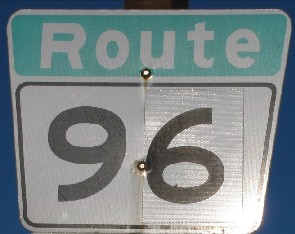
Metro Route 96
 |
|
Pictures are arranged from north to south. Click here to show the route.
;)
| Route 96 ends at PTH 1/Route 85 (Portage Avenue). Click here for PTH 1 images and here for Route 85 images. | ||||
| Location | Description | Photo
| ||
| City of Winnipeg |
Northbound view on Moray Street at Portage Avenue.  Photograph taken in January 2009. |
;) |
||
| City of Winnipeg |
Northbound view showing the new Clearview marker indicating the end of Route 96. Photograph taken in February 2014. |
|||
| City of Winnipeg |
Northbound view on Moray Street at Portage Avenue showing a closeup of the eastbound markers. Photograph taken in January 2009. |
;) |
||
| City of Winnipeg |
Northbound view on Moray Street north of the Charleswood Bridge. Photograph taken in December 2008. |
;) |
||
| City of Winnipeg |
Southbound view on Moray Street approaching the Charleswood Bridge. Photograph taken in December 2008. |
;) |
||
| City of Winnipeg |
Northbound view just north of the Charleswood Bridge. Photograph taken in October 2009. |
;) |
||
| City of Winnipeg |
Southbound view facing the Charleswood Bridge. Photograph taken in October 2009. |
;) |
||
| City of Winnipeg |
A plaque on the Charleswood Bridge. Photograph taken in December 2008. |
;) |
||
| City of Winnipeg |
Northbound view approaching the Charleswood Bridge. Photograph taken in December 2008. |
;) |
||
| City of Winnipeg |
Southbound view on William R. Clement Parkway approaching Roblin Boulevard. Photograph taken in January 2013. |
;) |
||
| City of Winnipeg |
Southbound view on William R. Clement Parkway approaching Roblin Boulevard showing the reassurance marker oddly placed before a major intersection. Photograph taken in January 2013. |
;) |
||
| City of Winnipeg |
Northbound view north of Roblin Boulevard. Photograph taken in December 2008. |
;) |
||
| Route 96 meets Route 95 at Roblin Boulevard. Click here for Route 95 images. | ||||
| City of Winnipeg |
Southbound view south of Roblin Boulevard. Photograph taken in May 2009. |
;) |
||
| City of Winnipeg |
A plaque honoring Tom Chester, for whom the park lining both sides of this stretch of Route 96 is named. Photograph taken in May 2013. |
;) |
||
| City of Winnipeg |
Northbound view from the pedestrian overpass that connects Oakdale Drive to Haney Street. Photograph taken in February 2005. |
;) |
||
| City of Winnipeg |
Northbound view from the pedestrian overpass that connects Oakdale Drive to Haney Street. Photograph taken in April 2010. |
;) |
||
| City of Winnipeg |
Southbound view from the pedestrian overpass that connects Oakdale Drive to Haney Street. Photograph taken in April 2010. |
;) |
||
| City of Winnipeg |
Southbound view on William R. Clement Parkway showing the advance signage for Grant Avenue. Photograph taken in January 2013. |
;) |
||
| City of Winnipeg |
Southbound view on William R. Clement Parkway showing a closeup of the advance signage for Grant Avenue. Photograph taken in January 2013. |
;) |
||
| City of Winnipeg |
Southbound view on William R. Clement Parkway showing the advance signage for Route 105. Photograph taken in May 2009. |
;) |
||
| Route 96 meets Route 105 at Grant Avenue and follows it to Shaftesbury Boulevard. Click here for Route 105 images. | ||||
| City of Winnipeg |
Southbound view on Shaftesbury Boulevard south of Grant Avenue. Photograph taken in May 2009. |
;) |
||
| City of Winnipeg |
Northbound view on Shaftesbury Boulevard approaching Grant Avenue. Photograph taken in August 2009. |
;) |
||
| City of Winnipeg |
Southbound view on Shaftesbury Boulevard showing the last marker for Route 96. Photograph taken in May 2009. |
;) |
||
| City of Winnipeg |
Southbound view on Shaftesbury Boulevard showing the newly installed marker featuring Clearview numbering that indicates the end of Route 96. Photograph taken in March 2012. |
|||
| City of Winnipeg |
Northbound view on Shaftesbury Boulevard showing the first northbound marker. Photograph taken in August 2009. |
;) |
||
| City of Winnipeg |
Southbound view on Shaftesbury Boulevard at Sterling Lyon Parkway/Wilkes Avenue showing the newly installed marker for Route 145 featuring Clearview numbering. Photograph taken in March 2012. |
|||
| Route 96 ends at Route 145 (Sterling Lyon Parkway/Wilkes Avenue). Click here for Route 145 images. | ||||
© Curtis Walker. All rights reserved. All pictures used on this site are the property of the respective photographers and are used by permission. No picture may be used without the consent of the respective photographer.
All pictures taken by Curtis Walker unless otherwise noted.