|
Southern Entrance: Mid-span on the John A. Blatnik Bridge that connects Duluth to Superior, WI.
Northern Terminus: U.S./Canada border at International Falls. Click here to show the route. |
;)
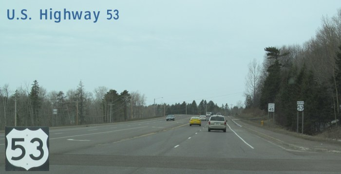
Pictures are arranged from south to north.
| Location | Description | Photo
| ||
| St. Louis County City of Duluth |
Northbound view showing the advance signage for the W. Superior Street/21st Ave. W. exit.  Photograph taken in April 2013. |
;) |
||
| St. Louis County City of Duluth |
Northbound view approaching the W. Superior Street/21st Ave. W. exit. Photograph taken in April 2013. |
;) |
||
| St. Louis County City of Duluth |
Northbound view past the W. Superior Street/21st Ave. W. exit. Photograph taken in April 2013. |
;) |
||
| St. Louis County City of Duluth |
Northbound view past the W. Superior Street/21st Ave. W. exit. Photograph taken in April 2013. |
;) |
||
| St. Louis County City of Duluth |
Northbound view showing the first reassurance marker past I-535/I-35 along with the sign designating this stretch of highway as Walter F. Mondale Drive. In 2008, the section of US 53 between Superior Street and Central Entrance Parkway was named in honor of the former Vice President, a Minnesota native. Photograph taken in April 2013. |
;) |
||
| St. Louis County City of Duluth |
Northbound view approaching West 6th Street. Photograph taken in April 2013. |
;) |
||
| St. Louis County City of Duluth |
Northbound view past West 7th Street. Photograph taken in April 2013. |
;) |
||
| St. Louis County City of Duluth |
Northbound view at West 10th Street. Photograph taken in April 2013. |
;) |
||
| St. Louis County City of Duluth |
Northbound view approaching West 13th Street. Photograph taken in April 2013. |
;) |
||
| St. Louis County City of Duluth |
Northbound view crossing Miller Creek. Photograph taken in April 2013. |
;) |
||
| St. Louis County City of Duluth |
Northbound view past Piedmont Avenue. Photograph taken in April 2013. |
;) |
||
| St. Louis County City of Duluth |
Northbound view approaching another crossing of Miller Creek. Photograph taken in April 2013. |
;) |
||
| St. Louis County City of Duluth |
Northbound view approaching Arlington Avenue. Photograph taken in April 2013. |
;) |
||
| St. Louis County City of Duluth |
Northbound view approaching Arlington Avenue. Photograph taken in April 2013. |
;) |
||
| St. Louis County City of Duluth |
Northbound view showing the reassurance marker past Arlington Avenue. Photograph taken in April 2013. |
;) |
||
| St. Louis County City of Duluth |
Northbound view past Arlington Avenue. Photograph taken in April 2013. |
;) |
||
| St. Louis County City of Duluth |
Northbound view at Mile 4. Photograph taken in April 2013. |
;) |
||
| St. Louis County City of Duluth |
Northbound view passing Coffee Creek Boulevard. Photograph taken in April 2013. |
;) |
||
| St. Louis County City of Duluth |
Northbound view past Coffee Creek Boulevard. Photograph taken in April 2013. |
;) |
||
| St. Louis County City of Duluth |
Northbound view past Coffee Creek Boulevard. Photograph taken in April 2013. |
;) |
||
| St. Louis County City of Duluth |
Northbound view approaching Anderson Road. Photograph taken in April 2013. |
;) |
||
| St. Louis County City of Duluth |
Northbound view approaching Anderson Road. Photograph taken in April 2013. |
;) |
||
| St. Louis County City of Duluth |
Northbound view at Mile 5. Photograph taken in April 2013. |
;) |
||
| St. Louis County City of Duluth |
Northbound view past Anderson Road. Photograph taken in April 2013. |
;) |
||
| St. Louis County City of Duluth |
Northbound view approaching Central Entrance Parkway. Photograph taken in April 2013. |
;) |
||
| St. Louis County City of Duluth |
Northbound view approaching MN 194/Central Entrance Parkway. Photograph taken in April 2013. |
;) |
||
| US 53 meets |
||||
| St. Louis County City of Duluth |
Northbound view showing the US 53/MN 194 markers. Photograph taken in April 2013. |
;) |
||
| St. Louis County City of Duluth |
Northbound view approaching Cottonwood Avenue. At left is Miller Hill Mall, the area's largest shopping center. Photograph taken in April 2013. |
;) |
||
| St. Louis County City of Duluth |
Northbound view past Cottonwood Avenue. Photograph taken in April 2013. |
;) |
||
| St. Louis County City of Duluth |
Northbound view approaching Maple Grove Road. Photograph taken in April 2013. |
;) |
||
| St. Louis County City of Duluth |
Northbound view approaching Maple Grove Road. Photograph taken in April 2013. |
;) |
||
| St. Louis County City of Duluth |
Northbound view past Burning Tree Road. Photograph taken in April 2013. |
;) |
||
| St. Louis County City of Duluth |
Northbound view approaching Haines Road. Photograph taken in April 2013. |
;) |
||
| St. Louis County City of Duluth |
Northbound view entering Hermantown. Photograph taken in April 2013. |
;) |
||
| St. Louis County City of Hermantown |
Northbound view at Mile 7. Photograph taken in April 2013. |
;) |
||
| St. Louis County City of Hermantown |
Northbound view approaching Mall Drive. Photograph taken in April 2013. |
;) |
||
| St. Louis County City of Hermantown |
Northbound view past Arrowhead Road. Photograph taken in April 2013. |
;) |
||
| St. Louis County City of Hermantown |
Northbound view approaching Stebner Road. Photograph taken in April 2013. |
;) |
||
| St. Louis County City of Hermantown |
Northbound view approaching Stebner Road. Photograph taken in April 2013. |
;) |
||
| St. Louis County City of Hermantown |
Northbound view approaching Stebner Road. Photograph taken in April 2013. |
;) |
||
| St. Louis County City of Hermantown |
Northbound view past Stebner Road. Photograph taken in April 2013. |
;) |
||
| St. Louis County City of Hermantown |
Northbound view approaching Sugar Maple Drive. Photograph taken in April 2013. |
;) |
||
| St. Louis County City of Hermantown |
Northbound view at Mile 9. Photograph taken in April 2013. |
;) |
||
| St. Louis County City of Hermantown |
Northbound view past Mile 9. Photograph taken in April 2013. |
;) |
||
| St. Louis County City of Hermantown |
Westbound view passing Lavaque Road. Photograph taken in April 2013. |
;) |
||
| St. Louis County City of Hermantown |
Westbound view past Lavaque Road. Photograph taken in April 2013. |
;) |
||
| St. Louis County City of Hermantown |
Westbound view past Lavaque Road. Photograph taken in April 2013. |
;) |
||
| St. Louis County City of Hermantown |
Westbound view approaching Ugstad Road. Photograph taken in April 2013. |
;) |
||
| St. Louis County City of Hermantown |
Westbound view approaching Ugstad Road. Photograph taken in April 2013. |
;) |
||
| St. Louis County City of Hermantown |
Northbound view past Ugstad Road. Photograph taken in April 2013. |
;) |
||
| St. Louis County City of Hermantown |
Northbound view at Mile 11. Photograph taken in April 2013. |
;) |
||
| St. Louis County City of Hermantown |
Northbound view past Mile 11. Photograph taken in April 2013. |
;) |
||
| St. Louis County City of Hermantown |
Northbound view approaching the turnoff for MN 194 west. Photograph taken in April 2013. |
;) |
||
| St. Louis County City of Hermantown |
Northbound view approaching the turnoff for MN 194 west. Photograph taken in April 2013. |
;) |
||
© Curtis Walker. All rights reserved. All pictures used on this site are the property of the respective photographers and are used by permission. No picture may be used without the consent of the respective photographer.
All pictures taken by Curtis Walker unless otherwise noted.