 |
|
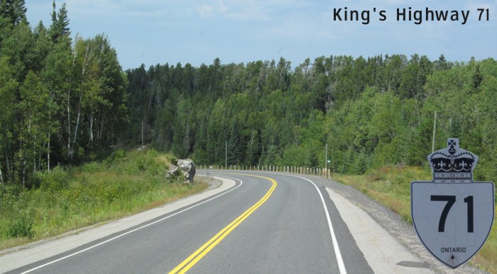
King's Highway 71 follows a winding path through remote wilderness between Kenora and Fort Frances, passing through the small communities of Sioux Narrows and Nestor Falls. The route is filled with countless numbers of blind curves and, not surprisingly, the speed limit is 80 km/h most of the way with few passing opportunites.
|
|
|
|
Click here to show the route.
|
|
Images of King's Highway 71:
- Page 1 - King's Highway 17 to Isabel Lake
- Page 2 - Isabel Lake to Rushing River Provincial Park
- Page 3 - Rushing River Provincial Park to Witch Bay Road
- Page 4 - Witch Bay Road to Tower Lake
- Page 5 - Tower Lake to Andy Lake
- Page 6 - Andy Lake to Divide Lake
- Page 7 - Divide Lake to Black River
- Page 8 - Black River to Bunny Lake
- Page 9 - Bunny Lake to Berry Lake Road
- Page 10 - Berry Lake Road to Laughing Water Road
- Page 11 - Laughing Water Road to Sioux Narrows
- Page 12 - Sioux Narrows
|
© Curtis Walker. All rights reserved. All pictures used on this site are the property of the respective photographers and are used by permission. No picture may be used without the consent of the respective photographer.
All pictures taken by Curtis Walker unless otherwise noted.
;)