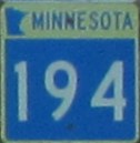
Minnesota Highway 194
 |
MN 194 runs east-west beginning at I-35 in Duluth, following Mesaba Avenue and Central Entrance Drive before meeting US 53 near the Miller Hill Mall. It follows US 53 for nearly seven miles through Hermantown before proceeding west and ending at US 2.
Eastern Terminus: Junction of I-35 at Mesaba Avenue in Duluth. Western Terminus: Junction of US 2 in Solway Township. Click here to show the route. |
Pictures are arranged from east to west.
| Location | Description | Photo
| ||
| St. Louis County City of Hermantown |
Westbound view past the junction of US 53.  Photograph taken in April 2013. |
 |
||
| St. Louis County City of Hermantown |
Westbound view showing the first reassurance marker past the junction of US 53.  Photograph taken in April 2013. |
 |
||
| St. Louis County City of Hermantown |
Westbound view showing the sign giving the mileage to US 2, Floodwood and Grand Rapids.  Photograph taken in April 2013. |
 |
||
| St. Louis County City of Hermantown |
Westbound view past the junction of US 53.  Photograph taken in April 2013. |
 |
||
| St. Louis County City of Hermantown |
Westbound view showing the advance signage for Midway Road.  Photograph taken in April 2013. |
 |
||
| St. Louis County City of Hermantown |
Westbound view approaching Midway Road.  Photograph taken in April 2013. |
 |
||
| St. Louis County City of Hermantown |
Westbound view showing the reassurance marker past Midway Road.  Photograph taken in April 2013. |
 |
||
| St. Louis County City of Hermantown |
Westbound view past Midway Road.  Photograph taken in April 2013. |
 |
||
| St. Louis County City of Hermantown |
Westbound view showing the advance signage for the junction of CSAH 889.  Photograph taken in April 2013. |
 |
||
| St. Louis County City of Hermantown |
Westbound view showing the advance signage for Solway Road.  Photograph taken in April 2013. |
 |
||
| St. Louis County Solway Township |
Westbound view past Solway Road.  Photograph taken in April 2013. |
 |
||
| St. Louis County Solway Township |
Westbound view showing the advance signage for Caribou Lake Road.  Photograph taken in April 2013. |
 |
||
| St. Louis County Solway Township |
Westbound view approaching for Caribou Lake Road.  Photograph taken in April 2013. |
 |
||
| St. Louis County Solway Township |
Westbound view passing Caribou Lake Road.  Photograph taken in April 2013. |
 |
||
| St. Louis County Solway Township |
Westbound view past Caribou Lake Road.  Photograph taken in April 2013. |
 |
||
| St. Louis County Solway Township |
Westbound view past Caribou Lake Road.  Photograph taken in April 2013. |
 |
||
| St. Louis County Solway Township |
Westbound view past Caribou Lake Road.  Photograph taken in April 2013. |
 |
||
| St. Louis County Solway Township |
Westbound view past Caribou Lake Road.  Photograph taken in April 2013. |
 |
||
| St. Louis County Solway Township |
Westbound view showing the advance signage for Canosia Road.  Photograph taken in April 2013. |
 |
||
| St. Louis County Solway Township |
Westbound view passing Canosia Road.  Photograph taken in April 2013. |
 |
||
| St. Louis County Solway Township |
Westbound view crossing the White Pine River.  Photograph taken in April 2013. |
 |
||
| St. Louis County Solway Township |
Westbound view past the crossing of the White Pine River.  Photograph taken in April 2013. |
 |
||
| St. Louis County Solway Township |
Westbound view past the crossing of the White Pine River.  Photograph taken in April 2013. |
 |
||
| St. Louis County Solway Township |
Westbound view showing the advance signage for the junction of US 2.  Photograph taken in April 2013. |
 |
||
| St. Louis County Solway Township |
Westbound view approaching the junction of US 2.  Photograph taken in April 2013. |
 |
||
| St. Louis County Solway Township |
Westbound view approaching the junction of US 2.  Photograph taken in April 2013. |
 |
||
| St. Louis County Solway Township |
Westbound view approaching the junction of US 2. Eastbound US 2 traffic proceeds to the left while westbound US 2 traffic continues straight ahead.  Photograph taken in April 2013. |
 |
||
© Curtis Walker. All rights reserved. All pictures used on this site are the property of the respective photographers and are used by permission. No picture may be used without the consent of the respective photographer.
All pictures taken by Curtis Walker unless otherwise noted.