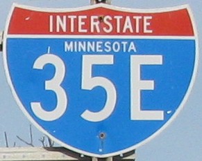
Interstate 35E
|
Southern Terminus: Junction of I-35E in Burnsville.
Northern Terminus: Junction of I-35E in Columbus. I-35E represents the eastern split of I-35 through the Twin Cities of Minneapolis and Saint Paul. From its southern terminus in Burnsville, I-35E proceeds north east to downtown Saint Paul, where it continues north until it meets up with I-35W in Columbus. Click here to show the route. |
;)
Pictures are arranged from south to north.
| I-35E ends at I-35W in Burnsville and continues south as I-35. Click here for I-35W images and here for I-35 images. | ||||
| Location | Description | Photo
| ||
| Dakota County City of Burnsville |
Southbound view from Buck Hill Road showing the sign for the end of I-35E.  Photograph taken in November 2009. |
;) |
||
| Dakota County City of Burnsville |
Looking north at the southbound ramp over Southcross Drive. Photograph taken in November 2009. |
;) |
||
| Dakota County City of Burnsville |
Facing the southbound ramp of I-35E from Southcross Drive. Though the signage is for I-35, this is still north of the I-35W/I-35E split. Photograph taken in November 2009. |
;) |
||
| Dakota County City of Burnsville |
Northbound view showing the overhead signage for Exit 88B - CSAH 42. Photograph taken in November 2009. |
;) |
||
| Dakota County City of Burnsville |
Approaching I-35E from the west along CSAH 42. Photograph taken in November 2009. |
;) |
||
| Dakota County City of Burnsville |
Approaching I-35E from the west along CSAH 42. Photograph taken in November 2009. |
;) |
||
| Dakota County City of Burnsville |
The southbound access for I-35E from CSAH 42. Photograph taken in November 2009. |
;) |
||
| Dakota County City of Burnsville |
Looking north at I-35E from the off ramp at CSAH 42. Photograph taken in November 2009. |
;) |
||
| Dakota County City of Burnsville |
Approaching I-35E from the east along CSAH 42. Photograph taken in November 2009. |
;) |
||
| I-35E meets MN 55 in Eagan. Click here for MN 55 images. | ||||
| I-35E meets I-494 in Eagan. Click here for I-494 images. | ||||
| I-35E meets MN 5 in Saint Paul. Click here for MN 5 images. | ||||
| Ramsey County City of Saint Paul |
Assembly of signs on John Ireland Boulevard at Kellogg Boulevard. Photograph taken in July 2014. |
;) |
||
| Ramsey County City of Saint Paul |
Southbound view showing the 1¼ mile advance signage for Exit 105/St. Clair Avenue. Photograph taken in July 2014. |
;) |
||
| I-35E meets US 10 in Saint Paul. Click here for US 10 images. | ||||
| I-35E meets I-94 in Saint Paul. Click here for I-94 images. | ||||
| I-35E meets I-694 in Little Canada. Click here for I-694 images. | ||||
| I-35E ends at I-35W in Columbus and continues north as I-35. Click here for I-35W images and here for I-35 images. | ||||
© Curtis Walker. All rights reserved. All pictures used on this site are the property of the respective photographers and are used by permission. No picture may be used without the consent of the respective photographer.
All pictures taken by Curtis Walker unless otherwise noted.