Provincial Trunk Highway 9
| Page 1 - PTH 101 to PTH 27/PR 238 | Page 2 --> |
Pictures are arranged from south to north.
| Location | Description | Photo
| ||
| RM of West St. Paul |
Northbound view after crossing the overpass at PTH 101.  Photograph taken in May 2005. |
 |
||
| RM of West St. Paul |
Southbound view at the junction of PTH 101.  Photograph taken in June 2009. |
 |
||
| RM of West St. Paul |
Northbound view showing the first northbound marker.  Photograph taken in June 2009. |
 |
||
| RM of West St. Paul |
Northbound view showing the recently replaced marker featuring the new “warthog”-style buffalo.  Photograph taken in August 2010. |
 |
||
| RM of West St. Paul |
Southbound view approaching the junction of PTH 101.  Photograph taken in March 2009. |
 |
||
| RM of West St. Paul |
Northbound view entering Middlechurch.  Photograph taken in May 2005. |
 |
||
| RM of West St. Paul |
Southbound view in Middlechurch south of Grassmere Road. This is the last southbound marker for PTH 9.  Photograph taken in January 2009. |
 |
||
| RM of West St. Paul |
Southbound view past Grassmere Road showing the last southbound marker, now featuring the new marker with the “warthog”-style buffalo.  Photograph taken in March 2011. |
 |
||
| RM of West St. Paul |
Northbound view at Grassmere Road.  Photograph taken in March 2010. |
 |
||
| RM of West St. Paul |
Southbound view at Grassmere Road.  Photograph taken in July 2010. |
 |
||
| RM of West St. Paul |
Northbound view showing the first marker north of Grassmere Road.  Photograph taken in March 2010. |
 |
||
| RM of West St. Paul |
Northbound view showing the reassurance marker past Grassmere Road featuring the new marker with the “warthog”-style buffalo.  Photograph taken in March 2011. |
 |
||
| RM of West St. Paul |
Northbound view showing the sign giving the distances to Lockport and Selkirk.  Photograph taken in March 2010. |
 |
||
| RM of West St. Paul |
Southbound view 2 km from PTH 101.  Photograph taken in March 2009. |
 |
||
| RM of West St. Paul |
Northbound view entering Rivercrest. The signs shown on the left side of the highway dot the fields all the way through the RM of West St. Paul.  Photograph taken in May 2005. |
 |
||
| RM of West St. Paul |
Northbound view at Allenford Drive showing the sign welcoming visitors to Rivercrest.  Photograph taken in May 2014. |
 |
||
| RM of West St. Paul |
Southbound view near Allenford Drive.  Photograph taken in July 2010. |
 |
||
| RM of West St. Paul |
Southbound view entering Rivercrest.  Photograph taken in March 2009. |
 |
||
| RM of West St. Paul |
Northbound view at Ward Way.  Photograph taken in March 2010. |
 |
||
| RM of West St. Paul |
Northbound view approaching the crossing of Parks Creek.  Photograph taken in March 2012. |
 |
||
| RM of St. Andrews |
Northbound view entering the RM of St. Andrews. The bridge ahead crosses Parks Creek.  Photograph taken in June 2005. |
 |
||
| RM of St. Andrews |
Northbound view approaching the newly constructed crossing of Parks Creek.  Photograph taken in March 2012. |
 |
||
| RM of St. Andrews |
Southbound view south of Parks Creek.  Photograph taken in March 2009. |
 |
||
| RM of St. Andrews |
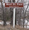
Southbound view showing the sign indicating entry into the RM of West St. Paul.  Photograph taken in March 2009. |
 |
||
| RM of St. Andrews |
Southbound view showing the new sign announcing entry into the RM of West St. Paul.  Photograph taken in May 2014. |
 |
||
| RM of St. Andrews |
Northbound view at the former junction of PR 238 (River Road). The two separate junctions at PR 238 and PTH 27 just north have since been combined into one. PR 238 was rerouted to the north to make for one junction and a traffic light was installed at that intersection.  Photograph taken in May 2005. |
 |
||
| RM of St. Andrews |
Northbound view showing the new Clearview advance signage for River Road.  Photograph taken in March 2013. |
 |
||
| RM of St. Andrews |
Northbound view showing a closeup of the new Clearview advance signage for River Road.  Photograph taken in March 2013. |
 |
||
| RM of St. Andrews |
Northbound view showing the advance signage for the junction of PTH 27/PR 238.  Photograph taken in March 2010. |
 |
||
| RM of St. Andrews |
Northbound view at the former junction of PR 238 (River Road). To the left, construction is already underway for the common junction of PR 238 and PTH 27.  Photograph taken in June 2005. |
 |
||
| RM of St. Andrews |
Northbound view at the former junction of PR 238.  Photograph taken in June 2005. |
 |
||
| RM of St. Andrews |
Northbound view at the junction of PTH 27/PR 238.  Photograph taken in March 2009. |
 |
||
| RM of St. Andrews |
Southbound view at the junction of PTH 27/PR 238.  Photograph taken in March 2009. |
 |
||
| RM of St. Andrews |
Northbound view at the junction of PTH 27/PR 238.  Photograph taken in June 2006. |
 |
||
| Click here to continue north along |
||||
© Curtis Walker. All rights reserved. All pictures used on this site are the property of the respective photographers and are used by permission. No picture may be used without the consent of the respective photographer.
All pictures taken by Curtis Walker unless otherwise noted.