|
Pictures are arranged from south to north. Click here to show the route.
;)
| PR 428 ends at PTH 14/PTH 32 in Winkler. Click here for PTH 14 images and here for PTH 32 images. | ||||
| Location | Description | Photo
| ||
| City of Winkler |
Northbound view past the junction of PTH 14.  Photograph taken in August 2011. |
;) |
||
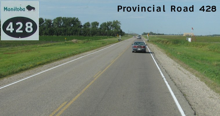
| City of Winkler |
Northbound view showing the first northbound reassurance marker. Photograph taken in August 2011. |
;) |
||
| City of Winkler |
Northbound view leaving Winkler. Photograph taken in August 2011. |
;) |
||
| City of Winkler |
Northbound view leaving Winkler. Photograph taken in August 2011. |
;) |
||
| RM of Stanley |
Northbound view approaching Road 14N, not to be confused with PTH 14 one mile south. Photograph taken in August 2011. |
;) |
||
| RM of Stanley |
Northbound view approaching Road 15N. Photograph taken in August 2011. |
;) |
||
| RM of Stanley |
Northbound view approaching Road 15N. Photograph taken in August 2011. |
;) |
||
| RM of Stanley |
Northbound view approaching Road 16N. Photograph taken in August 2011. |
;) |
||
| RM of Stanley |
Northbound view approaching Road 17N. Photograph taken in August 2011. |
;) |
||
| RM of Stanley |
Northbound view approaching Road 18N. At right is the sign indicating the entry into the RM of Roland. Photograph taken in August 2011. |
;) |
||
| RM of Roland |
Northbound view past Road 18N. Photograph taken in August 2011. |
;) |
||
| RM of Roland |
Northbound view past Road 18N showing a first-generation reassurance marker. Photograph taken in August 2011. |
;) |
||
| RM of Roland |
Northbound view approaching Road 19N. Photograph taken in August 2011. |
;) |
||
| RM of Roland |
Northbound view approaching Road 20N. Photograph taken in August 2011. |
;) |
||
| RM of Roland |
Northbound view approaching Road 21N. Photograph taken in August 2011. |
;) |
||
| RM of Roland |
Northbound view approaching Road 21N. Photograph taken in August 2011. |
;) |
||
| RM of Roland |
Northbound view approaching Road 22N. Photograph taken in August 2011. |
;) |
||
| RM of Roland |
Northbound view approaching Road 23N, not to be confused with PTH 23 one mile north. Photograph taken in August 2011. |
;) |
||
| RM of Roland |
Northbound view approaching the junction of PTH 23. At left is the village of Roland. Photograph taken in August 2011. |
;) |
||
| RM of Roland |
Northbound view showing the advance signage for the junction of PTH 23. Photograph taken in August 2011. |
;) |
||
| RM of Roland |
Northbound view approaching the junction of PTH 23. Photograph taken in August 2011. |
;) |
||
| RM of Roland |
Northbound view at the junction of PTH 23. Photograph taken in August 2011. |
;) |
||
| RM of Roland |
Northbound view at the junction of PTH 23. Photograph taken in August 2011. |
;) |
||
| PR 428 ends at PTH 23 near Roland. Click here for PTH 23 images. | ||||
© Curtis Walker. All rights reserved. All pictures used on this site are the property of the respective photographers and are used by permission. No picture may be used without the consent of the respective photographer.
All pictures taken by Curtis Walker unless otherwise noted.