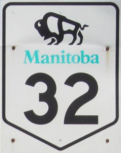
Provincial Trunk Highway 32
 |
|
;)
Pictures are arranged from north to south.
| PTH 32 ends at PTH 14/PR 428 in Winkler. Click here for PTH 14 images and here for PR 428 images. | ||||
| Location | Description | Photo
| ||
| City of Winkler |
Northbound view on 1st Street showing the signs indicating the end of PTH 32 and that PR 428 continues past PTH 14.  Photograph taken in July 2013. |
;) |
||
| City of Winkler |
Southbound view on 1st Street approaching Triple E Boulevard. Photograph taken in July 2013. |
;) |
||
| City of Winkler |
Southbound view on 1st Street approaching Triple E Boulevard. Photograph taken in July 2013. |
;) |
||
| City of Winkler |
Northbound view on 1st Street showing the directional signs for PTH 14. Photograph taken in July 2013. |
;) |
||
| City of Winkler |
Northbound view on 1st Street showing the sign giving directions to Roland, Morden and Morris. Photograph taken in July 2013. |
;) |
||
| City of Winkler |
Southbound view on 1st Street approaching Roblin Boulevard showing the first southbound marker. Photograph taken in July 2013. |
;) |
||
| City of Winkler |
Southbound view on 1st Street approaching Roblin Boulevard showing the first southbound marker. Photograph taken in July 2013. |
;) |
||
| City of Winkler |
Southbound view on 1st Street approaching Roblin Boulevard showing a closeup of the first southbound marker. Photograph taken in July 2013. |
;) |
||
| City of Winkler |
Northbound view on 1st Street approaching Norquay Drive showing the advance signage for the junction of PR 428/PTH 14. Photograph taken in July 2013. |
;) |
||
| City of Winkler |
Northbound view on 1st Street past Norquay Drive. Photograph taken in July 2013. |
;) |
||
| City of Winkler |
Southbound view on 1st Street approaching Roblin Boulevard. Photograph taken in July 2013. |
;) |
||
| City of Winkler |
Northbound view on 1st Street approaching Roblin Boulevard. Photograph taken in July 2013. |
;) |
||
| City of Winkler |
Southbound view on 1st Street past Roblin Boulevard. Photograph taken in July 2013. |
;) |
||
| City of Winkler |
Northbound view on 1st Street approaching Roblin Boulevard. Photograph taken in July 2013. |
;) |
||
| City of Winkler |
Northbound view on 1st Street past Cargill Road. Photograph taken in July 2013. |
;) |
||
| PTH 32 meets PR 201 south of Winkler. Click here for PR 201 images. | ||||
© Curtis Walker. All rights reserved. All pictures used on this site are the property of the respective photographers and are used by permission. No picture may be used without the consent of the respective photographer.
All pictures taken by Curtis Walker unless otherwise noted.