|
;)
Pictures are arranged from west to east.
| PR 325 ends at PTH 68 east of the Lake Manitoba Narrows. Click here for PTH 68 images. | ||||
| Location | Description | Photo
| ||
| RM of West Interlake |
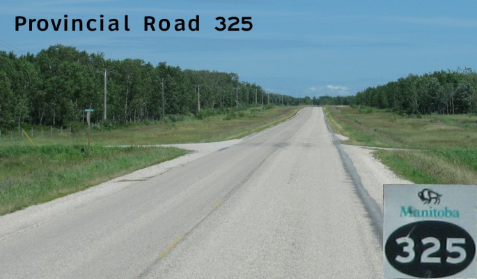
Northbound view showing the first marker past the junction of PTH 68.  Photograph taken in July 2011. |
;) |
||
| RM of West Interlake |
Northbound view showing the sign giving the distance to Ashern. Photograph taken in July 2011. |
;) |
||
| RM of West Interlake |
Northbound view past the junction of PTH 68. Photograph taken in July 2011. |
;) |
||
| RM of West Interlake |
Northbound view past the junction of PTH 68. Photograph taken in July 2011. |
;) |
||
| RM of West Interlake |
Northbound view past the junction of PTH 68. Photograph taken in July 2011. |
;) |
||
| RM of West Interlake |
Northbound view approaching Jonsson Road. Photograph taken in July 2011. |
;) |
||
| RM of West Interlake |
Northbound view approaching Jonsson Road. Photograph taken in July 2011. |
;) |
||
| RM of West Interlake |
Northbound view past Jonsson Road. Photograph taken in July 2011. |
;) |
||
| RM of West Interlake |
Eastbound view past Thorlacius Road. Photograph taken in July 2011. |
;) |
||
| RM of West Interlake |
Eastbound view past Thorlacius Road. Photograph taken in July 2011. |
;) |
||
| RM of West Interlake |
Eastbound view near Marsh Bay Road. Photograph taken in July 2011. |
;) |
||
| RM of West Interlake |
Eastbound view past Marsh Bay Road. Photograph taken in July 2011. |
;) |
||
| RM of West Interlake |
Eastbound view past Marsh Bay Road. Photograph taken in July 2011. |
;) |
||
| RM of West Interlake |
Eastbound view past Marsh Bay Road. Photograph taken in July 2011. |
;) |
||
| RM of West Interlake |
Northbound view approaching Ralph Connor Road. Photograph taken in July 2011. |
;) |
||
| RM of West Interlake |
Northbound view approaching Ralph Connor Road. Photograph taken in July 2011. |
;) |
||
| RM of West Interlake |
Eastbound view near Koops Road. Regrettably, the RM of Siglunes is one of the few Manitoba municipalities that does not indicate the proper road numbers on the signage. Photograph taken in July 2011. |
;) |
||
| RM of West Interlake |
Eastbound view past Koops Road. Photograph taken in July 2011. |
;) |
||
| RM of West Interlake |
Eastbound view near Dory Road. Photograph taken in July 2011. |
;) |
||
| RM of West Interlake |
Eastbound view past Dory Road. Photograph taken in July 2011. |
;) |
||
| RM of West Interlake |
Eastbound view approaching Quarry Road. Photograph taken in July 2011. |
;) |
||
| RM of West Interlake |
Eastbound view near Quarry Road. Photograph taken in July 2011. |
;) |
||
| RM of West Interlake |
Eastbound view near Arnold Road. Photograph taken in July 2011. |
;) |
||
| RM of West Interlake |
Eastbound view approaching Geisler Road. Photograph taken in July 2011. |
;) |
||
| RM of West Interlake |
Eastbound view near Geisler Road. Photograph taken in July 2011. |
;) |
||
| RM of West Interlake |
Eastbound view approaching Gutknecht Road. Photograph taken in July 2011. |
;) |
||
| RM of West Interlake |
Eastbound view near Gutknecht Road. Photograph taken in July 2011. |
;) |
||
| RM of West Interlake |
Eastbound view approaching the decommissioned PR 514. Photograph taken in July 2011. |
;) |
||
| RM of West Interlake |
Eastbound view past the decommissioned PR 514. Photograph taken in July 2011. |
;) |
||
| RM of West Interlake |
Eastbound view approaching Kurbis Road. Photograph taken in July 2011. |
;) |
||
| RM of West Interlake |
Eastbound view approaching Kurbis Road. Photograph taken in July 2011. |
;) |
||
| RM of West Interlake |
Eastbound view near Kurbis Road. Photograph taken in July 2011. |
;) |
||
| RM of West Interlake |
Northbound view past Kurbis Road. Photograph taken in July 2011. |
;) |
||
| RM of West Interlake |
Northbound view approaching the junction of PTH 6. Photograph taken in July 2011. |
;) |
||
| RM of West Interlake |
Northbound view showing the advance signage for the junction of PTH 6. In the distance straight ahead is the village of Ashern. Photograph taken in July 2011. |
;) |
||
| RM of West Interlake |
Northbound view approaching the junction of PTH 6. Photograph taken in July 2011. |
;) |
||
| RM of West Interlake |
Northbound view at the junction of PTH 6. Photograph taken in July 2011. |
;) |
||
| RM of West Interlake |
Northbound view at the junction of PTH 6. Photograph taken in July 2011. |
;) |
||
| PR 325 meets PTH 6 south of Ashern. Click here for PTH 6 images. | ||||
| PR 325 meets PTH 17 near Hodgson. Click here for PTH 17 images. | ||||
© Curtis Walker. All rights reserved. All pictures used on this site are the property of the respective photographers and are used by permission. No picture may be used without the consent of the respective photographer.
All pictures taken by Curtis Walker unless otherwise noted.