PR 320 runs north-south along Main Street in Selkirk following the western shore of the Red River and continues north as Breezy Point Road in the RM of St. Andrews. It passes underneath the “Bridge to Nowhere” at PTH 4 and proceeds north to Clandeboye Road. Breezy Point Road continues north to Breezy Point and Netley Creek Provincial Park at the southern tip of Lake Winnipeg, but PR 320 ends at Clandeboye Road.
Southern Terminus: Junction of PTH 9A (Manitoba Avenue) in Selkirk.
Northern Terminus: Intersection of Breezy Point Road and Clandeboye Road (Road 84N) south of Breezy Point.
Multiplexes: None.
Pictures are arranged from south to north. Click here to show the route.
;)
| PR 320 ends at Manitoba Avenue in Selkirk and continues south as PTH 9A. Click here for PTH 9A images. | ||||
| Location | Description | Photo
| ||
| City of Selkirk |
Southbound view at Superior Avenue. There are no markers indicating the end of PR 320 at the lights nor of the junction of PTH 9A.  Photograph taken in April 2009. |
;) |
||
| City of Selkirk |
Northbound view at Lake Avenue. Photograph taken in April 2009. |
;) |
||
| RM of St. Andrews |
Southbound view entering Selkirk. Photograph taken in May 2009. |
;) |
||
| RM of St. Andrews |
Northbound view showing the sign indicating the entry into the RM of St. Andrews. In the background is an amphibious airplane that took off from Selkirk Air. Planes also land on the Red River just ahead. Photograph taken in May 2010. |
;) |
||
| RM of St. Andrews |
Southbound view at Selkirk Air. Photograph taken in May 2009. |
;) |
||
| RM of St. Andrews |
Northbound view north of Selkirk. Photograph taken in May 2009. |
;) |
||
| RM of St. Andrews |
Northbound view approaching the turnoff for PTH 4. Photograph taken in May 2009. |
;) |
||
| RM of St. Andrews |
Northbound view approaching the turnoff for PTH 4. Photograph taken in May 2010. |
;) |
||
| RM of St. Andrews |
Southbound view south of the turnoff for PTH 4. Photograph taken in May 2009. |
;) |
||
| RM of St. Andrews |
Northbound view at the “Bridge to Nowhere”. Photograph taken in May 2009. |
;) |
||
| PR 320 meets PTH 4 north of Selkirk. Click here for PTH 4 images. | ||||
| RM of St. Andrews |
Southbound view at the turnoff for PTH 4. Photograph taken in May 2010. |
;) |
||
| RM of St. Andrews |
Southbound view at the turnoff for PTH 4 showing a closeup of the markers. Photograph taken in May 2010. |
;) |
||
| RM of St. Andrews |
Northbound view at the “Bridge to Nowhere” showing a closeup of the only northbound reassurance marker. Photograph taken in May 2009. |
;) |
||
| RM of St. Andrews |
Another look at the one and only northbound PR 320 reassurance marker. Photograph taken in May 2010. |
;) |
||
| RM of St. Andrews |
Looking north atop the “Bridge to Nowhere”. Photograph taken in May 2009. |
;) |
||
| RM of St. Clements |
Looking south atop the “Bridge to Nowhere”. Photograph taken in May 2009. |
;) |
||
| RM of St. Andrews |
Southbound view at the “Bridge to Nowhere”. Photograph taken in May 2010. |
;) |
||
| RM of St. Andrews |
Southbound view approaching the turnoff for PTH 4. Photograph taken in May 2010. |
;) |
||
| RM of St. Andrews |
Southbound view approaching the turnoff for PTH 4 showing a closeup of the marker. Photograph taken in May 2010. |
;) |
||
| RM of St. Andrews |
Northbound view showing the sign giving the distance to Breezy Point. Photograph taken in May 2010. |
;) |
||
| RM of St. Andrews |
Northbound view showing a closeup of the sign giving the distance to Breezy Point. Photograph taken in May 2010. |
;) |
||
| RM of St. Andrews |
Southbound view showing the “Bridge to Nowhere” off in the distance. Photograph taken in May 2010. |
;) |
||
| RM of St. Andrews |
Northbound view south of an unnamed creek. Photograph taken in May 2010. |
;) |
||
| RM of St. Andrews |
Northbound view crossing an unnamed creek. Photograph taken in May 2010. |
;) |
||
| RM of St. Andrews |
Southbound view approaching the turn near an unnamed creek. Photograph taken in May 2010. |
;) |
||
| RM of St. Andrews |
Northbound view near Clandeboye Road. Photograph taken in May 2010. |
;) |
||
| RM of St. Andrews |
Northbound view near Clandeboye Road showing a closeup of the sign indicating the direction for each of nearby Breezy Point and Clandeboye. Photograph taken in May 2010. |
;) |
||
| RM of St. Andrews |
Northbound view at Clandeboye Road. Photograph taken in May 2010. |
;) |
||
| RM of St. Andrews |
Northbound view showing the sign indicating the end of the pavement ahead. Photograph taken in May 2010. |
;) |
||
| RM of St. Andrews |
Southbound view at Clandeboye Road. There is no reassurance marker until the junction of PTH 4. Photograph taken in May 2010. |
;) |
||
| RM of St. Andrews |
Facing PR 320 from Clandeboye Road. The bi-directional sign is rather pointless here, since the sign for the end of PR 320 is only a few feet off to the left. Photograph taken in May 2010. |
;) |
||
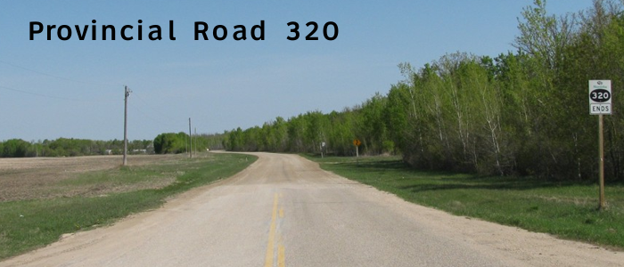
| RM of St. Andrews |
Northbound view showing the sign indicating the end of PR 320. Photograph taken in May 2010. |
;) |
||
| RM of St. Andrews |
Northbound view showing a closeup of the sign indicating the end of PR 320. Photograph taken in May 2010. |
;) |
||
| RM of St. Andrews |
Northbound view north of Clandeboye Road showing the end of the pavement on Breezy Point Road and the end of PR 320. Photograph taken in May 2010. |
;) |
||
© Curtis Walker. All rights reserved. All pictures used on this site are the property of the respective photographers and are used by permission. No picture may be used without the consent of the respective photographer.
All pictures taken by Curtis Walker unless otherwise noted.