 |
|
;)
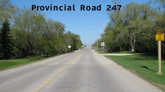
Pictures are arranged from east to west.
| PR 247 ends at PTH 75 south of Winnipeg. Click here for PTH 75 images. | ||||
| Location | Description | Photo
| ||
| RM of Ritchot |
Westbound view at a railway crossing just west of the junction of PTH 75.  Photograph taken in July 2011. |
;) |
||
| RM of Macdonald |
Westbound view at the northern junction of PR 330. The pair of first-generation provincial road signs will likely soon be disappearing in favor of the newer versions featuring the “warthog”-style buffalo. Photograph taken in April 2006. |
;) |
||
| RM of Macdonald |
Westbound view approaching the northern junction of PR 330. Photograph taken in October 2009. |
;) |
||
| RM of Macdonald |
Eastbound view east of the northern junction of PR 330. Photograph taken in October 2009. |
;) |
||
| PR 247 meets PR 330 in La Salle. Click here for PR 330 images. | ||||
| RM of Macdonald |
Eastbound view at the southern junction of PR 330. Photograph taken in October 2009. |
;) |
||
| RM of Macdonald |
Westbound view at a railway crossing west of the southern junction of PR 330. Photograph taken in October 2009. |
;) |
||
| RM of Macdonald |
Westbound view showing the reassurance marker past the junction of PR 330. Photograph taken in April 2012. |
;) |
||
| RM of Macdonald |
Eastbound view showing the advance signage for the junction of PR 330. Photograph taken in April 2012. |
;) |
||
| RM of Macdonald |
Westbound view leaving La Salle. Photograph taken in April 2012. |
;) |
||
| RM of Macdonald |
Eastbound view from the northern junction of PTH 3. Photograph taken in June 2009. |
;) |
||
| PR 247 meets PTH 3 near Sanford. Click here for PTH 3 images. | ||||
| RM of Macdonald |
Westbound view at the southern junction of PTH 3. Photograph taken in May 2010. |
;) |
||
| RM of Macdonald |
Eastbound view at the southern junction of PTH 3. Photograph taken in May 2010. |
;) |
||
| RM of Macdonald |
Westbound view approaching the narrow bridge that crosses the La Salle River. Photograph taken in May 2010. |
;) |
||
| RM of Macdonald |
Eastbound view approaching the junction of PTH 3. Photograph taken in May 2010. |
;) |
||
| RM of Macdonald |
Westbound view at River Crescent. Photograph taken in May 2010. |
;) |
||
| RM of Macdonald |
Westbound view at River Crescent showing a closeup of the marker. Photograph taken in May 2010. |
;) |
||
| RM of Macdonald |
Westbound view at Blythefield Road. Photograph taken in May 2010. |
;) |
||
| RM of Macdonald |
Eastbound view showing the advance signage for the junction of PTH 3. Photograph taken in May 2010. |
;) |
||
| RM of Macdonald |
Westbound view approaching the eastern junction of PR 334. Photograph taken in May 2010. |
;) |
||
| RM of Macdonald |
Eastbound view approaching Blythefield Road. Photograph taken in May 2010. |
;) |
||
| RM of Macdonald |
Eastbound view showing the marker past the eastern junction of PR 334. Photograph taken in May 2010. |
;) |
||
| RM of Macdonald |
Westbound view at Evergreen Place. Photograph taken in May 2010. |
;) |
||
| RM of Macdonald |
Westbound view at Evergreen Place showing a closeup of the markers. Photograph taken in May 2010. |
;) |
||
| PR 247 meets PR 334 in Sanford. Click here for PR 334 images. | ||||
| RM of Macdonald |
Westbound view west of the eastern junction of PR 334. Photograph taken in June 2009. |
;) |
||
| RM of Macdonald |
Westbound view west of the eastern junction of PR 334 showing a closeup of the markers. Photograph taken in June 2009. |
;) |
||
| RM of Macdonald |
Eastbound view at the eastern junction of PR 334. Photograph taken in June 2009. |
;) |
||
| RM of Macdonald |
A look at the offices for the RM of Macdonald. Photograph taken in June 2009. |
;) |
||
| RM of Macdonald |
A look at the grain elevator in Sanford. Photograph taken in June 2009. |
;) |
||
| RM of Macdonald |
Westbound view approaching a railway crossing west of Railway Avenue. Photograph taken in June 2009. |
;) |
||
| PR 247 meets PR 334 west of Sanford. Click here for PR 334 images. | ||||
| PR 247 meets PR 332 west of Sanford. Click here for PR 332 images. | ||||
| PR 247 meets PR 248 west of Sanford. Click here for PR 248 images. | ||||
| PR 247 ends at PTH 2 in Elm Creek. Click here for PTH 2 images. | ||||
© Curtis Walker. All rights reserved. All pictures used on this site are the property of the respective photographers and are used by permission. No picture may be used without the consent of the respective photographer.
All pictures taken by Curtis Walker unless otherwise noted.