|
Southern Entrance: West Virginia state line near Mount Morris.
Northern Terminus: Junction of US 20 in Erie. |
Pictures are arranged from south to north.
| Location | Description | Photo
| ||
| Erie County Summit Township |
A look at the signs for US 19 from Oliver Road.  Photograph taken in October 2015. |
;) |
||
| Erie County Summit Township |
Northbound view on Peach Street approaching the junction of I-90. Photograph taken in October 2015. |
;) |
||
| Erie County Summit Township |
Southbound view on Peach Street approaching Oliver Road. Photograph taken in October 2015. |
;) |
||
| Erie County Summit Township |
Northbound view on Peach Street at the turnoff to I-90 east. Photograph taken in October 2015. |
;) |
||
| Erie County Summit Township |
Northbound view on Peach Street at the turnoff to I-90 east. Photograph taken in October 2015. |
;) |
||
| Erie County Summit Township |
Southbound view on Peach Street at the turnoff to I-90 east. Photograph taken in October 2015. |
;) |
||
| Erie County Summit Township |
Northbound view on Peach Street approaching the turnoff to I-90 west. Photograph taken in October 2015. |
;) |
||
| Erie County Summit Township |
Southbound view on Peach Street approaching the turnoff to I-90 east. Photograph taken in October 2015. |
;) |
||
| Erie County Summit Township |
Northbound view on Peach Street approaching the turnoff to I-90 west. Photograph taken in October 2015. |
;) |
||
| Erie County Summit Township |
Southbound view on Peach Street approaching the turnoff to I-90 east. Photograph taken in October 2015. |
;) |
||
| Erie County Summit Township |
Northbound view on Peach Street at the turnoff to I-90 west. Photograph taken in October 2015. |
;) |
||
| Erie County Summit Township |
Southbound view on Peach Street at the turnoff to I-90 west. Photograph taken in October 2015. |
;) |
||
| Erie County Summit Township |
Southbound view on Peach Street approaching the turnoff to I-90 west. Photograph taken in October 2015. |
;) |
||
| Erie County Summit Township |
Northbound view on Peach Street showing the reassurance marker past the junction of I-90. Photograph taken in October 2015. |
;) |
||
| Erie County Summit Township |
Northbound view on Peach Street approaching Downs Drive showing the sign directing visitors to hotels and restaurants. Below is a Pennsylvania reference marker found on every state highway. The markers appear every half mile and are numbered in increments of 10. Photograph taken in October 2015. |
;) |
||
| Erie County Summit Township |
Southbound view on Peach Street approaching the junction of I-90. Photograph taken in October 2015. |
;) |
||
| Erie County Summit Township |
Northbound view on Peach Street approaching Downs Drive. Photograph taken in October 2015. |
;) |
||
| Erie County Summit Township |
Southbound view on Peach Street approaching Downs Drive. Photograph taken in October 2015. |
;) |
||
| Erie County Summit Township |
Northbound view on Peach Street past Downs Drive. Photograph taken in October 2015. |
;) |
||
| Erie County Summit Township |
Southbound view on Peach Street showing the advance signage for the junction of I-90. Photograph taken in October 2015. |
;) |
||
| Erie County Summit Township |
Southbound view on Peach Street showing advance signage for the I-90 east entrance. Photograph taken in October 2015. |
;) |
||
| Erie County Summit Township |
Northbound view on Peach Street approaching Douglas Drive. Photograph taken in October 2015. |
;) |
||
| Erie County Summit Township |
Northbound view on Peach Street past Douglas Drive. Photograph taken in October 2015. |
;) |
||
| Erie County Summit Township |
Southbound view on Peach Street approaching Douglas Drive. Photograph taken in October 2015. |
;) |
||
| Erie County Summit Township |
Northbound view on Peach Street past Douglas Drive. Photograph taken in October 2015. |
;) |
||
| Erie County Summit Township |
Northbound view on Peach Street at Keystone Drive. Photograph taken in October 2015. |
;) |
||
| Erie County Summit Township |
Southbound view on Peach Street approaching Keystone Drive. Photograph taken in October 2015. |
;) |
||
| Erie County Summit Township |
Northbound view on Peach Street past Rotunda Drive. Photograph taken in October 2015. |
;) |
||
| Erie County Millcreek Township |
Northbound view on Peach Street showing the advance signage for the junction of PA 99. Photograph taken in October 2015. |
;) |
||
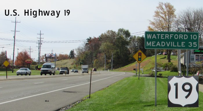
| Erie County Millcreek Township |
Southbound view on Peach Street past Marmon Drive showing the sign giving the mileage to Waterford and Meadville. Photograph taken in October 2015. |
;) |
||
| Erie County Millcreek Township |
Northbound view on Peach Street approaching the junction of PA 99. Photograph taken in October 2015. |
;) |
||
| Erie County Millcreek Township |
Southbound view on Peach Street at Marmon Drive showing the reassurance marker past the junction of PA 99. Photograph taken in October 2015. |
;) |
||
| Erie County Millcreek Township |
Northbound view on Peach Street showing the sign indicating entry into Millcreek Township. The boundary between Millcreek and Summit Townships, however, is farther south near Hershey Road. Photograph taken in October 2015. |
;) |
||
| Erie County Millcreek Township |
Northbound view on Peach Street approaching the junction of PA 99. Photograph taken in October 2015. |
;) |
||
| Erie County Millcreek Township |
Northbound view on Peach Street at the junction of PA 99. Photograph taken in October 2015. |
;) |
||
| Erie County Millcreek Township |
Northbound view on Peach Street showing the reassurance marker past the junction of PA 99. Photograph taken in October 2015. |
;) |
||
| Erie County Millcreek Township |
Southbound view on Peach Street at the turnoff for PA 99. Photograph taken in October 2015. |
;) |
||
| Erie County Millcreek Township |
Southbound view on Peach Street approaching the junction of PA 99. Photograph taken in October 2015. |
;) |
||
| Erie County Millcreek Township |
A look at the sign for the Millcreek Mall Complex facing US 19. Photograph taken in October 2015. |
;) |
||
| Erie County City of Erie |
Northbound view on Peach Street showing the signs for the upcoming junction of US 20. Oddly, there is no signage to indicate the end of US 19. Photograph taken in October 2015. |
;) |
||
| Erie County City of Erie |
Southbound view on Peach Street showing the sign designating the route as the General Strong Vincent Memorial Highway. A native of nearby Waterford, General Vincent grew up in Erie and played a decisive role at the Battle of Gettysburg, where he was fatally wounded. Photograph taken in October 2015. |
;) |
||
| Erie County City of Erie |
Northbound view on Peach Street approaching the junction of US 20. Photograph taken in October 2015. |
;) |
||
| Erie County City of Erie |
Northbound view on Peach Street at the junction of US 20. Photograph taken in October 2015. |
;) |
||
© Curtis Walker. All rights reserved. All pictures used on this site are the property of the respective photographers and are used by permission. No picture may be used without the consent of the respective photographer.
All pictures taken by Curtis Walker unless otherwise noted.