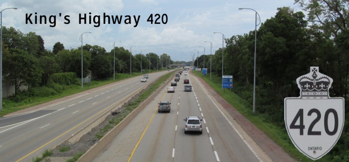
| King's Highway 420 runs east-west through Niagara Falls, connecting the QEW to Stanley Avenue and the Rainbow Bridge via Falls Avenue. |
| Western Terminus: Junction of QEW in Niagara Falls. |
| Eastern Terminus: Intersection of Stanley and Falls Avenues in Niagara Falls. |
| Click here to show the route. |
;)
Pictures are arranged from west to east.
| Location | Description | Photo
| ||
| Regional Municipality of Niagara City of Niagara Falls |
Eastbound view at Montrose Road at the access to 420 and QEW.  Photograph taken in November 2014. |
;) |
||
| Regional Municipality of Niagara City of Niagara Falls |
Eastbound view past Montrose Road at the exit to Fort Erie-bound QEW. Toronto-bound QEW and 420 traffic proceeds straight ahead. Photograph taken in November 2014. |
;) |
||
| Regional Municipality of Niagara City of Niagara Falls |
Northbound view merging with Toronto-bound QEW traffic. Photograph taken in December 2014. |
;) |
||
| Regional Municipality of Niagara City of Niagara Falls |
Eastbound view coming from Fort Erie-bound QEW. Photograph taken in May 2015. |
;) |
||
| Regional Municipality of Niagara City of Niagara Falls |
Westbound view past Dorchester Road approaching the QEW. Photograph taken in December 2014. |
;) |
||
| Regional Municipality of Niagara City of Niagara Falls |
Eastbound view coming from Fort Erie-bound QEW. Photograph taken in May 2015. |
;) |
||
| Regional Municipality of Niagara City of Niagara Falls |
Sign for 420 on Dorchester Road. Photograph taken in September 2014. |
;) |
||
| Regional Municipality of Niagara City of Niagara Falls |
Northbound view on Dorchester Road showing the advance signage for the turnoff to 420 east. Photograph taken in January 2016. |
;) |
||
| Regional Municipality of Niagara City of Niagara Falls |
Northbound view on Dorchester Road showing the advance signage for the turnoff to 420 east. Photograph taken in January 2016. |
;) |
||
| Regional Municipality of Niagara City of Niagara Falls |
Westbound view from Dorchester Road. Photograph taken in September 2014. |
;) |
||
| Regional Municipality of Niagara City of Niagara Falls |
Eastbound view from atop the overpass at Dorchester Road. Photograph taken in January 2016. |
;) |
||
| Regional Municipality of Niagara City of Niagara Falls |
Westbound view at the Dorchester Road/Lundy's Lane exit. Photograph taken in December 2014. |
;) |
||
| Regional Municipality of Niagara City of Niagara Falls |
Eastbound view merging with traffic coming from Toronto-bound QEW. Photograph taken in May 2015. |
;) |
||
| Regional Municipality of Niagara City of Niagara Falls |
Westbound view approaching the Dorchester Road/Lundy's Lane exit. Photograph taken in December 2014. |
;) |
||
| Regional Municipality of Niagara City of Niagara Falls |
Eastbound view at the exit for Drummond Road. Photograph taken in May 2015. |
;) |
||
| Regional Municipality of Niagara City of Niagara Falls |
Westbound view from atop the overpass at Drummond Road. Photograph taken in August 2014. |
;) |
||
| Regional Municipality of Niagara City of Niagara Falls |
Southbound view on Drummond Road approaching Valley Way showing advance signage for QEW/420. Photograph taken in October 2017. |
;) |
||
| Regional Municipality of Niagara City of Niagara Falls |
Southbound view on Drummond Road at Valley Way showing the signs for QEW/420. Photograph taken in October 2017. |
;) |
||
| Regional Municipality of Niagara City of Niagara Falls |
Southbound view on Drummond Road at Frederica Street showing the trailblazer sign for 420. Photograph taken in October 2017. |
;) |
||
| Regional Municipality of Niagara City of Niagara Falls |
Northbound view on Drummond Road at Frederica Stret showing the signs for QEW/420. Photograph taken in June 2015. |
;) |
||
| Regional Municipality of Niagara City of Niagara Falls |
Eastbound view from atop the overpass at Drummond Road. Photograph taken in August 2014. |
;) |
||
| Regional Municipality of Niagara City of Niagara Falls |
Eastbound view past Drummond Road. Photograph taken in May 2015. |
;) |
||
| Regional Municipality of Niagara City of Niagara Falls |
Eastbound view past Drummond Road. Photograph taken in May 2015. |
;) |
||
| Regional Municipality of Niagara City of Niagara Falls |
Eastbound view past Drummond Road. Photograph taken in May 2015. |
;) |
||
| Regional Municipality of Niagara City of Niagara Falls |
Eastbound view passing under Portage Road showing the sign indicating the upcoming end of 420. The road continues ahead as Niagara Region 420/Falls Avenue that connects to the Rainbow Bridge to the U.S.A. Photograph taken in May 2015. |
;) |
||
| Regional Municipality of Niagara City of Niagara Falls |
Westbound view from Portage Road. Photograph taken in August 2014. |
;) |
||
| Regional Municipality of Niagara City of Niagara Falls |
Westbound view past Stanley Avenue. Photograph taken in December 2014. |
;) |
||
| Regional Municipality of Niagara City of Niagara Falls |
Eastbound view approaching the traffic light at Stanley Avenue. Photograph taken in May 2015. |
;) |
||
| Regional Municipality of Niagara City of Niagara Falls |
Eastbound view approaching the traffic light at Stanley Avenue. Photograph taken in May 2015. |
;) |
||
| Regional Municipality of Niagara City of Niagara Falls |
Westbound view at the turnoff to the Ontario Travel Information Center. Photograph taken in December 2014. |
;) |
||
| Regional Municipality of Niagara City of Niagara Falls |
Westbound view at the exit to the Ontario Travel Information Center. Photograph taken in September 2015. |
;) |
||
| Regional Municipality of Niagara City of Niagara Falls |
A look at the Ontario Travel Information Center. Photograph taken in September 2015. |
;) |
||
| Regional Municipality of Niagara City of Niagara Falls |
Eastbound view approaching the traffic light at Stanley Avenue. Photograph taken in May 2015. |
;) |
||
| Regional Municipality of Niagara City of Niagara Falls |
Westbound view on Falls Avenue at Stanley Avenue showing the eastern terminus of 420. Photograph taken in August 2014. |
;) |
||
| Regional Municipality of Niagara City of Niagara Falls |
Westbound view on Falls Avenue at Stanley Avenue showing a closeup of the first marker for 420. Photograph taken in August 2014. |
;) |
||
| Regional Municipality of Niagara City of Niagara Falls |
Westbound view on Falls Avenue showing the sign designating 420 as the Niagara Veterans Memorial Highway. Photograph taken in August 2014. |
;) |
||
| Regional Municipality of Niagara City of Niagara Falls |
Eastbound view on Falls Avenue approaching the turnoff to Victoria Avenue. As the sign at right says, U.S.-bound traffic turns left ahead at the Rainbow Bridge. Photograph taken in December 2014. |
;) |
||
| Regional Municipality of Niagara City of Niagara Falls |
Southbound view on Victoria Avenue showing the sign at the approach to westbound Falls Avenue, which connects to 420/QEW. Photograph taken in March 2017. |
;) |
||
| Regional Municipality of Niagara City of Niagara Falls |
Westbound view atop the overpass at Victoria Avenue. Photograph taken in March 2017. |
;) |
||
| Regional Municipality of Niagara City of Niagara Falls |
Eastbound view from atop the overpass at Victoria Avenue. The buildings in the distance are just across the Rainbow Bridge in neighboring Niagara Falls, NY. Photograph taken in September 2018. |
;) |
||
| Regional Municipality of Niagara City of Niagara Falls |
Northbound view on Falls Avenue showing the new “Open for Business” slogan on the Welcome to Ontario sign. This slogan is the brainchild of Premier Doug Ford, who has proven to be one of the most business-hostile premiers in Canada's history. Photograph taken in November 2018. |
;) |
||
| Regional Municipality of Niagara City of Niagara Falls |
Guide signs for 420 near the Rainbow Bridge. Niagara Region 420/Falls Avenue connects the bridge to 420. Photograph taken in August 2014. |
;) |
||
| Regional Municipality of Niagara City of Niagara Falls |
Southbound view on Falls Avenue at the entrance to the Rainbow Bridge. Across the bridge and past customs is the northern terminus of NY 384. Photograph taken in December 2014. |
;) |
||
© Curtis Walker. All rights reserved. All pictures used on this site are the property of the respective photographers and are used by permission. No picture may be used without the consent of the respective photographer.
All pictures taken by Curtis Walker unless otherwise noted.