 |
|
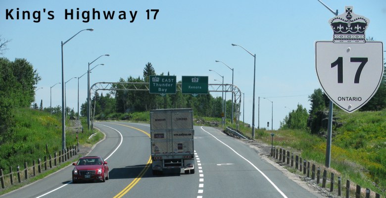
King's Highway 17 carries the bulk of traffic through Northwestern Ontario and is one of the two Trans-Canada routes through the region. The route is two-lane undivided through most of its length and is one of the most-travelled and dangerous highways in the country. Recent road work between the Manitoba boundary and Kenora, however, has seen the addition of many passing lanes and rumble strips for added safety.
|
|
|
|
Click here to show the route between Manitoba and Thunder Bay.
|
|
 |
Images of King's Highway 17:
- Page 1 - Manitoba to Secondary Highway 673
- Page 2 - Secondary Highway 673 to Engineer Lake Road
- Page 3 - Engineer Lake Road to Clearwater Bay
- Page 4 - Clearwater Bay to King's Highway 17A West
- Page 5 - King's Highway 17A West to Secondary Highway 641
- Page 6 - Secondary Highway 641 to Erie Street
- Page 7 - Erie Street to Secondary Highway 596
- Page 8 - Secondary Highway 596 to Secondary Highway 658
- Page 9 - Downtown Kenora
- Page 10 - Downtown Kenora to King's Highway 17A East
- Page 11 - King's Highway 17A East to King's Highway 71
|
Time lapse video driving eastbound on King's Highway 17 from Falcon Lake to Rat Portage:
Time lapse video driving westbound on King's Highway 17 from Rat Portage to West Hawk Lake:
© Curtis Walker. All rights reserved. All pictures used on this site are the property of the respective photographers and are used by permission. No picture may be used without the consent of the respective photographer.
All pictures taken by Curtis Walker unless otherwise noted.
;)