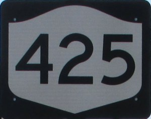
State Route 425
 |
Southern Terminus: Junction of I-290 in Tonawanda.
Northern Terminus: Junction of NY 18 in Wilson. Click here to show the route. |
Pictures are arranged from south to north.
| Location | Description | Photo
| ||
| Niagara County City of North Tonawanda |
Southbound view on the Twin Cities Memorial Highway showing the sign indicating that NY 425 leads to I-290.  Photograph taken in July 2015. |
 |
||
| Niagara County City of North Tonawanda |
Eastbound view on Wheatfield Road showing the advance signage for the junction of NY 425.  Photograph taken in July 2015. |
 |
||
| Niagara County City of North Tonawanda |
Eastbound view on Wheatfield Road at the Twin Cities Memorial Highway.  Photograph taken in July 2015. |
 |
||
| Niagara County City of North Tonawanda |
A look at the North Tonawanda Water Department.  Photograph taken in November 2016. |
 |
||
| Niagara County City of North Tonawanda |
Northbound view on Erie Avenue showing the first marker past Wheatfield Road.  Photograph taken in July 2015. |
 |
||
| Niagara County City of North Tonawanda |
Southbound view on Erie Avenue approaching the Twin Cities Memorial Highway and Wheatfield Road.  Photograph taken in July 2015. |
 |
||
| Niagara County City of North Tonawanda |
Northbound view on Erie Avenue showing the second marker past Wheatfield Road.  Photograph taken in July 2015. |
 |
||
| Niagara County City of North Tonawanda |
Northbound view on Erie Avenue approaching Zimmerman Street.  Photograph taken in November 2016. |
 |
||
| Niagara County City of North Tonawanda |
Northbound view on Erie Avenue at Walck Road.  Photograph taken in November 2016. |
 |
||
| Niagara County City of North Tonawanda |
Northbound view on Erie Avenue at Sisson Drive.  Photograph taken in November 2016. |
 |
||
| Niagara County City of North Tonawanda |
A look at the North Tonawanda water tower.  Photograph taken in November 2016. |
 |
||
| Niagara County City of North Tonawanda |
Northbound view on Erie Avenue showing the marker past Wurlitzer Drive.  Photograph taken in November 2016. |
 |
||
| Niagara County City of North Tonawanda |
Northbound view on Erie Avenue at Strad Avenue showing the assembly of markers at the junction of US 62.  Photograph taken in November 2016. |
 |
||
| Niagara County Town of Wheatfield |
Northbound view on Shawnee Road showing the first marker past the junction of US 62.  Photograph taken in November 2016. |
 |
||
© Curtis Walker. All rights reserved. All pictures used on this site are the property of the respective photographers and are used by permission. No picture may be used without the consent of the respective photographer.
All pictures taken by Curtis Walker unless otherwise noted.