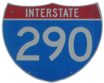
Interstate 290
Youngmann Memorial Highway
 |
Western Terminus: Junction of I-190 in Tonawanda.
Eastern Terminus: Junction of I-90 in Amherst. Click here to show the route. |
;)
Pictures are arranged from west to east.
| Location | Description | Photo
| ||
| Erie County Town of Tonawanda |
Eastbound view entering I-290 from southbound I-190.  Photograph taken in March 2018. |
;) |
||
| Erie County Town of Tonawanda |
Eastbound view past I-190. Photograph taken in March 2018. |
;) |
||
| Erie County Town of Tonawanda |
Eastbound view showing the first marker past I-190. Photograph taken in March 2018. |
;) |
||
| Erie County Town of Tonawanda |
Eastbound view past I-190. Photograph taken in March 2018. |
;) |
||
| Erie County Town of Tonawanda |
Eastbound view approaching Two Mile Creek Road. Photograph taken in March 2018. |
;) |
||
| Erie County Town of Tonawanda |
Eastbound view passing under Two Mile Creek Road showing the 1 mile advance signage for the Elmwood Avenue exit. Photograph taken in March 2018. |
;) |
||
| Erie County Town of Tonawanda |
Westbound view from atop the overpass at Two Mile Creek Road. Photograph taken in August 2015. |
;) |
||
| Erie County Town of Tonawanda |
Eastbound view from atop the overpass at Two Mile Creek Road. Photograph taken in August 2015. |
;) |
||
| Erie County Town of Tonawanda |
Eastbound view showing the advisory sign that NY 384 and NY 265 are accessible via the Elmwood Avenue exit. There are separate exits for both routes in the opposite direction. Photograph taken in March 2018. |
;) |
||
| Erie County Town of Tonawanda |
Eastbound view showing the ½ mile advance signage for the Elmwood Avenue exit. Photograph taken in March 2018. |
;) |
||
| Erie County Town of Tonawanda |
Eastbound view approaching the Elmwood Avenue exit. Photograph taken in March 2018. |
;) |
||
| Erie County Town of Tonawanda |
Eastbound view passing the Elmwood Avenue exit. Photograph taken in March 2018. |
;) |
||
| Erie County Town of Tonawanda |
Eastbound view showing the marker past the Elmwood Avenue exit. Photograph taken in March 2018. |
;) |
||
| Erie County Town of Tonawanda |
Eastbound view showing the ½ mile advance signage for the NY 425/Colvin Boulevard exit. Photograph taken in March 2018. |
;) |
||
| Erie County Town of Tonawanda |
Eastbound view approaching the NY 425/Colvin Boulevard exit. Photograph taken in March 2018. |
;) |
||
| Erie County City of Tonawanda |
Southbound view on Young Street showing the square trailblazer marker for I-290. Photograph taken in July 2019. |
;) |
||
| Erie County Town of Tonawanda |
Eastbound view past the NY 425/Colvin Boulevard exit. At left is the sign designating the bridge as the New York State Trooper Kevin P. Dobson, Sr. Memorial Bridge. A 13-year veteran of the State Police, Trooper Dobson was killed in March 2011 when he was struck by a motorist while conducting a traffic stop on I-290. Photograph taken in March 2018. |
;) |
||
| Erie County Town of Tonawanda |
Eastbound view showing the marker past the NY 425/Colvin Boulevard exit. At left is the Brighton Park Golf Dome and adjacent driving range. Photograph taken in March 2018. |
;) |
||
| Erie County Town of Tonawanda |
Eastbound view past the NY 425/Colvin Boulevard exit. Photograph taken in March 2018. |
;) |
||
| Erie County Town of Tonawanda |
Eastbound view showing the advance signage for the US 62 and I-990 exits. Photograph taken in March 2018. |
;) |
||
| Erie County Town of Tonawanda |
Eastbound view approaching the US 62/Niagara Falls Boulevard exits. Photograph taken in March 2018. |
;) |
||
| Erie County Town of Tonawanda |
Eastbound view approaching the US 62/Niagara Falls Boulevard exits. Photograph taken in March 2018. |
;) |
||
| Erie County Town of Tonawanda |
Eastbound view approaching the US 62/Niagara Falls Boulevard north exit. Photograph taken in March 2018. |
;) |
||
| Erie County Town of Tonawanda |
Eastbound view approaching the US 62/Niagara Falls Boulevard north exit. Photograph taken in March 2018. |
;) |
||
| Erie County Town of Amherst |
Eastbound view approaching the I-990 exit. Photograph taken in March 2018. |
;) |
||
| Erie County Town of Amherst |
Eastbound view approaching the I-990 exit. Photograph taken in March 2018. |
;) |
||
| Erie County Town of Amherst |
Eastbound view passing under I-990. Photograph taken in March 2018. |
;) |
||
| Erie County Town of Amherst |
Eastbound view past the I-990 exit. Photograph taken in March 2018. |
;) |
||
| Erie County Town of Amherst |
Eastbound view showing the marker past the I-990 exit. Photograph taken in March 2018. |
;) |
||
| Erie County Town of Amherst |
Eastbound view showing the ½ mile advance signage for the NY 263/Millersport Highway exit. Photograph taken in March 2018. |
;) |
||
| Erie County Town of Amherst |
Eastbound view approaching the NY 263/Millersport Highway exits. Photograph taken in March 2018. |
;) |
||
| Erie County Town of Amherst |
Eastbound view passing the NY 263/Millersport Highway exits. Photograph taken in March 2018. |
;) |
||
| Erie County Town of Amherst |
Eastbound view showing the ½ mile advance signage for the NY 324/NY 240 exit. Photograph taken in March 2018. |
;) |
||
| Erie County Town of Amherst |
Eastbound view approaching the NY 324/NY 240 exit. Photograph taken in March 2018. |
;) |
||
| Erie County Town of Amherst |
Eastbound view showing the 1 mile advance signage for the NY 5/Main Street exit. Photograph taken in March 2018. |
;) |
||
| Erie County Town of Amherst |
Eastbound view approaching the NY 5/Main Street exit. Photograph taken in March 2018. |
;) |
||
| Erie County Town of Amherst |
Eastbound view approaching the NY 5/Main Street exit. Photograph taken in March 2018. |
;) |
||
| Erie County Town of Amherst |
Southbound view approaching the NY 5/Main Street exits. Photograph taken in March 2018. |
;) |
||
| Erie County Town of Amherst |
Southbound view approaching the NY 5/Main Street east exit. Photograph taken in March 2018. |
;) |
||
| Erie County Town of Amherst |
Southbound view approaching the NY 5/Main Street east exit. Photograph taken in March 2018. |
;) |
||
| Erie County Town of Amherst |
Southbound view showing the advance signage for the junction of I-90. Photograph taken in March 2018. |
;) |
||
| Erie County Town of Amherst |
Southbound view approaching the junction of I-90. Photograph taken in March 2018. |
;) |
||
| Erie County Town of Amherst |
Southbound view taking the exit for I-90 east. Photograph taken in March 2018. |
;) |
||
© Curtis Walker. All rights reserved. All pictures used on this site are the property of the respective photographers and are used by permission. No picture may be used without the consent of the respective photographer.
All pictures taken by Curtis Walker unless otherwise noted.