State Route 182
 |
Western Terminus: Whirlpool Bridge that connects to Niagara Falls, Canada.
Eastern Terminus: Junction of US 62 in Niagara Falls. Click here to show the route. |
;)
Pictures are arranged from west to east.
| Location | Description | Photo
| ||
| Regional Municipality of Niagara City of Niagara Falls |
Looking southeast at the Whirlpool Bridge from the Canadian side.  Photograph taken in December 2014. |
;) |
||
| Regional Municipality of Niagara City of Niagara Falls |
The entrance to the Whirlpool Bridge from the Canadian side. Photograph taken in December 2014. |
;) |
||
| Regional Municipality of Niagara City of Niagara Falls |
The entrance to the Whirlpool Bridge from the Canadian side. Photograph taken in December 2014. |
;) |
||
| Regional Municipality of Niagara City of Niagara Falls |
Looking northeast at the Whirlpool Bridge from the Canadian side. Photograph taken in December 2014. |
;) |
||
| Niagara County City of Niagara Falls |
Eastbound view showing the signage at Whirlpool Street after entering the U.S. via the Whirlpool Bridge. Photograph taken in September 2014. |
;) |
||
| Niagara County City of Niagara Falls |
Southbound view on Whirlpool Street showing the first marker. At right is the Robert Moses State Parkway, which, despite the fact that it runs closer to the border, does not directly service any of the Rainbow, Whirlpool or Lewiston-Queenston Bridges. Photograph taken in September 2014. |
;) |
||
| Niagara County City of Niagara Falls |
Southbound view on Whirlpool Street showing the second marker. Photograph taken in September 2014. |
;) |
||
| Niagara County City of Niagara Falls |
Southbound view on Whirlpool Street approaching Cleveland Avenue. Photograph taken in September 2014. |
;) |
||
| Niagara County City of Niagara Falls |
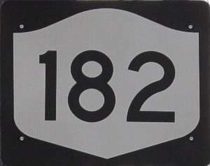
Northbound view on Whirlpool Street showing the last marker for NY 182. Photograph taken in September 2014. |
;) |
||
| Niagara County City of Niagara Falls |
Southbound view on Whirlpool Street approaching Cleveland Avenue. Photograph taken in September 2014. |
;) |
||
| Niagara County City of Niagara Falls |
Westbound view on Cleveland Avenue at Whirlpool Street. Photograph taken in September 2014. |
;) |
||
| Niagara County City of Niagara Falls |
Eastbound view on Cleveland Avenue past Whirlpool Street. Photograph taken in September 2014. |
;) |
||
| Niagara County City of Niagara Falls |
Westbound view on Cleveland Avenue approaching Whirlpool Street. Photograph taken in September 2014. |
;) |
||
| Niagara County City of Niagara Falls |
Eastbound view on Cleveland Avenue showing the advance signage for the junction of NY 104. Photograph taken in September 2014. |
;) |
||
| Niagara County City of Niagara Falls |
Westbound view on Cleveland Avenue at the junction of NY 104. Photograph taken in September 2014. |
;) |
||
| Niagara County City of Niagara Falls |
Eastbound view on Cleveland Avenue past the junction of NY 104. It is odd, given how NYSDOT religiously places not just one, but two markers on state highways after every major junction, that there are no markers past NY 104. Photograph taken in September 2014. |
;) |
||
| Niagara County City of Niagara Falls |
Westbound view on Cleveland Avenue showing the advance signage for the junction of NY 104. Photograph taken in September 2014. |
;) |
||
| Niagara County City of Niagara Falls |
Westbound view on Cleveland Avenue at 13th Street. Photograph taken in November 2014. |
;) |
||
| Niagara County City of Niagara Falls |
Eastbound view on Cleveland Avenue approaching Lockport Street. Photograph taken in November 2014. |
;) |
||
| Niagara County City of Niagara Falls |
Eastbound view on Lockport Street. Photograph taken in November 2014. |
;) |
||
| Niagara County City of Niagara Falls |
Westbound view on Lockport Street approaching Cleveland Avenue. Photograph taken in October 2016. |
;) |
||
| Niagara County City of Niagara Falls |
Eastbound view on Lockport Street approaching Ontario Avenue. Photograph taken in November 2014. |
;) |
||
| Niagara County City of Niagara Falls |
Eastbound view on Ontario Avenue showing the first marker past Lockport Street. Photograph taken in November 2014. |
;) |
||
| Niagara County City of Niagara Falls |
Westbound view on Ontario Avenue approaching Lockport Street. Photograph taken in October 2016. |
;) |
||
| Niagara County City of Niagara Falls |
Eastbound view on Ontario Avenue showing the second marker past Lockport Street. Photograph taken in November 2014. |
;) |
||
| Niagara County City of Niagara Falls |
Westbound view on Ontario Avenue at 24th Street showing the second marker past the junction of NY 182. Photograph taken in October 2016. |
;) |
||
| Niagara County City of Niagara Falls |
Eastbound view on Ontario Avenue showing the advance signage for the junction of NY 61. Photograph taken in November 2014. |
;) |
||
| Niagara County City of Niagara Falls |
Westbound view on Ontario Avenue showing the first marker past the junction of NY 61. Photograph taken in October 2016. |
;) |
||
| Niagara County City of Niagara Falls |
Eastbound view on Ontario Avenue at the junction of NY 61. NY 182 turns right towards Porter Road, where it will continue east. Photograph taken in November 2014. |
;) |
||
| Niagara County City of Niagara Falls |
Westbound view on Porter Road approaching the junction of NY 61. NY 182 traffic turns right and will follow Ontario Avenue west. Photograph taken in November 2014. |
;) |
||
| Niagara County City of Niagara Falls |
Eastbound view on Porter Road showing the first marker past the junction of NY 61. Photograph taken in October 2014. |
;) |
||
| Niagara County City of Niagara Falls |
Eastbound view on Porter Road showing the second marker past the junction of NY 61. Photograph taken in November 2014. |
;) |
||
| Niagara County City of Niagara Falls |
Westbound view on Porter Road at 29th Street showing the advance signage for the junction of NY 61. Photograph taken in November 2014. |
;) |
||
| Niagara County City of Niagara Falls |
Westbound view on Porter Road showing the sign for Hyde Park. Photograph taken in November 2014. |
;) |
||
| Niagara County City of Niagara Falls |
Eastbound view on Porter Road passing through Hyde Park Golf Course. Photograph taken in November 2014. |
;) |
||
| Niagara County City of Niagara Falls |
Westbound view on Porter Road passing through Hyde Park Golf Course. Photograph taken in November 2014. |
;) |
||
| Niagara County City of Niagara Falls |
A look at Niagara Falls High School that faces NY 182. Photograph taken in November 2014. |
;) |
||
| Niagara County City of Niagara Falls |
Eastbound view on Porter Road at New Road. Photograph taken in November 2014. |
;) |
||
| Niagara County City of Niagara Falls |
Westbound view on Porter Road past New Road. Photograph taken in November 2014. |
;) |
||
| Niagara County City of Niagara Falls |
Westbound view on Porter Road descending a railway overpass. Photograph taken in May 2015. |
;) |
||
| Niagara County City of Niagara Falls |
Westbound view on Porter Road descending a railway overpass. Photograph taken in October 2016. |
;) |
||
| Niagara County City of Niagara Falls |
Eastbound view on Porter Road descending a railway overpass. At right is the abandoned site of the former Sam's Club/Walmart location that has since been relocated farther south off Military Road. Photograph taken in April 2018. |
;) |
||
| Niagara County City of Niagara Falls |
Westbound view on Porter Road showing the sign indicating entry into the City of Niagara Falls. Photograph taken in November 2014. |
;) |
||
| Niagara County Town of Niagara |
Eastbound view on Porter Road approaching the junction of I-190. Photograph taken in November 2014. |
;) |
||
| Niagara County Town of Niagara |
Eastbound view on Porter Road approaching the turnoff to southbound I-190. Photograph taken in November 2014. |
;) |
||
| Niagara County Town of Niagara |
Westbound view on Porter Road at the turnoff to southbound I-190. Photograph taken in November 2014. |
;) |
||
| Niagara County Town of Niagara |
Eastbound view on Porter Road at the turnoff to northbound I-190. Photograph taken in November 2014. |
;) |
||
| Niagara County Town of Niagara |
Westbound view on Porter Road approaching the turnoff to northbound I-190. Photograph taken in November 2014. |
;) |
||
| Niagara County Town of Niagara |
Eastbound view on Porter Road showing the marker past I-190. Photograph taken in November 2014. |
;) |
||
| Niagara County Town of Niagara |
Westbound view on Porter Road showing more advance signage for the junction of I-190. I-190 is accessible from both Porter Road and nearby Packard Road. Photograph taken in November 2014. |
;) |
||
| Niagara County Town of Niagara |
Eastbound view on Porter Road approaching Packard Road. As the sign indicates, NY 182 traffic turns left to follow Packard Road briefly before continuing along Porter Road. Photograph taken in November 2014. |
;) |
||
| Niagara County Town of Niagara |
Westbound view on Packard Road showing the advance signage for the junction of I-190. Photograph taken in November 2014. |
;) |
||
| Niagara County Town of Niagara |
Westbound view on Packard Road at the junction of NY 265/Military Road. Photograph taken in May 2015. |
;) |
||
| Niagara County Town of Niagara |
Eastbound view on Packard Road approaching Porter Road. Photograph taken in December 2015. |
;) |
||
| Niagara County Town of Niagara |
Northbound view on Porter Road approaching Packard Road. Photograph taken in May 2015. |
;) |
||
| Niagara County Town of Niagara |
Eastbound view on Porter Road showing the first marker past Packard Road. Photograph taken in December 2015. |
;) |
||
| Niagara County Town of Niagara |
Westbound view on Porter Road approaching Packard Road. Photograph taken in May 2015. |
;) |
||
| Niagara County Town of Niagara |
Westbound view on Porter Road past Young Street. Photograph taken in May 2015. |
;) |
||
| Niagara County Town of Niagara |
Westbound view on Porter Road approaching Recovery Road. Photograph taken in May 2015. |
;) |
||
| Niagara County Town of Niagara |
Eastbound view on Porter Road approaching Tuscarora Road. Photograph taken in December 2015. |
;) |
||
| Niagara County Town of Niagara |
Westbound view on Porter Road at Tuscarora Road. Photograph taken in May 2015. |
;) |
||
| Niagara County Town of Niagara |
Westbound view on Porter Road past the Niagara Falls International Airport. Photograph taken in May 2015. |
;) |
||
| Niagara County Town of Niagara |
Westbound view on Porter Road passing the Niagara Falls International Airport. Photograph taken in May 2015. |
;) |
||
| Niagara County Town of Niagara |
Westbound view showing the reassurance and reference markers past the junction of US 62. Photograph taken in October 2016. |
;) |
||
| Niagara County Town of Niagara |
Eastbound view on Porter Road showing the marker indicating the end of NY 182. Photograph taken in December 2014. |
;) |
||
| Niagara County Town of Niagara |
Looking south at the intersection at Niagara Falls Boulevard, the eastern terminus of NY 182. Photograph taken in October 2016. |
;) |
||
| Niagara County City of Niagara Falls |
Westbound view on Porter Road showing the first marker for NY 182. Photograph taken in December 2014. |
;) |
||
© Curtis Walker. All rights reserved. All pictures used on this site are the property of the respective photographers and are used by permission. No picture may be used without the consent of the respective photographer.
All pictures taken by Curtis Walker unless otherwise noted.