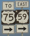
State Highway 59
 |
|
Pictures are arranged from west to east. Click here to show the route.
| ND 59 ends at I-29/US 81. Click here for I-29 images. | ||||
| Location | Description | Photo
| ||
| Pembina County City of Pembina |
Westbound view at the junction of I-29/US 81.  Photograph taken in September 2008. |
 |
||
| Pembina County City of Pembina |
Eastbound view as ND 59 turns off Stutsman Street.  Photograph taken in December 2008. |
 |
||
| Pembina County City of Pembina |
Eastbound view as ND 59 turns off Stutsman Street. At right is the Duty Free Americas store, a magnet for visiting Canadians and probably Pembina's most thriving business.  Photograph taken in December 2008. |
 |
||
| Pembina County City of Pembina |
Northbound view following alongside I-29 before turning east. This is the first eastbound reassurance marker for ND 59.  Photograph taken in September 2008. |
 |
||
| Pembina County City of Pembina |
Northbound view showing a closeup of the first eastbound marker. As the adjacent sign says, this highway crosses into Minnesota and links up to US 75, which dead-ends at MN 171 south of the US/Canada border. In years past, US 75 proceeded north to the border, but since the closure of the Canadian Customs office on the east side of the Red River, northbound traffic on US 75 headed for Canada must cross into North Dakota and use I-29.  Photograph taken in May 2012. |
 |
||
| Pembina County City of Pembina |
Northbound view showing the pair of new markers past Stutsman Street.  Photograph taken in July 2014. |
 |
||
| Pembina County City of Pembina |
A look at the sign welcoming visitors to Pembina.  Photograph taken in July 2014. |
 |
||
| Pembina County City of Pembina |
Westbound view on Stutsman Street approaching ND 59 and I-29/US 81.  Photograph taken in September 2008. |
 |
||
| Pembina County City of Pembina |
Westbound view on Stutsman Street approaching ND 59 and I-29/US 81 showing a closeup of the signs.  Photograph taken in August 2005. |
 |
||
| Pembina County City of Pembina |
Westbound view on Stutsman Street showing the advance signage for ND 59.  Photograph taken in May 2012. |
 |
||
| Pembina County City of Pembina |
Westbound view on Stutsman Street showing a closeup of the advance signage for ND 59.  Photograph taken in May 2012. |
 |
||
| Pembina County City of Pembina |
Southbound view passing the DFA store.  Photograph taken in July 2014. |
 |
||
| Pembina County City of Pembina |
Northbound view approaching Rolette Street.  Photograph taken in July 2014. |
 |
||
© Curtis Walker. All rights reserved. All pictures used on this site are the property of the respective photographers and are used by permission. No picture may be used without the consent of the respective photographer.
All pictures taken by Curtis Walker unless otherwise noted.