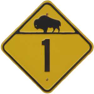
Provincial Trunk Highway 44
Historic Highway No. 1

| <-- Page 14 | Page 15 - West Hawk Lake (Decommissioned Section of Route) |
Pictures are arranged from west to east.
| Click here to continue east and here to continue west along the present-day |
||||
| Location | Description | Photo
| ||
| Whiteshell Provincial Park |
Westbound view facing the corner where PTH 44 turns towards PTH 1.  Photograph taken in July 2012. |
 |
||
| Whiteshell Provincial Park |
Westbound view facing the corner where PTH 44 turns towards PTH 1 showing a closeup of the markers.  Photograph taken in July 2012. |
 |
||
| Whiteshell Provincial Park |
Eastbound view showing the Historic Highway No. 1 marker.  Photograph taken in July 2012. |
 |
||
| Whiteshell Provincial Park |
Eastbound view past the Historic Highway No. 1 marker.  Photograph taken in July 2013. |
 |
||
| Whiteshell Provincial Park |
Eastbound view near the West Hawk Camping and Picnic Area.  Photograph taken in July 2013. |
 |
||
| Whiteshell Provincial Park |
Westbound view past the West Hawk Camping and Picnic Area.  Photograph taken in July 2013. |
 |
||
| Whiteshell Provincial Park |
Eastbound view showing the sign for the West Hawk Camping and Picnic Area.  Photograph taken in July 2013. |
 |
||
| Whiteshell Provincial Park |
Manitoba Conservation West Hawk Lake District Office.  Photograph taken in July 2013. |
 |
||
| Whiteshell Provincial Park |
Eastbound view approaching the lake.  Photograph taken in July 2013. |
 |
||
| Whiteshell Provincial Park |
A look at an old PTH 1 sign on a garage facing the highway.  Photograph taken in July 2012. |
 |
||
| Whiteshell Provincial Park |
Westbound view in West Hawk Lake.  Photograph taken in July 2012. |
 |
||
| Whiteshell Provincial Park |
A sign by the beach giving a brief history of the formation of West Hawk Lake.  Photograph taken in July 2012. |
 |
||
| Whiteshell Provincial Park |
Westbound view passing the lake.  Photograph taken in July 2013. |
 |
||
| Whiteshell Provincial Park |
Eastbound view passing the lake.  Photograph taken in July 2012. |
 |
||
| Whiteshell Provincial Park |
Eastbound view passing the lake.  Photograph taken in July 2013. |
 |
||
| The former routing of |
||||
© Curtis Walker. All rights reserved. All pictures used on this site are the property of the respective photographers and are used by permission. No picture may be used without the consent of the respective photographer.
All pictures taken by Curtis Walker unless otherwise noted.