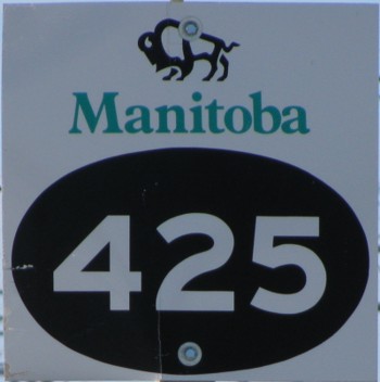
Provincial Road 425
 |
|
;)
Pictures are arranged from east to west.
| Location | Description | Photo
| ||
| City of Winnipeg |
Looking west on Saskatchewan Avenue at Buchanan Boulevard showing the advance signage for the junction of PTH 101 and PR 425.  Photograph taken in March 2010. |
;) |
||
| City of Winnipeg |
Westbound view approaching the junction of PTH 101 and the start of PR 425. Photograph taken in October 2009. |
;) |
||
| City of Winnipeg |
Westbound view approaching the junction of PTH 101 and the start of PR 425 showing a closeup of the markers. Photograph taken in October 2009. |
;) |
||
| City of Winnipeg |
A look at the construction vehicles assembling near the junction of PTH 101. Photograph taken in July 2011. |
;) |
||
| City of Winnipeg |
A look at the overpass under construction at the junction of PTH 101. Photograph taken in March 2012. |
;) |
||
| City of Winnipeg |
Westbound view on Saskatchewan Avenue approaching the overpass at PTH 101. Photograph taken in December 2013. |
;) |
||
| City of Winnipeg |
A look at the remains of the railway crossing that was in use prior to the construction of the overpass. Photograph taken in December 2013. |
;) |
||
| PR 425 ends at the overpass at PTH 101. Click here for PTH 101 images. | ||||
| City of Winnipeg |
Eastbound view approaching the overpass at PTH 101. The first two spans are for north and southbound PTH 101 traffic, while the third is for the exit to PTH 190. Photograph taken in December 2013. |
;) |
||
| City of Winnipeg |
Eastbound view at the junction of PTH 101. Photograph taken in January 2009. |
;) |
||
| City of Winnipeg |
Eastbound view approaching PR 425's eastern terminus. Photograph taken in December 2013. |
;) |
||
| City of Winnipeg |
Eastbound view showing the marker indicating the end of PR 425. Photograph taken in December 2013. |
;) |
||
| City of Winnipeg |
Westbound view west of the junction of PTH 101. Photograph taken in January 2009. |
;) |
||
| City of Winnipeg |
Eastbound view showing the marker for the junction of PTH 101. Photograph taken in January 2009. |
;) |
||
| City of Winnipeg |
Westbound view west of the junction of PTH 101. Photograph taken in January 2009. |
;) |
||
| City of Winnipeg |
A look at the St. Charles Rifle Range, located on the north side of the highway. Photograph taken in October 2009. |
;) |
||
| RM of Headingley |
Westbound view approaching a railway crossing. Photograph taken in March 2009. |
;) |
||
| RM of Headingley |
Westbound view in the middle of nowhere. Photograph taken in March 2009. |
;) |
||
| RM of Headingley |
Eastbound view in the middle of nowhere. Photograph taken in March 2009. |
;) |
||
| RM of Headingley |
Westbound view at the junction of PR 334. Photograph taken in March 2009. |
;) |
||
| RM of Headingley |
Eastbound view showing the first and only eastbound reassurance marker. Photograph taken in March 2009. |
;) |
||
| PR 425 ends at PR 334 north of Headingley. Click here for PR 334 images. | ||||
© Curtis Walker. All rights reserved. All pictures used on this site are the property of the respective photographers and are used by permission. No picture may be used without the consent of the respective photographer.
All pictures taken by Curtis Walker unless otherwise noted.