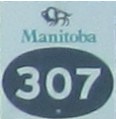
Provincial Road 307
 |
|
Pictures are arranged from west to east. Click here to show the route.
| PR 307 ends at |
||||
| Location | Description | Photo
| ||
| RM of Whitemouth |
Westbound view at the junction of PTH 11.  Photograph taken in July 2012. |
 |
||
| RM of Whitemouth |
Eastbound view past the junction of PTH 11.  Photograph taken in July 2012. |
 |
||
| RM of Whitemouth |
Westbound view approaching the junction of PTH 11.  Photograph taken in July 2012. |
 |
||
| RM of Whitemouth |
Eastbound view showing the first eastbound marker.  Photograph taken in July 2012. |
 |
||
| RM of Whitemouth |
Eastbound view showing the ceremonial La Vérendrye Trail marker. Strangely, this ceremonial marker, in many places throughout Manitoba, takes precedence over the actual route marker.  Photograph taken in July 2012. |
 |
||
| RM of Whitemouth |
Westbound view approaching the junction of PTH 11.  Photograph taken in July 2012. |
 |
||
| RM of Whitemouth |
Westbound view approaching the junction of PTH 11.  Photograph taken in July 2012. |
 |
||
| RM of Whitemouth |
Westbound view approaching the junction of PTH 11.  Photograph taken in July 2012. |
 |
||
| RM of Whitemouth |
Westbound view showing the advance signage for the junction of PTH 11.  Photograph taken in July 2012. |
 |
||
| RM of Whitemouth |
Westbound view approaching the junction of PTH 11.  Photograph taken in July 2012. |
 |
||
| RM of Whitemouth |
Eastbound view past the junction of PTH 11.  Photograph taken in July 2012. |
 |
||
| RM of Whitemouth |
Eastbound view approaching Brookfield Road.  Photograph taken in July 2012. |
 |
||
| RM of Whitemouth |
Eastbound view approaching Brookfield Road.  Photograph taken in July 2012. |
 |
||
| RM of Whitemouth |
Westbound view approaching the junction of PTH 11.  Photograph taken in July 2012. |
 |
||
| RM of Whitemouth |
Eastbound view past Brookfield Road.  Photograph taken in July 2012. |
 |
||
| RM of Whitemouth |
Westbound view approaching Brookfield Road.  Photograph taken in July 2012. |
 |
||
| RM of Whitemouth |
Westbound view approaching Brookfield Road.  Photograph taken in July 2012. |
 |
||
| RM of Whitemouth |
Eastbound view approaching a crossing of the Whitemouth River.  Photograph taken in July 2012. |
 |
||
| RM of Whitemouth |
Eastbound view entering Seven Sisters Falls.  Photograph taken in July 2012. |
 |
||
| RM of Whitemouth |
Westbound view approaching a crossing of the Whitemouth River.  Photograph taken in July 2012. |
 |
||
| RM of Whitemouth |
Eastbound view entering Seven Sisters Falls.  Photograph taken in July 2012. |
 |
||
| RM of Whitemouth |
Eastbound view showing the advance signage for the junction of PR 408.  Photograph taken in July 2012. |
 |
||
| RM of Whitemouth |
Eastbound view approaching the junction of PR 408. To the left is the turnoff to Whitemouth Falls Provincial Park.  Photograph taken in July 2012. |
 |
||
| RM of Whitemouth |
Westbound view passing the junction of PR 408.  Photograph taken in July 2012. |
 |
||
| RM of Whitemouth |
Westbound view approaching the junction of PR 408.  Photograph taken in July 2012. |
 |
||
| RM of Whitemouth |
Eastbound view past the junction of PR 408.  Photograph taken in July 2012. |
 |
||
| RM of Whitemouth |
Westbound view showing the advance signage for the junction of PR 408.  Photograph taken in July 2012. |
 |
||
| RM of Whitemouth |
Eastbound view approaching Townsite Road.  Photograph taken in July 2012. |
 |
||
| RM of Whitemouth |
Westbound view past Townsite Road.  Photograph taken in July 2012. |
 |
||
| RM of Whitemouth |
Eastbound view approaching Townsite Road. At left is the turnoff to the Seven Sisters Falls Generating Station, a dam located on the Winnipeg River.  Photograph taken in July 2012. |
 |
||
| RM of Whitemouth |
Westbound view past Townsite Road.  Photograph taken in July 2012. |
 |
||
| PR 307 ends at PTH 44 east of Rennie. Click here for PTH 44 images. | ||||
© Curtis Walker. All rights reserved. All pictures used on this site are the property of the respective photographers and are used by permission. No picture may be used without the consent of the respective photographer.
All pictures taken by Curtis Walker unless otherwise noted.