PR 214 follows Milner Ridge Road in a northeasterly direction through the Agassiz Provincial Forest between PTH 44 at Seddons Corner and PTH 11 south of Lac du Bonnet.
This route originally served as the southern part of PTH 11 until the early 1950s when the present-day PTH 11 was built. It returned to the provincial highway system with the introduction of provincial roads in the late 1960s.
Southern Terminus: Junction of PTH 44 at Seddons Corner.
Northern Terminus: Junction of PTH 11 south of Lac du Bonnet.
Pictures are arranged from south to north. Click here to show the route.
;)
| PR 214 ends at PTH 44 at Seddons Corner. Click here for PTH 44 images. | ||||
| Location | Description | Photo
| ||
| RM of Lac du Bonnet |
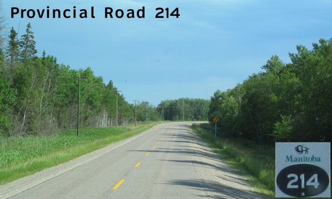
Northbound view past the junction of PTH 44. At right is the sign indicating entry into the RM of Lac du Bonnet. PTH 44 (Road 72N) serves as the boundary between the RM of Lac du Bonnet and the RM of Reynolds.  Photograph taken in July 2012. |
;) |
||
| RM of Lac du Bonnet |
Northbound view past the junction of PTH 44 showing the first northbound marker. Photograph taken in July 2012. |
;) |
||
| RM of Lac du Bonnet |
Northbound view past the junction of PTH 44 showing the advisory sign for the 90 km/h speed limit. Photograph taken in July 2012. |
;) |
||
| RM of Lac du Bonnet |
Northbound view past the junction of PTH 44 showing the sign giving the distance to Lac du Bonnet. Photograph taken in July 2012. |
;) |
||
| RM of Lac du Bonnet |
Northbound view past the junction of PTH 44. Photograph taken in July 2012. |
;) |
||
| RM of Lac du Bonnet |
Northbound view past the junction of PTH 44. Photograph taken in July 2012. |
;) |
||
| RM of Lac du Bonnet |
Northbound view approaching Buchan Road (Road 74N). Photograph taken in July 2012. |
');) |
||
| RM of Lac du Bonnet |
Northbound view approaching Buchan Road. Regrettably, the RM of Lac du Bonnet is one of the few municipalities in the province that does not provide the road numbers on its signs. Photograph taken in July 2012. |
;) |
||
| RM of Lac du Bonnet |
Northbound view past Buchan Road. Photograph taken in July 2012. |
;) |
||
| RM of Lac du Bonnet |
Northbound view showing the 1 km advance signage for the RM of Lac du Bonnet Transfer Station. Photograph taken in July 2012. |
;) |
||
| RM of Lac du Bonnet |
Northbound view approaching the turnoff for the RM of Lac du Bonnet Transfer Station. Photograph taken in July 2012. |
;) |
||
| RM of Lac du Bonnet |
Northbound view approaching Betker Road. Photograph taken in July 2012. |
;) |
||
| RM of Lac du Bonnet |
Northbound view approaching Betker Road. Photograph taken in July 2012. |
;) |
||
| RM of Lac du Bonnet |
Northbound view past Betker Road. Photograph taken in July 2012. |
;) |
||
| RM of Lac du Bonnet |
Northbound view approaching the turnoff to the Milner Ridge Correctional Center. Photograph taken in July 2012. |
;) |
||
| RM of Lac du Bonnet |
Northbound view approaching the turnoff to the Milner Ridge Correctional Center. Photograph taken in July 2012. |
;) |
||
| RM of Lac du Bonnet |
Northbound view showing the advance signage for the junction of PR 435. Photograph taken in July 2012. |
;) |
||
| RM of Lac du Bonnet |
Northbound view approaching the junction of PR 435. Photograph taken in July 2012. |
;) |
||
| RM of Lac du Bonnet |
Northbound view approaching the junction of PR 435. Photograph taken in July 2012. |
;) |
||
| RM of Lac du Bonnet |
Northbound view showing the reassurance marker past the junction of PR 435. Photograph taken in July 2012. |
;) |
||
| RM of Lac du Bonnet |
Northbound view past the junction of PR 435. Photograph taken in July 2012. |
;) |
||
| RM of Lac du Bonnet |
Northbound view past the junction of PR 435. Photograph taken in July 2012. |
;) |
||
| RM of Lac du Bonnet |
Northbound view past the junction of PR 435. Photograph taken in July 2012. |
;) |
||
| RM of Lac du Bonnet |
Northbound view past the junction of PR 435. Photograph taken in July 2012. |
;) |
||
| RM of Lac du Bonnet |
Northbound view past the junction of PR 435. Photograph taken in July 2012. |
;) |
||
| RM of Lac du Bonnet |
Northbound view past the junction of PR 435. Photograph taken in July 2012. |
;) |
||
| RM of Lac du Bonnet |
Northbound view showing the sign for the virtually empty hamlet of Milner Ridge. Photograph taken in July 2012. |
;) |
||
| RM of Lac du Bonnet |
Northbound view approaching Forest Road. Photograph taken in July 2012. |
;) |
||
| RM of Lac du Bonnet |
Northbound view past Forest Road. Photograph taken in July 2012. |
;) |
||
| RM of Lac du Bonnet |
Northbound view past Milner Ridge. Photograph taken in July 2012. |
;) |
||
| RM of Lac du Bonnet |
Northbound view past Milner Ridge. Photograph taken in July 2012. |
;) |
||
| RM of Lac du Bonnet |
Northbound view past Milner Ridge. Photograph taken in July 2012. |
;) |
||
| RM of Lac du Bonnet |
Northbound view past Milner Ridge. Photograph taken in July 2012. |
;) |
||
| RM of Lac du Bonnet |
Northbound view past Milner Ridge. Photograph taken in July 2012. |
;) |
||
| RM of Lac du Bonnet |
Northbound view past Milner Ridge. Photograph taken in July 2012. |
;) |
||
| RM of Lac du Bonnet |
Northbound view past Milner Ridge. Photograph taken in July 2012. |
;) |
||
| RM of Lac du Bonnet |
Northbound view past Milner Ridge. Photograph taken in July 2012. |
;) |
||
| RM of Lac du Bonnet |
Northbound view past Milner Ridge. Photograph taken in July 2012. |
;) |
||
| RM of Lac du Bonnet |
Northbound view past Milner Ridge. Photograph taken in July 2012. |
;) |
||
| RM of Lac du Bonnet |
Northbound view past Milner Ridge. Photograph taken in July 2012. |
;) |
||
| RM of Lac du Bonnet |
Northbound view past Milner Ridge. Photograph taken in July 2012. |
;) |
||
| RM of Lac du Bonnet |
Northbound view past Milner Ridge. Photograph taken in July 2012. |
;) |
||
| RM of Lac du Bonnet |
Northbound view past Milner Ridge. Photograph taken in July 2012. |
;) |
||
| RM of Lac du Bonnet |
Northbound view past Milner Ridge. Photograph taken in July 2012. |
;) |
||
| RM of Lac du Bonnet |
Northbound view past Milner Ridge. Photograph taken in July 2012. |
;) |
||
| RM of Lac du Bonnet |
Northbound view past Milner Ridge. Photograph taken in July 2012. |
;) |
||
| RM of Lac du Bonnet |
Northbound view past Milner Ridge. Photograph taken in July 2012. |
;) |
||
| RM of Lac du Bonnet |
Northbound view approaching Lansard and Weiss Roads. Photograph taken in July 2012. |
;) |
||
| RM of Lac du Bonnet |
Northbound view approaching Lansard and Weiss Roads. Photograph taken in July 2012. |
;) |
||
| RM of Lac du Bonnet |
Northbound view past Lansard and Weiss Roads. Photograph taken in July 2012. |
;) |
||
| RM of Lac du Bonnet |
Eastbound view approaching the junction of PTH 11. Photograph taken in July 2012. |
;) |
||
| RM of Lac du Bonnet |
Eastbound view showing the advance signage for the junction of PTH 11. Photograph taken in July 2012. |
;) |
||
| RM of Lac du Bonnet |
Eastbound view approaching the junction of PTH 11. Photograph taken in July 2012. |
;) |
||
| RM of Lac du Bonnet |
Eastbound view approaching the junction of PTH 11. Photograph taken in July 2012. |
;) |
||
| RM of Lac du Bonnet |
Eastbound view approaching the junction of PTH 11. Photograph taken in July 2012. |
;) |
||
| RM of Lac du Bonnet |
Eastbound view at the junction of PTH 11. Photograph taken in July 2012. |
;) |
||
| PR 214 ends at |
||||
© Curtis Walker. All rights reserved. All pictures used on this site are the property of the respective photographers and are used by permission. No picture may be used without the consent of the respective photographer.
All pictures taken by Curtis Walker unless otherwise noted.