 |
|
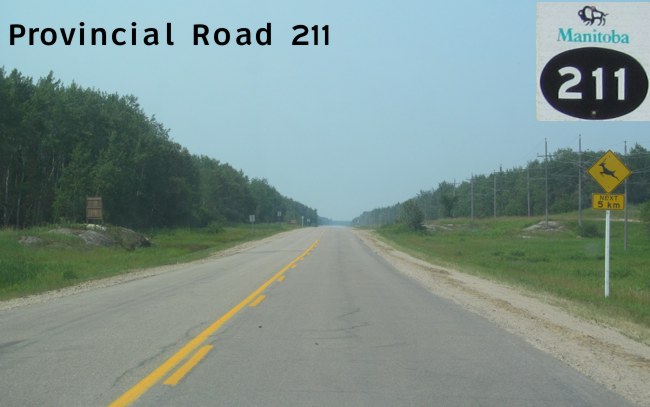
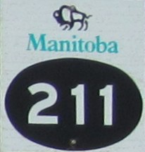
Pictures are arranged from west to east. Click here to show the route.
;)
| PR 211 ends at |
||||
| Location | Description | Photo
| ||
| RM of Lac du Bonnet |
Westbound view at the junction of PTH 11.  Photograph taken in July 2012. |
;) |
||
| RM of Lac du Bonnet |
Eastbound view past the junction of PTH 11. Photograph taken in July 2012. |
;) |
||
| RM of Lac du Bonnet |
Westbound view approaching the junction of PTH 11. Photograph taken in July 2012. |
;) |
||
| RM of Lac du Bonnet |
Westbound view approaching the junction of PTH 11. Photograph taken in July 2012. |
;) |
||
| RM of Lac du Bonnet |
Westbound view approaching the junction of PTH 11. Photograph taken in July 2012. |
;) |
||
| RM of Lac du Bonnet |
Eastbound view past the junction of PTH 11. Photograph taken in July 2012. |
;) |
||
| RM of Lac du Bonnet |
Westbound view showing the advance signage for the junction of PTH 11. Photograph taken in July 2012. |
;) |
||
| RM of Lac du Bonnet |
Eastbound view approaching Brookfield Road. Photograph taken in July 2012. |
;) |
||
| RM of Lac du Bonnet |
Eastbound view passing Brookfield Road. Photograph taken in July 2012. |
;) |
||
| RM of Lac du Bonnet |
Westbound view approaching Brookfield Road. Photograph taken in July 2012. |
;) |
||
| RM of Lac du Bonnet |
Eastbound view approaching the crossing of the Winnipeg River. Photograph taken in July 2012. |
;) |
||
| RM of Lac du Bonnet |
Westbound view showing the sign indicating entry into the RM of Lac du Bonnet. Photograph taken in July 2012. |
;) |
||
| RM of Lac du Bonnet |
Eastbound view approaching the crossing of the Winnipeg River. Photograph taken in July 2012. |
;) |
||
| RM of Lac du Bonnet |
Westbound view past the Winnipeg River. Photograph taken in July 2012. |
;) |
||
| RM of Lac du Bonnet |
Eastbound view approaching the crossing of the Winnipeg River. Photograph taken in July 2012. |
;) |
||
| RM of Lac du Bonnet |
Eastbound view crossing the Winnipeg River. Photograph taken in July 2012. |
;) |
||
| RM of Lac du Bonnet |
Eastbound view crossing the Winnipeg River. Photograph taken in July 2012. |
;) |
||
| LGD of Pinawa |
Westbound view approaching the crossing of the Winnipeg River. Photograph taken in July 2012. |
;) |
||
| LGD of Pinawa |
Westbound view approaching the crossing of the Winnipeg River. Photograph taken in July 2012. |
;) |
||
| LGD of Pinawa |
Eastbound view approaching Ara Mooradian Way. This road leads to the AECL research facility that has been in the process of being decommissioned since 1998. After the original townsite was abandoned in 1951, Pinawa was re-established 12 km east of this location in 1963 to house the workers at the AECL facility. Photograph taken in July 2012. |
;) |
||
| LGD of Pinawa |
Westbound view approaching the crossing of the Winnipeg River. Photograph taken in July 2012. |
;) |
||
| LGD of Pinawa |
Eastbound view approaching Ara Mooradian Way. Photograph taken in July 2012. |
;) |
||
| LGD of Pinawa |
Westbound view approaching Ara Mooradian Way. Photograph taken in July 2012. |
;) |
||
| LGD of Pinawa |
Eastbound view past Ara Mooradian Way showing the sign giving the distance to Pinawa. For some reason, there are two advisory signs for the 100 km/h speed limit. Photograph taken in July 2012. |
;) |
||
| LGD of Pinawa |
Westbound view approaching Ara Mooradian Way. Photograph taken in July 2012. |
;) |
||
| LGD of Pinawa |
Eastbound view showing the second of two advisory signs for the 100 km/h speed limit. Photograph taken in July 2012. |
;) |
||
| LGD of Pinawa |
Westbound view approaching Ara Mooradian Way. Photograph taken in July 2012. |
;) |
||
| LGD of Pinawa |
Eastbound view past Ara Mooradian Way. Photograph taken in July 2012. |
;) |
||
| LGD of Pinawa |
Westbound view approaching Ara Mooradian Way. Photograph taken in July 2012. |
;) |
||
| LGD of Pinawa |
Westbound view approaching Ara Mooradian Way. Photograph taken in July 2012. |
;) |
||
| LGD of Pinawa |
Eastbound view past Ara Mooradian Way. Photograph taken in July 2012. |
;) |
||
| LGD of Pinawa |
Westbound view approaching Ara Mooradian Way. Photograph taken in July 2012. |
;) |
||
| LGD of Pinawa |
Eastbound view past Ara Mooradian Way. Photograph taken in July 2012. |
;) |
||
| LGD of Pinawa |
Westbound view showing the advisory sign for the great gray owl habitat area. Photograph taken in July 2012. |
;) |
||
| LGD of Pinawa |
Westbound view past the junction of PR 520. Photograph taken in July 2012. |
;) |
||
| LGD of Pinawa |
Eastbound view past Ara Mooradian Way. Photograph taken in July 2012. |
;) |
||
| LGD of Pinawa |
Eastbound view past Ara Mooradian Way. Photograph taken in July 2012. |
;) |
||
| LGD of Pinawa |
Westbound view past the junction of PR 520. Photograph taken in July 2012. |
;) |
||
| LGD of Pinawa |
Westbound view past the junction of PR 520. Photograph taken in July 2012. |
;) |
||
| LGD of Pinawa |
Westbound view past the junction of PR 520. Photograph taken in July 2012. |
;) |
||
| LGD of Pinawa |
Eastbound view approaching the junction of PR 520. Photograph taken in July 2012. |
;) |
||
| LGD of Pinawa |
Eastbound view showing the advance signage for the junction of PR 520. Photograph taken in July 2012. |
;) |
||
| LGD of Pinawa |
Westbound view showing the advisory sign for the 100 km/h speed limit. Photograph taken in July 2012. |
;) |
||
| LGD of Pinawa |
Westbound view past the junction of PR 520. Photograph taken in July 2012. |
;) |
||
| LGD of Pinawa |
Eastbound view approaching the junction of PR 520. This road leads to the Pinawa Dam Provincial Heritage Park and the original Pinawa townsite. Photograph taken in July 2012. |
;) |
||
| PR 211 meets PR 520 west of Pinawa. Click here for PR 520 images. | ||||
| LGD of Pinawa |
Westbound view approaching the junction of PR 520. Photograph taken in July 2012. |
;) |
||
| LGD of Pinawa |
Eastbound view past the junction of PR 520. Photograph taken in July 2012. |
;) |
||
| LGD of Pinawa |
Westbound view approaching the junction of PR 520. Photograph taken in July 2012. |
;) |
||
| LGD of Pinawa |
Westbound view approaching the junction of PR 520. Photograph taken in July 2012. |
;) |
||
| LGD of Pinawa |
Westbound view showing the advance signage for the junction of PR 520. Photograph taken in July 2012. |
;) |
||
| LGD of Pinawa |
Westbound view approaching the junction of PR 520. Photograph taken in July 2012. |
;) |
||
| LGD of Pinawa |
Westbound view approaching the junction of PR 520. Photograph taken in July 2012. |
;) |
||
| LGD of Pinawa |
Eastbound view past the junction of PR 520. Photograph taken in July 2012. |
;) |
||
| LGD of Pinawa |
Westbound view approaching the junction of PR 520. Photograph taken in July 2012. |
;) |
||
| LGD of Pinawa |
Eastbound view past the junction of PR 520. Photograph taken in July 2012. |
;) |
||
| LGD of Pinawa |
Eastbound view past the junction of PR 520. Photograph taken in July 2012. |
;) |
||
| LGD of Pinawa |
Westbound view past Willis Drive West. Photograph taken in July 2012. |
;) |
||
| LGD of Pinawa |
Eastbound view approaching Willis Drive West. Photograph taken in July 2012. |
;) |
||
| LGD of Pinawa |
Westbound view approaching Willis Drive West. Photograph taken in July 2012. |
;) |
||
| LGD of Pinawa |
Eastbound view approaching Aberdeen Avenue. Photograph taken in July 2012. |
;) |
||
| LGD of Pinawa |
Westbound view past Aberdeen Avenue. Photograph taken in July 2012. |
;) |
||
| LGD of Pinawa |
Eastbound view approaching Aberdeen Avenue. Photograph taken in July 2012. |
;) |
||
| LGD of Pinawa |
Eastbound view approaching Vanier Avenue. Photograph taken in July 2012. |
;) |
||
| LGD of Pinawa |
Eastbound view approaching Vanier Avenue. Photograph taken in July 2012. |
;) |
||
| LGD of Pinawa |
Eastbound view approaching Vanier Avenue. Photograph taken in July 2012. |
;) |
||
| LGD of Pinawa |
Eastbound view at Vanier Avenue showing the sign welcoming visitors to Pinawa. Photograph taken in July 2012. |
;) |
||
| LGD of Pinawa |
Eastbound view approaching Willis Drive showing the sign indicating the end of PR 211. Photograph taken in July 2012. |
;) |
||
| LGD of Pinawa |
Eastbound view approaching Willis Drive showing a closeup of the sign indicating the end of PR 211. Photograph taken in July 2012. |
;) |
||
| LGD of Pinawa |
Westbound view past Willis Drive showing the first westbound marker. Photograph taken in July 2012. |
;) |
||
| LGD of Pinawa |
Westbound view past Willis Drive showing a closeup of the first westbound marker. Photograph taken in July 2012. |
;) |
||
| LGD of Pinawa |
Westbound view at the end of the pavement. Off to the right is the trail that leads to the diversion dam on the Pinawa Channel. Photograph taken in July 2012. |
;) |
||
© Curtis Walker. All rights reserved. All pictures used on this site are the property of the respective photographers and are used by permission. No picture may be used without the consent of the respective photographer.
All pictures taken by Curtis Walker unless otherwise noted.