PTH 16A follows the former route of PTH 10 and the Yellowhead Highway, then known as PTH 4, through Minnedosa prior to the construction of the bypass around the town that is currently used by present-day PTH 10 and 16. Prior to the redesignation of PTH 4 to PTH 16, this route was known as PTH 4A.
PTH 16A does not carry the Trans Canada or Yellowhead signage of its parent highway, PTH 16, despite the fact that alternates of PTH 1 do carry the Trans Canada signage.
| Southern Terminus: Junction of PTH 16 south of Minnedosa. |
| Northern Terminus: Junction of PTH 10/16 northwest of Minnedosa. |
| Multiplexes: PR 262 follows PTH 16A from PTH 16 to 2nd Avenue SE. |
Pictures are arranged from south to north. Click here to show the route.
;)
| PTH 16A ends at PTH 16 south of Minnedosa. Click here for PTH 16 images. | ||||
| PTH 16A meets PR 262 south of Minnedosa. Click here for PR 262 images. | ||||
| Location | Description | Photo
| ||
| RM of Odanah |
Southbound view at the junction of PTH 16.  Photograph taken in August 2011. |
;) |
||
| RM of Odanah |
Northbound view north of the junction of PTH 16. Photograph taken in August 2011. |
;) |
||
| RM of Odanah |
Southbound view approaching the junction of PTH 16. Photograph taken in August 2011. |
;) |
||
| RM of Odanah |
Northbound view north of the junction of PTH 16. Photograph taken in August 2011. |
;) |
||
| Town of Minnedosa |
Northbound view approaching Minnedosa. Photograph taken in August 2011. |
;) |
||
| Town of Minnedosa |
Northbound view showing the advance signage for the 70 km/h speed limit. Photograph taken in August 2011. |
;) |
||
| Town of Minnedosa |
Northbound view approaching 9th Avenue South. Photograph taken in August 2011. |
;) |
||
| Town of Minnedosa |
Northbound view showing the sign welcoming visitors to Minnedosa. Photograph taken in August 2011. |
;) |
||
| Town of Minnedosa |
Northbound view approaching 1st Street West. Photograph taken in August 2011. |
;) |
||
| Town of Minnedosa |
Northbound view at 5th Avenue South. Photograph taken in August 2011. |
;) |
||
| Town of Minnedosa |
Northbound view approaching 3rd Avenue South. Photograph taken in August 2011. |
;) |
||
| Town of Minnedosa |
Northbound view approaching 2nd Avenue South. Photograph taken in August 2011. |
;) |
||
| Town of Minnedosa |
Northbound view at 2nd Avenue South. Photograph taken in August 2011. |
;) |
||
| Town of Minnedosa |
Northbound view at 2nd Avenue South showing a closeup of the markers. Photograph taken in August 2011. |
;) |
||
| Town of Minnedosa |
Westbound view on 2nd Avenue South at 1st Street West. Photograph taken in August 2011. |
;) |
||
| Town of Minnedosa |
Westbound view on 2nd Avenue South approaching 1st Street West. Photograph taken in August 2011. |
;) |
||
| Town of Minnedosa |
Eastbound view on 2nd Avenue South approaching Main Street. Photograph taken in August 2011. |
;) |
||
| Town of Minnedosa |
Eastbound view on 2nd Avenue South at Main Street. Photograph taken in August 2011. |
;) |
||
| Town of Minnedosa |
Northbound view on Main Street past approaching 2nd Avenue SE. Photograph taken in August 2011. |
;) |
||
| Town of Minnedosa |
Northbound view on Main Street past approaching 2nd Avenue SE. Photograph taken in August 2011. |
;) |
||
| PTH 16A meets PR 262 at 2nd Avenue SE. Click here for PR 262 images. | ||||
| Town of Minnedosa |
Northbound view on Main Street past approaching 1st Avenue SE. Photograph taken in August 2011. |
;) |
||
| Town of Minnedosa |
Northbound view on Main Street crossing the Little Saskatchewan River. Photograph taken in August 2011. |
;) |
||
| Town of Minnedosa |
Northbound view on Main Street approaching 2nd Avenue North. Photograph taken in August 2011. |
;) |
||
| Town of Minnedosa |
Northbound view approaching 3rd Avenue North. Photograph taken in August 2011. |
;) |
||
| Town of Minnedosa |
Northbound view approaching the junction of PR 355. Photograph taken in August 2011. |
;) |
||
| Town of Minnedosa |
Northbound view on Main Street at 6th Avenue North. Photograph taken in August 2011. |
;) |
||
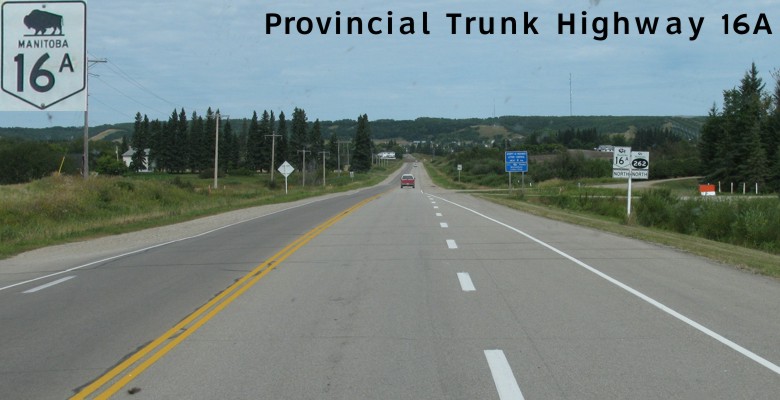
| PTH 16A ends at PTH 10/16 northwest of Minnedosa. Click here for PTH 10 images and here for PTH 16 images. | ||||
© Curtis Walker. All rights reserved. All pictures used on this site are the property of the respective photographers and are used by permission. No picture may be used without the consent of the respective photographer.
All pictures taken by Curtis Walker unless otherwise noted.