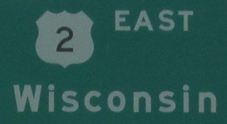
U.S. Highway 2
 |
US 2 crosses the northern part of the state from Superior to the Michigan state line near Hurley. After traversing through part of Michigan's upper peninsula, it re-enters Wisconsin near Florence before continuing east back into Michigan near Iron Mountain. Click here to show the route.
Western Entrance: Mid-span on the Richard I. Bong Bridge. Eastern Entrances: Michigan state line near Hurley, then later near Iron Mountain, MI. |
;)
Pictures are arranged from west to east.
| US 2 continues west into Minnesota. Click here for US 2 images in Minnesota. | ||||
| Location | Description | Photo
| ||
| Douglas County City of Superior |
Eastbound view on the Richard I. Bong Bridge entering Wisconsin.  Photograph taken in April 2013. |
;) |
||
| Douglas County City of Superior |
Eastbound view on the Richard I. Bong Bridge entering Wisconsin. Photograph taken in April 2013. |
;) |
||
| Douglas County City of Superior |
Eastbound view on the Richard I. Bong Bridge entering Wisconsin. Photograph taken in April 2013. |
;) |
||
| Douglas County City of Superior |
Eastbound view on the Richard I. Bong Bridge entering Wisconsin. Photograph taken in April 2013. |
;) |
||
| Douglas County City of Superior |
Eastbound view on the Richard I. Bong Bridge past St. Louis Bay. Photograph taken in April 2013. |
;) |
||
| Douglas County City of Superior |
Eastbound view showing the first signs for the Lake Superior Circle Tour and Douglas County. Photograph taken in April 2013. |
;) |
||
| Douglas County City of Superior |
Eastbound view showing more signs entering Wisconsin. Curiously, there is no signage welcoming visitors to the state. Photograph taken in April 2013. |
;) |
||
| Douglas County City of Superior |
Eastbound view showing the sign indicating entry into Superior. Photograph taken in April 2013. |
;) |
||
| Douglas County City of Superior |
Eastbound view passing over Susquehanna Avenue. Photograph taken in April 2013. |
;) |
||
| Douglas County City of Superior |
Eastbound view approaching Belknap Street. Photograph taken in April 2013. |
;) |
||
| Douglas County City of Superior |
Eastbound view approaching Belknap Street. Photograph taken in April 2013. |
;) |
||
| Douglas County City of Superior |
Eastbound view approaching Belknap Street. At right is the turnoff to the US 2/US 53 truck route. The US 2 truck route follows Winter Street through Superior. Photograph taken in April 2013. |
;) |
||
| Douglas County City of Superior |
Eastbound view at Belknap Street. Photograph taken in April 2013. |
;) |
||
| Douglas County City of Superior |
Eastbound view on Belknap Street approaching 15th Street. Photograph taken in April 2013. |
;) |
||
| Douglas County City of Superior |
Eastbound view on Belknap Street approaching a railway overpass. Photograph taken in April 2013. |
;) |
||
| Douglas County City of Superior |
Eastbound view on Belknap Street on a railway overpass. Photograph taken in April 2013. |
;) |
||
| Douglas County City of Superior |
Eastbound view on Belknap Street on a railway overpass. Photograph taken in April 2013. |
;) |
||
| Douglas County City of Superior |
Eastbound view on Belknap Street approaching Banks Avenue. Photograph taken in April 2013. |
;) |
||
| Douglas County City of Superior |
Eastbound view on Belknap Street approaching Banks Avenue. Photograph taken in April 2013. |
;) |
||
| Douglas County City of Superior |
Eastbound view on Belknap Street at Banks Avenue. Photograph taken in April 2013. |
;) |
||
| Douglas County City of Superior |
Eastbound view on Belknap Street approaching Tower Avenue and the junction of WIS 35. Photograph taken in April 2013. |
;) |
||
| Douglas County City of Superior |
Westbound view on Belknap Street past Tower Avenue showing the reassurance marker for US 2 and the trailblazer sign for I-35. Photograph taken in April 2013. |
;) |
||
| Douglas County City of Superior |
Eastbound view on Belknap Street approaching Tower Avenue. Photograph taken in April 2013. |
;) |
||
| US 2 meets WIS 35 in Superior. Click here for WIS 35 images. | ||||
| Douglas County City of Superior |
Eastbound view on Belknap Street at Tower Avenue. Photograph taken in April 2013. |
;) |
||
| Douglas County City of Superior |
Eastbound view on Belknap Street at Tower Avenue showing a closeup of the reassurance marker for US 2. Photograph taken in April 2013. |
;) |
||
| Douglas County City of Superior |
A look at the park at the southeast corner of Belknap Street and Tower Avenue. Photograph taken in April 2013. |
;) |
||
| Douglas County City of Superior |
Eastbound view on Belknap Street approaching Ogden Avenue. Photograph taken in April 2013. |
;) |
||
| Douglas County City of Superior |
Eastbound view on Belknap Street past Ogden Avenue. Photograph taken in April 2013. |
;) |
||
| Douglas County City of Superior |
Eastbound view on Belknap Street approaching Hammond Avenue. Photograph taken in April 2013. |
;) |
||
| Douglas County City of Superior |
Eastbound view on Belknap Street approaching Hammond Avenue. Photograph taken in April 2013. |
;) |
||
| Douglas County City of Superior |
Eastbound view on Belknap Street past Hammond Avenue. Photograph taken in April 2013. |
;) |
||
| Douglas County City of Superior |
Eastbound view on Belknap Street approaching Grand Avenue. Photograph taken in April 2013. |
;) |
||
| Douglas County City of Superior |
Eastbound view on Belknap Street past Grand Avenue. Photograph taken in April 2013. |
;) |
||
| Douglas County City of Superior |
Eastbound view on Belknap Street approaching Catlin Avenue. Photograph taken in April 2013. |
;) |
||
| Douglas County City of Superior |
Eastbound view on Belknap Street past Catlin Avenue. Photograph taken in April 2013. |
;) |
||
| Douglas County City of Superior |
Eastbound view on Belknap Street past Poplar Avenue. Photograph taken in April 2013. |
;) |
||
| Douglas County City of Superior |
Eastbound view on Belknap Street approaching a railway crossing. Photograph taken in April 2013. |
;) |
||
| Douglas County City of Superior |
Eastbound view on Belknap Street past the railway crossing. Photograph taken in April 2013. |
;) |
||
| Douglas County City of Superior |
Eastbound view on Belknap Street approaching Hill Avenue. Photograph taken in April 2013. |
;) |
||
| Douglas County City of Superior |
Eastbound view on Lenroot Highway approaching East 7th Street. Photograph taken in April 2013. |
;) |
||
| Douglas County City of Superior |
Eastbound view on Lenroot Highway approaching East 5th Street. Photograph taken in April 2013. |
;) |
||
| Douglas County City of Superior |
Eastbound view on Lenroot Highway showing the advance signage for the junction of US 53. Photograph taken in April 2013. |
;) |
||
| Douglas County City of Superior |
Eastbound view on Lenroot Highway approaching the junction of US 53. Photograph taken in April 2013. |
;) |
||
| Douglas County City of Superior |
Eastbound view on Lenroot Highway approaching the junction of US 53. Photograph taken in April 2013. |
;) |
||
| Douglas County City of Superior |
Eastbound view on Lenroot Highway at the junction of US 53. Ahead is the parking lot for Barker's Island the S.S. Meteor whaling ship. Photograph taken in April 2013. |
;) |
||
| US 2 meets US 53 in Superior. Click here for US 53 images. | ||||
© Curtis Walker. All rights reserved. All pictures used on this site are the property of the respective photographers and are used by permission. No picture may be used without the consent of the respective photographer.
All pictures taken by Curtis Walker unless otherwise noted.