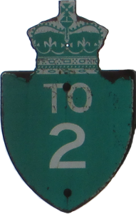
King's Highway 2
(Decommissioned Route)
 |
|
Pictures are arranged from west to east.
| Location | Description | Photo
| ||
| City of Hamilton |
Southbound view on Dundurn Street approaching King Street.  Photograph taken in October 2019. |
;) |
||
| City of Hamilton |
Southbound view on Dundurn Street at Head Street. Photograph taken in October 2019. |
;) |
||
| City of Hamilton |
Southbound view on Dundurn Street at Lochearne Street. Photograph taken in October 2019. |
;) |
||
| City of Hamilton |
Southbound view on Dundurn Street at Tom Street. Photograph taken in October 2019. |
;) |
||
| City of Hamilton |
Southbound view on Dundurn Street past York Boulevard. Photograph taken in October 2019. |
;) |
||
| City of Hamilton |
Northbound view on York Boulevard past Dundurn Street. Photograph taken in October 2019. |
;) |
||
| City of Hamilton |
Northbound view on York Boulevard past Dundurn Street. Photograph taken in October 2019. |
;) |
||
| Regional Municipality of Halton City of Burlington |
Eastbound view on Plains Road approaching Glenwood Avenue. Photograph taken in June 2015. |
;) |
||
| Regional Municipality of Halton City of Burlington |
Westbound view on Plains Road approaching St. Matthews Avenue. Photograph taken in June 2015. |
;) |
||
| Regional Municipality of Halton City of Burlington |
Westbound view on Plains Road passing the East Plains United Church. Photograph taken in June 2015. |
;) |
||
| Regional Municipality of Halton City of Burlington |
Westbound view on Plains Road approaching Kingsway Drive. Photograph taken in June 2015. |
;) |
||
| Regional Municipality of Halton City of Burlington |
Westbound view on Fairview Street at Guelph Line showing trailblazer signs for King's Highway 2 and the nearby QEW. Photograph taken in June 2015. |
;) |
||
| Regional Municipality of Halton City of Burlington |
Eastbound view on Lakeshore Road approaching Walkers Line. Photograph taken in June 2015. |
;) |
||
| Regional Municipality of Halton City of Burlington |
Westbound view on Lakeshore Road approaching Walkers Line. Photograph taken in June 2015. |
;) |
||
| Regional Municipality of Halton City of Burlington |
Eastbound view on Lakeshore Road approaching Appleby Line. Photograph taken in June 2015. |
;) |
||
| Regional Municipality of Halton City of Burlington |
Eastbound view on Lakeshore Road at Kenwood Avenue. Photograph taken in June 2015. |
;) |
||
| Regional Municipality of Halton City of Burlington |
Westbound view on Lakeshore Road past Burloak Drive. Photograph taken in June 2015. |
;) |
||
| Regional Municipality of Halton City of Burlington |
Eastbound view on Lakeshore Road approaching Burloak Drive. Photograph taken in June 2015. |
;) |
||
| Regional Municipality of Halton Town of Oakville |
Eastbound view on Lakeshore Road past Great Lakes Boulevard. Photograph taken in June 2015. |
;) |
||
| Regional Municipality of Halton Town of Oakville |
Eastbound view on Lakeshore Road approaching the crossing of Bronte Creek. Photograph taken in June 2015. |
;) |
||
| Regional Municipality of Halton Town of Oakville |
Westbound view on Lakeshore Road past Bronte Road. Photograph taken in June 2015. |
;) |
||
| Regional Municipality of Peel City of Mississauga |
Westbound view on Lakeshore Road approaching Deta Road. Photograph taken in April 2018. |
;) |
||
| Regional Municipality of Peel City of Mississauga |
Westbound view on Lakeshore Road past Etobicoke Creek. Photograph taken in April 2018. |
;) |
||
| City of Toronto |
Westbound view on Lake Shore Boulevard crossing Etobicoke Creek. Photograph taken in April 2018. |
;) |
||
| City of Toronto |
Westbound view on Lake Shore Boulevard approaching Brow Drive. Photograph taken in April 2018. |
;) |
||
| City of Toronto |
Westbound view on Lake Shore Boulevard past Bay Street. Photograph taken in March 2015. |
;) |
||
| City of Toronto |
Eastbound view on Harbour Street approaching Yonge Street. Photograph taken in March 2015. |
;) |
||
| City of Toronto |
Eastbound view on Harbour Street approaching Yonge Street. Photograph taken in March 2015. |
;) |
||
| City of Toronto |
Eastbound view on Lake Shore Boulevard past Yonge Street. Photograph taken in March 2015. |
;) |
||
| City of Toronto |
Eastbound view on Lake Shore Boulevard past Yonge Street. Photograph taken in March 2015. |
;) |
||
| City of Toronto |
Eastbound view on Lake Shore Boulevard past Yonge Street. Photograph taken in March 2015. |
;) |
© Curtis Walker. All rights reserved. All pictures used on this site are the property of the respective photographers and are used by permission. No picture may be used without the consent of the respective photographer.
All pictures taken by Curtis Walker unless otherwise noted.