 |
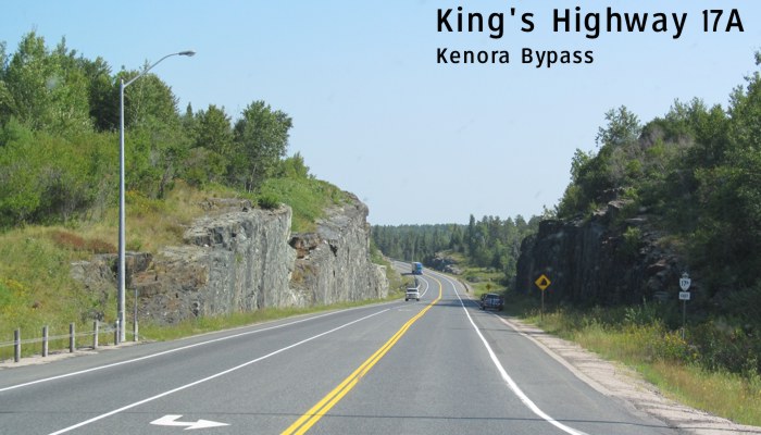
King's Highway 17A serves as the bypass around Kenora and was opened in 1990, providing much relief to truckers who were forced to navigate through Kenora on their way from Winnipeg to Thunder Bay and beyond. Unlike its parent highway, King's Highway 17A does not carry any Trans-Canada signage along its route. Click here to show the route. Click here for more images of King's Highway 17A on AsphaltPlanet.ca. |
;)
Images of King's Highway 17A:
© Curtis Walker. All rights reserved. All pictures used on this site are the property of the respective photographers and are used by permission. No picture may be used without the consent of the respective photographer.
All pictures taken by Curtis Walker unless otherwise noted.