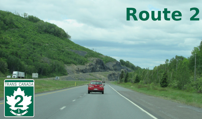
Route 2 runs the length of the province and carries the Trans-Canada designation for its entire length. It is fully twinned and serves the cities of Edmundston, Fredericton, the provincial capital, and Moncton, the province’s largest city.
|
Western Terminus: Quebec border near Dégelis, QC.
Eastern Terminus: Nova Scotia boundary near Amherst, NS. Click here to show the route. |
;)
Pictures are arranged from west to east.
| Location | Description | Photo
| ||
| Madawaska County Saint-Jacques Parish |
Southbound view entering New Brunswick.  Photograph taken in June 2023. |
;) |
||
| Madawaska County Saint-Jacques Parish |
Southbound view passing under Madawaska Avenue. In this direction, access to Madawaska Avenue is in New Brunswick, but in the opposite direction, access is on the Quebec side. Photograph taken in June 2023. |
;) |
||
| Madawaska County Saint-Jacques Parish |
Northbound view passing under Madawaska Avenue. On the other side is the Quebec border. Photograph taken in June 2023. |
;) |
||
| Madawaska County Saint-Jacques Parish |
Southbound view approaching the Madawaska Avenue exit. Photograph taken in June 2023. |
;) |
||
| Madawaska County Saint-Jacques Parish |
Northbound view approaching the Quebec border. Photograph taken in June 2023. |
;) |
||
| Madawaska County Saint-Jacques Parish |
Northbound view showing the sign indicating the end of the River Valley Drive. There is no signage to indicate the upcoming end of Route 2 at the Quebec border. Photograph taken in June 2023. |
;) |
||
| Madawaska County Saint-Jacques Parish |
Southbound view passing the Madawaska Avenue exit. Photograph taken in June 2023. |
;) |
||
| Madawaska County Saint-Jacques Parish |
Southbound view passing the Madawaska Avenue exit showing the sign showing the scenic drives available in the province. Photograph taken in June 2023. |
;) |
||
| Madawaska County Saint-Jacques Parish |
Southbound view passing the Madawaska Avenue exit. Curiously, rather than use a yield sign, New Brunswick uses a “merge/convergez” sign at on-ramps. Given the constitutional requirement for both languages to be on signs, it would make more sense to use the wordless pictogram. Photograph taken in June 2023. |
;) |
||
| Madawaska County Saint-Jacques Parish |
Southbound view passing the Madawaska Avenue exit showing the 1.5 km advance signage for the weigh station. Photograph taken in June 2023. |
;) |
||
| Madawaska County Saint-Jacques Parish |
Southbound view showing the marker past the Madawaska Avenue exit. Photograph taken in June 2023. |
;) |
||
| Madawaska County Saint-Jacques Parish |
Northbound view showing the 2 km advance signage for the Avenue de la Madawaska exit, the first exit in Quebec. Photograph taken in June 2023. |
;) |
||
| Madawaska County Saint-Jacques Parish |
Southbound view past the Madawaska Avenue exit showing the sign indicating the 110 km/h speed limit and that speed fines are doubled in construction zones. Photograph taken in June 2023. |
;) |
||
| Madawaska County Saint-Jacques Parish |
Southbound view past the Madawaska Avenue exit. Photograph taken in June 2023. |
;) |
||
| Madawaska County Saint-Jacques Parish |
Northbound view past the 3 km marker. Photograph taken in June 2023. |
;) |
||
| Madawaska County Saint-Jacques Parish |
Southbound view approaching the weigh station. Photograph taken in June 2023. |
;) |
||
| Madawaska County Saint-Jacques Parish |
Southbound view approaching the weigh station. Photograph taken in June 2023. |
;) |
||
| Madawaska County Saint-Jacques Parish |
Northbound view at the 3 km marker. Photograph taken in June 2023. |
;) |
||
| Madawaska County Saint-Jacques Parish |
Southbound view approaching the weigh station. Photograph taken in June 2023. |
;) |
||
| Madawaska County Saint-Jacques Parish |
Southbound view passing the weigh station. Photograph taken in June 2023. |
;) |
||
| Madawaska County Saint-Jacques Parish |
Southbound view passing the weigh station. Photograph taken in June 2023. |
;) |
||
| Madawaska County Saint-Jacques Parish |
Northbound view at the 4 km marker. Photograph taken in June 2023. |
;) |
||
| Madawaska County Saint-Jacques Parish |
Southbound view showing the sign indicating that Parc de la République is accessible via Exit 8. Photograph taken in June 2023. |
;) |
||
| Madawaska County Saint-Jacques Parish |
Southbound view showing the sign indicating that Edmundston is accessible via the next 7 exits. Photograph taken in June 2023. |
;) |
||
| Madawaska County Saint-Jacques Parish |
Northbound past the second Principale Street/Saint-Jacques exit. Photograph taken in June 2023. |
;) |
||
| Madawaska County Saint-Jacques Parish |
Southbound view showing more signage for the upcoming Exit 8. Photograph taken in June 2023. |
;) |
||
| Madawaska County Saint-Jacques Parish |
Southbound view showing the 2 km advance signage for the Principale Street/Saint-Jacques exit. Photograph taken in June 2023. |
;) |
||
| Madawaska County City of Edmundston |
Southbound view showing signage for Edmundston. Photograph taken in June 2023. |
;) |
||
| Madawaska County City of Edmundston |
Southbound view showing signage for the River Valley Drive, which breaks from Route 2 in Edmundston. Photograph taken in June 2023. |
;) |
||
| Madawaska County City of Edmundston |
Southbound view showing the sign indicating that the New Brunswick Botanical Garden is accessible via the upcoming Exit 8. Photograph taken in June 2023. |
;) |
||
| Madawaska County City of Edmundston |
Northbound past the second Principale Street/Saint-Jacques exit. Photograph taken in June 2023. |
;) |
||
| Madawaska County City of Edmundston |
Southbound view showing the sign indicating the 100 km/h speed limit. There is no advance signage of the reduction in the limit from 110 km/h, which began just over the Quebec border. Photograph taken in June 2023. |
;) |
||
| Madawaska County City of Edmundston |
Northbound showing the marker past the second Principale Street/Saint-Jacques exit. This is the last westbound marker in New Brunswick. Photograph taken in June 2023. |
;) |
||
| Madawaska County City of Edmundston |
Southbound view approaching the Principale Street/Saint-Jacques exit. Photograph taken in June 2023. |
;) |
||
| Madawaska County City of Edmundston |
Northbound passing the second Principale Street/Saint-Jacques exit showing the signs warning motorists of moose in the area. Photograph taken in June 2023. |
;) |
||
| Madawaska County City of Edmundston |
Northbound view approaching the second Principale Street/Saint-Jacques exit. Photograph taken in June 2023. |
;) |
||
| Madawaska County City of Edmundston |
Southbound view passing under Bérubé Road. Photograph taken in June 2023. |
;) |
||
| Madawaska County City of Edmundston |
Northbound view approaching the second Principale Street/Saint-Jacques exit. Photograph taken in June 2023. |
;) |
||
| Madawaska County City of Edmundston |
Southbound view showing the marker past the Principale Street/Saint-Jacques exit. Photograph taken in June 2023. |
;) |
||
| Madawaska County City of Edmundston |
Northbound view approaching the second Principale Street/Saint-Jacques exit. Photograph taken in June 2023. |
;) |
||
| Madawaska County City of Edmundston |
Southbound view showing the sign indicating that the Edmundston campus of the Université de Moncton is accessible via Exit 18. Photograph taken in June 2023. |
;) |
||
| Madawaska County City of Edmundston |
Southbound view passing over Rivière-à-la-Truite Road. Photograph taken in June 2023. |
;) |
||
| Madawaska County City of Edmundston |
Northbound view passing over Rivière-à-la-Truite Road. Photograph taken in June 2023. |
;) |
||
| Madawaska County City of Edmundston |
Southbound view crossing the Rivière-à-la-Truite. Photograph taken in June 2023. |
;) |
||
| Madawaska County City of Edmundston |
Northbound view showing the 2 km advance signage for the second Principale Street/Saint-Jacques exit. This is the last exit before the Quebec border. Photograph taken in June 2023. |
;) |
||
| Madawaska County City of Edmundston |
Southbound view showing the sign indicating that the Madawaska Maliseet First Nation is accessible via Exit 21. Photograph taken in June 2023. |
;) |
||
| Madawaska County City of Edmundston |
Southbound view showing the 2 km advance signage for the Canada Road exit. Photograph taken in June 2023. |
;) |
||
| Madawaska County City of Edmundston |
Northbound view showing the marker past the Principale Street/Saint-Jacques exit. Photograph taken in June 2023. |
;) |
||
| Madawaska County City of Edmundston |
Southbound view approaching the second Principale Street/Saint-Jacques exit. Photograph taken in June 2023. |
;) |
||
| Madawaska County City of Edmundston |
Northbound view past Mont Farlagne Road. Photograph taken in June 2023. |
;) |
||
| Madawaska County City of Edmundston |
Southbound view passing over Mont Farlagne Road. Photograph taken in June 2023. |
;) |
||
| Madawaska County City of Edmundston |
Northbound view passing over Mont Farlagne Road. Photograph taken in June 2023. |
;) |
||
| Madawaska County City of Edmundston |
Southbound view approaching the Canada Road exit. Photograph taken in June 2023. |
;) |
||
| Madawaska County City of Edmundston |
Northbound view at the Principale Street/Saint-Jacques exit. Photograph taken in June 2023. |
;) |
||
| Madawaska County City of Edmundston |
Southbound view approaching the Canada Road exit. Photograph taken in June 2023. |
;) |
||
| Madawaska County City of Edmundston |
Northbound view approaching the Principale Street/Saint-Jacques exit. Photograph taken in June 2023. |
;) |
||
| Madawaska County City of Edmundston |
Northbound view passing over Route 144. Photograph taken in June 2023. |
;) |
||
| Madawaska County City of Edmundston |
Northbound view passing over Victoria Street. Photograph taken in June 2023. |
;) |
||
| Madawaska County City of Edmundston |
Northbound view showing the 2 km advance signage for the Principale Street/Saint-Jacques exit. Photograph taken in June 2023. |
;) |
||
| Madawaska County City of Edmundston |
Northbound view passing the Carrier Street/Victoria Street exit. Photograph taken in June 2023. |
;) |
||
| Madawaska County City of Edmundston |
Northbound view passing the Carrier Street/Victoria Street exit. Photograph taken in June 2023. |
;) |
||
| Madawaska County City of Edmundston |
Northbound view approaching the Carrier Street/Victoria Street exit. Photograph taken in June 2023. |
;) |
||
| Madawaska County City of Edmundston |
Northbound view showing the marker past the Route 120 exit. Photograph taken in June 2023. |
;) |
||
| Madawaska County City of Edmundston |
Northbound view showing the sign giving the distance to the Quebec border. Photograph taken in June 2023. |
;) |
||
| Madawaska County City of Edmundston |
Northbound view taking the on-ramp to Route 2 from the Route 120 exit. Photograph taken in June 2023. |
;) |
||
| Westmorland County City of Moncton |
Eastbound view showing the sign at the Route 126 exit. Photograph taken in September 2025. |
;) |
||
© Curtis Walker. All rights reserved. All pictures used on this site are the property of the respective photographers and are used by permission. No picture may be used without the consent of the respective photographer.
All pictures taken by Curtis Walker unless otherwise noted.