|
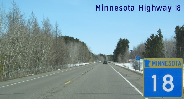
MN 18 runs east-west across the east-central portion of the state beginning in Brainerd, following the north shore of Mille Lacs Lake and ending near Finlayson, a half-mile from the junction of I-35.
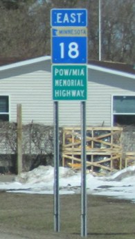
The portion of the route between Brainerd and Garrison has been designated part of the POW/MIA Memorial Highway that continues south along US 169 at Garrison. Western Terminus: Junction of MN 25 in Brainerd. Eastern Terminus: Junction of MN 23 between Finlayson and Askov. Click here to show the route. |
;)
Pictures are arranged from west to east.
| Location | Description | Photo
| ||
| Crow Wing County City of Brainerd |
Eastbound view past the junction of MN 25.  Photograph taken in April 2013. |
;) |
||
| Crow Wing County City of Brainerd |
Eastbound view past the junction of MN 25 showing the sign giving the mileage to Garrison. Photograph taken in April 2013. |
;) |
||
| Crow Wing County |
Eastbound view at Mile 3. Photograph taken in April 2013. |
;) |
||
| Crow Wing County |
Eastbound view past Mile 3. Photograph taken in April 2013. |
;) |
||
| Crow Wing County |
Eastbound view at Mile 4. Photograph taken in April 2013. |
;) |
||
| Crow Wing County |
Eastbound view approaching the junction of CSAH 25/144. Photograph taken in April 2013. |
;) |
||
| Crow Wing County |
Eastbound view approaching the junction of CSAH 25/144. Photograph taken in April 2013. |
;) |
||
| Crow Wing County |
Eastbound view at Mile 5. Photograph taken in April 2013. |
;) |
||
| Crow Wing County |
Eastbound view past Mile 5. Photograph taken in April 2013. |
;) |
||
| Crow Wing County |
Eastbound view at Mile 6. Photograph taken in April 2013. |
;) |
||
| Crow Wing County |
Eastbound view showing the advance signage for the junction of CSAH 23/159. Photograph taken in April 2013. |
;) |
||
| Crow Wing County |
Eastbound view passing the junction of CSAH 23/159. Photograph taken in April 2013. |
;) |
||
| Crow Wing County |
Eastbound view at Mile 7. Photograph taken in April 2013. |
;) |
||
| Crow Wing County |
Eastbound view showing the advance signage for Burgwald Road. Photograph taken in April 2013. |
;) |
||
| Crow Wing County |
Eastbound view at Mile 8. Photograph taken in April 2013. |
;) |
||
| Crow Wing County |
Eastbound view past Mile 8. Photograph taken in April 2013. |
;) |
||
| Crow Wing County |
Eastbound view showing the advance signage for Thorson Road. Photograph taken in April 2013. |
;) |
||
| Crow Wing County |
Eastbound view at Mile 9. Photograph taken in April 2013. |
;) |
||
| Crow Wing County |
Eastbound view past Mile 9. Photograph taken in April 2013. |
;) |
||
| Crow Wing County |
Eastbound view showing the advance signage for Pine Center Road. Photograph taken in April 2013. |
;) |
||
| Crow Wing County |
Eastbound view passing Pine Center Road. Ahead is the marker for Mile 10. Photograph taken in April 2013. |
;) |
||
| Crow Wing County |
Eastbound view showing the advance signage for Nokay Lake Road. Photograph taken in April 2013. |
;) |
||
| Crow Wing County |
Eastbound view showing the advance signage for Pine Hurst Road. Photograph taken in April 2013. |
;) |
||
| Crow Wing County |
Eastbound view at Mile 11. Photograph taken in April 2013. |
;) |
||
| Crow Wing County |
Eastbound view past Mile 11. Photograph taken in April 2013. |
;) |
||
| Crow Wing County |
Eastbound view at Mile 12. Photograph taken in April 2013. |
;) |
||
| Crow Wing County |
Eastbound view past Mile 12. Photograph taken in April 2013. |
;) |
||
| Crow Wing County |
Eastbound view past Mile 12. Photograph taken in April 2013. |
;) |
||
| Crow Wing County |
Eastbound view at Mile 13. Photograph taken in April 2013. |
;) |
||
| Crow Wing County |
Eastbound view showing the advance signage for Crooked Lake Road. Photograph taken in April 2013. |
;) |
||
| Crow Wing County |
Eastbound view showing the advance signage for Esden Road. Photograph taken in April 2013. |
;) |
||
| Crow Wing County |
Eastbound view at Mile 14. Photograph taken in April 2013. |
;) |
||
| Crow Wing County |
Eastbound view past Mile 14. Photograph taken in April 2013. |
;) |
||
| Crow Wing County |
Eastbound view showing the advance signage for Maghan Road. Photograph taken in April 2013. |
;) |
||
| Crow Wing County |
Eastbound view at Mile 15. Photograph taken in April 2013. |
;) |
||
| Crow Wing County |
Eastbound view showing the ½ advance signage for the junction of MN 6. Photograph taken in April 2013. |
;) |
||
| Crow Wing County |
Eastbound view at Mile 16. Photograph taken in April 2013. |
;) |
||
| Crow Wing County |
Eastbound view approaching the junction of MN 6. Photograph taken in April 2013. |
;) |
||
| Crow Wing County |
Eastbound view showing the reassurance marker past the junction of MN 6. Photograph taken in April 2013. |
;) |
||
| Crow Wing County |
Eastbound view past the junction of MN 6 showing the sign giving the mileage to Garrison. Photograph taken in April 2013. |
;) |
||
| Crow Wing County |
Eastbound view past the junction of MN 6. Photograph taken in April 2013. |
;) |
||
| Crow Wing County |
Eastbound view approaching the turnoff to East Shore Bay Lake. Photograph taken in April 2013. |
;) |
||
| Crow Wing County |
Eastbound view past the turnoff to East Shore Bay Lake. Photograph taken in April 2013. |
;) |
||
| Crow Wing County |
Eastbound view showing the ½ mile advance signage for the wayside rest area at Kenney Lake. Photograph taken in April 2013. |
;) |
||
| Crow Wing County |
Eastbound view at Mile 18. Photograph taken in April 2013. |
;) |
||
| Crow Wing County |
Eastbound view past Mile 18. Photograph taken in April 2013. |
;) |
||
| Crow Wing County |
Eastbound view showing the advance signage for Borden Lake Road. Photograph taken in April 2013. |
;) |
||
| Crow Wing County |
Eastbound view passing around Borden Lake. Photograph taken in April 2013. |
;) |
||
| Crow Wing County |
Eastbound view near Garrison. Photograph taken in April 2013. |
;) |
||
| Crow Wing County |
Eastbound view showing the advance signage for Allen Road. Photograph taken in April 2013. |
;) |
||
| Crow Wing County |
Eastbound view entering Garrison. Photograph taken in April 2013. |
;) |
||
| Crow Wing County |
Eastbound view at Mile 20. Photograph taken in April 2013. |
;) |
||
| Crow Wing County City of Garrison |
Eastbound view past Mile 20. Photograph taken in April 2013. |
;) |
||
| Crow Wing County City of Garrison |
Eastbound view showing the advance signage for the junction of US 169. Photograph taken in April 2013. |
;) |
||
| Crow Wing County City of Garrison |
Eastbound view approaching the junction of US 169. MN 18 follows US 169 to the left along the shore of Mille Lacs Lake, which is straight ahead. Photograph taken in April 2013. |
;) |
||
© Curtis Walker. All rights reserved. All pictures used on this site are the property of the respective photographers and are used by permission. No picture may be used without the consent of the respective photographer.
All pictures taken by Curtis Walker unless otherwise noted.