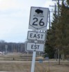
Provincial Trunk Highway 26
| Page 1 - PTH 1 to St. François Xavier | Page 2 --> |
Pictures are arranged from east to west.
| PTH 26 ends at |
||||
| Location | Description | Photo
| ||
| RM of St. François Xavier |
Westbound view at the junction of PTH 1.  Photograph taken in April 2011. |
 |
||
| RM of St. François Xavier |
Eastern terminus of PTH 26 showing a closeup of the markers.  Photograph taken in August 2008. |
 |
||
| RM of St. François Xavier |
Westbound view at the junction of PTH 1. The first yellow marker is the sign for the Assiniboine Trail and following is the first reassurance marker for PTH 26. The gravel road to the left leads to the white horse statue that is prominently visible from PTH 1.  Photograph taken in August 2004. |
 |
||
| RM of St. François Xavier |
Westbound view showing the marker for the Assiniboine Trail. The shadow next to the marker is from your friendly neighborhood two-wheeled photographer.  Photograph taken in January 2009. |
 |
||
| RM of St. François Xavier |
Westbound view showing the first westbound marker.  Photograph taken in January 2009. |
 |
||
| RM of St. François Xavier |
Westbound view showing the new marker featuring the “warthog”-style buffalo.  Photograph taken in March 2012. |
 |
||
| RM of St. François Xavier |
Eastbound view showing the advance signage for the junction of PTH 1 featuring the new marker with Clearview numbering.  Photograph taken in September 2013. |
 |
||
| RM of St. François Xavier |
Eastbound view approaching the junction of PTH 1.  Photograph taken in May 2009. |
 |
||
| RM of St. François Xavier |
Westbound view showing the sign giving the distance to St. François Xavier and Poplar Point.  Photograph taken in February 2010. |
 |
||
| RM of St. François Xavier |
Westbound view entering St. François Xavier.  Photograph taken in May 2009. |
 |
||
| RM of St. François Xavier |
Westbound view entering St. François Xavier.  Photograph taken in June 2008. |
 |
||
| RM of St. François Xavier |
Eastbound view showing the last eastbound marker.  Photograph taken in May 2009. |
 |
||
| RM of St. François Xavier |
Eastbound view showing a closeup of the last eastbound marker.  Photograph taken in May 2009. |
 |
||
| RM of St. François Xavier |
Westbound view entering St. François Xavier.  Photograph taken in June 2008. |
 |
||
| RM of St. François Xavier |
A view of the cairn honoring Cuthbert Grant. In the background is PTH 26.  Photograph taken in June 2011. |
 |
||
| RM of St. François Xavier |
A closeup of the cairn honoring Cuthbert Grant.  Photograph taken in June 2011. |
 |
||
| RM of St. François Xavier |
Westbound view showing the marker past St. François Xavier Park.  Photograph taken in June 2011. |
 |
||
| RM of St. François Xavier |
Westbound view showing a closeup of the marker past St. François Xavier Park.  Photograph taken in June 2011. |
 |
||
| Click here to continue west along PTH 26. | ||||
© Curtis Walker. All rights reserved. All pictures used on this site are the property of the respective photographers and are used by permission. No picture may be used without the consent of the respective photographer.
All pictures taken by Curtis Walker unless otherwise noted.