Provincial Road 238
| <-- Page 2 | Page 2 - St. Andrews Road to Lockport |
Pictures are arranged from south to north.
| Click here to continue south along PR 238. | ||||
| Location | Description | Photo
| ||
| RM of St. Andrews |
Northbound view at the junction of PR 410 showing a “Road Closed” sign on account of flooding.  Photograph taken in April 2009. |
 |
||
| RM of St. Andrews |
Southbound view approaching the junction of PR 410.  Photograph taken in August 2009. |
 |
||
| RM of St. Andrews |
Southbound view approaching the junction of PR 410 showing a closeup of the signage for St. Andrews Church and St. Andrews Rectory.  Photograph taken in August 2009. |
 |
||
| RM of St. Andrews |
A look at the Captain Kennedy House. Inside is the Maple Grove Tea Room and outside, there is a garden along the Red River.  Photograph taken in October 2009. |
 |
||
| RM of St. Andrews |
Northbound view at Captain Kennedy House.  Photograph taken in May 2005. |
 |
||
| RM of St. Andrews |
View from PR 204 on the east side of the Red River showing the ice buildup.  Photograph taken in April 2009. |
 |
||
| RM of St. Andrews |
Northbound view near Donald Road.  Photograph taken in October 2009. |
 |
||
| RM of St. Andrews |
Northbound view near Donald Road showing the scenic view of the Red River.  Photograph taken in October 2013. |
 |
||
| RM of St. Andrews |
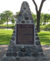
River Road Heritage Parkway stone marker.  Photograph taken in June 2008. |
 |
||
| RM of St. Andrews |
Southbound view in Lockport showing a “Road Closed” sign on account of the flooding in the area.  Photograph taken in April 2009. |
 |
||
| RM of St. Andrews |
Northbound view entering Lockport. To the right are the Lockport Bridge and the St. Andrews Lock and Dam. River Road continues straight and eventually meets up at PTH 9 north of PTH 44 while PR 238 turns to the left and ends up at PTH 44.  Photograph taken in June 2005. |
 |
||
| RM of St. Andrews |
Northbound view near Steven Avenue.  Photograph taken in August 2009. |
 |
||
| RM of St. Andrews |
The plaque at the park near St. Andrews Lock and Dam.  Photograph taken in August 2009. |
 |
||
| RM of St. Andrews |
The sign for St. Andrews Lock and Dam.  Photograph taken in August 2009. |
 |
||
| RM of St. Andrews |
St. Thomas Church facing Steven Avenue.  Photograph taken in October 2009. |
 |
||
| RM of St. Andrews |
Westbound view on Steven Avenue.  Photograph taken in May 2010. |
 |
||
| RM of St. Andrews |
Eastbound view on Steven Avenue approaching the portion of the street that is part of PR 238.  Photograph taken in April 2014. |
 |
||
| RM of St. Andrews |
Northern terminus of PR 238, the junction of PTH 44 just west of the Lockport Bridge.  Photograph taken in May 2005. |
 |
||
| PR 238 ends at PTH 44 in Lockport. Click here for PTH 44 images. | ||||
© Curtis Walker. All rights reserved. All pictures used on this site are the property of the respective photographers and are used by permission. No picture may be used without the consent of the respective photographer.
All pictures taken by Curtis Walker unless otherwise noted.