A grid road system covers much of southern Manitoba and the other prairie provinces.
Roads have been marked at one-mile intervals across the province and are numbered according to the number of miles from one of two measuring points.
For roads that travel from east to west, road numbers are assigned based on the number of miles from the U.S./Canada border, located at the 49th parallel. For roads that travel from north to south, road numbers are assigned based on the number of miles east or west of the principal meridian, located west of Winnipeg. The location of this principal meridian does not correspond to a particular meridian of longitude, but was established when the land was surveyed prior to the large-scale settlement of the North West Territories by those who emigrated from elsewhere in Canada, the U.S., and from across Europe.
For example, the junction of PR 222 and PR 324 at Camp Morton is located at the intersection of Roads 116N and 20E. This point is 116 miles north of the U.S. border and 20 miles east of the principal meridian.
Municipal boundaries in rural Manitoba are often defined along this grid and many provincial trunk highways and provincial roads follow these roads. The numbers assigned to the provincial highways bear no correlation to their grid road numbers.
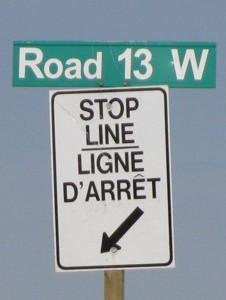
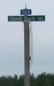
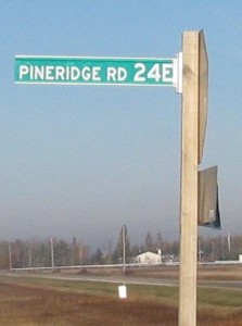
When travelling through Manitoba, the grid road numbers are frequently displayed at intersections and individual municipalities are responsible for the signage within their respective jurisdictions.
Though Saskatchewan and Alberta each use a one-mile grid system, the roads in those provinces are numbered according to a range and township system.
 |
 |
 |
| Road 13W in the RM of Cartier | Road 110N in the RM of Gimli | Road 24E in the RM of Springfield |
© Curtis Walker. All rights reserved. All pictures used on this site are the property of the respective photographers and are used by permission. No picture may be used without the consent of the respective photographer.
All pictures taken by Curtis Walker unless otherwise noted.